
Mori Atlas logo
Nearby park discovery

Map protected-land geography around a limestone wall above the Adriatic coast

Compare protected-area geography around Biokovo Nature Park between Dalmatia and the Adriatic

Biokovo Nature Park climbs from the Adriatic edge of the Makarska Riviera to 1,762-metre Sveti Jure across a massive limestone face, ridges, plateaus, sinkholes, caves, and deep shafts. The nearby map reveals Dalmatia's wider protected geography while keeping every coastal, mountain, and karst record's identity and setting distinct.

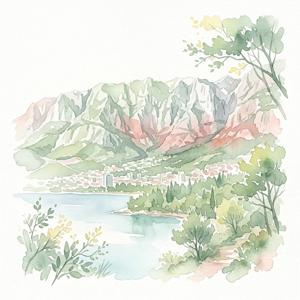
Watercolor illustration depicting a mountainous landscape with a lake, trees, and a coastal town

Dalmatian Adriatic karst mountain nature park with Sveti Jure summit

Biokovo Nature Park

Biokovo Nature Park is a protected mountain area along the Dalmatian coast of Croatia, forming a dramatic limestone barrier between the Adriatic Sea and the continental interior known as Zagora. The park encompasses the northern portion of the Biokovo mountain range, which rises steeply from the Makarska Riviera to reach its highest point at Sveti Jure, at 1,762 meters above sea level—making it the second-highest mountain in Croatia and the highest peak visible from the coast. The landscape is characterized by classic karst topography, with extensive sinkholes, caves, and rock formations shaped by millions of years of limestone erosion. The park supports over 1,500 plant and animal species, including numerous endemic species adapted to the unique microclimates created by the mountain's position at the intersection of Mediterranean and continental climatic zones. Biokovo forms part of the Dinaric Alps, a mountain chain that runs parallel to the Adriatic coast, and on exceptionally clear days the summit offers views extending across the sea to Monte Gargano in Italy, some 250 kilometers away.

Location
Croatia
Park type
Protected landscape
Established
1981
Area
196 km²
Highest point
1,762 m
Biokovo Nature Park Protected Landscape
Regional park map

See the ranked park cluster in its geographic setting

Nearby parks around Biokovo Nature Park

This regional map shows the same 20 nearby parks ranked below around Biokovo Nature Park. Select a ranked marker to highlight that park’s boundary where boundary data is available.
Reference park: Biokovo Nature ParkRanked nearby park20 nearby parks shown
20 nearby parks

Distance ranked collection and surrounding regional park geography for comparison

Parks and Protected Areas Geographically Near Biokovo Nature Park

Examine the ranked collection of protected areas situated geographically near Biokovo Nature Park by measuring straight line separation and directional spread. Reviewing these surrounding landscapes provides structured environmental comparison signals across regional park geography without implying shared terrain or travel routes.
Watercolor illustration of rolling hills, green vegetation, and distant mountains under a light sky
Protected areaCroatia
About 57 km away#1 closest

South

Lastovo Nature Park: Discover the Adriatic Karst Archipelago's Protected Landscape

Mapped karst terrain, ancient architecture, and natural island geography.

Lastovo Nature Park protects a remote Croatian archipelago characterized by its striking karst landscape, featuring 46 hills and 46 karstic fields. This protected area offers significant natural biodiversity and remarkably preserved cultural heritage, with extensive Holm Oak and Aleppo Pine forests covering over 60% of the island. Explore Lastovo's unique geography, mapped terrain, and its distinct place within the Adriatic region.

Area
46.87 km²
Established
2006
IUCN
V
Relief
Upland
Watercolor painting showing two pink-hued lakes surrounded by green vegetation and distant mountains under a light yellow sky
National parkCroatia
About 63 km away#2 closest

Southeast

Mljet National Park: Protected Karst Terrain and Unique Marine Lakes in Croatia

Explore mapped park boundaries and Mediterranean island geography.

Mljet National Park represents a significant protected landscape within the Adriatic Sea, celebrated for its distinctive karst terrain and the extraordinary phenomenon of its saltwater lakes, Veliko and Malo jezero. This national park showcases some of the most intact Mediterranean forests in the region, offering a unique geographic profile for atlas-based discovery. Examine the park's protected status and its relationship to the surrounding island and marine geography.

Area
53 km²
Established
1960
IUCN
II
Relief
Lowland
National parkŠibenik-Knin County
About 98 km away#3 closest

Northwest

Krka National Park: Croatia's National Park with European Cascade Waterfalls

Explore the mapped protected landscape and karst geography.

Krka National Park, designated as a national park in Croatia, offers a rich exploration of its protected landscape. Located in Šibenik-Knin County, the park is defined by the Krka River and its extraordinary seven travertine waterfalls, most notably Skradinski buk, the largest cascade system of its kind in Europe. This atlas-focused view highlights the park's unique karst terrain, Mediterranean ecosystems, and its position within the regional geography, providing essential context for understanding its protected natural heritage.

Area
109 km²
Established
1985
IUCN
II
Relief
Lowland
Watercolor illustration of mountain ranges, a lake, and forested hills in soft pastel colors
National parkBosnia and Herzegovina
About 120 km away#4 closest

East

Sutjeska National Park: Bosnia and Herzegovina's Oldest National Park and Primeval Forest Reserve

Explore the mapped geography and protected landscape of this vital Balkan natural area.

Sutjeska National Park, Bosnia and Herzegovina's inaugural national park, protects a dramatic mountainous region defined by primeval forests and its highest peak, Maglić. As a strict nature reserve, Perućica's ancient trees represent a rare ecological treasure within the Balkan landscape. This page offers a detailed look at the park's protected boundaries, its diverse natural terrain, and its significant geographic setting for atlas exploration.

Area
160.52 km²
Established
1962
IUCN
II
Relief
Mountain
National parkŠibenik-Knin County
About 126 km away#5 closest

West

Kornati Islands National Park: Dense Mediterranean Archipelago and Protected Karst Landscape

Explore the mapped geography and unique protected island terrain.

Kornati Islands National Park, located in Šibenik-Knin County, Croatia, is distinguished as the Mediterranean's most densely packed archipelago. This national park protects a vast expanse of karst limestone islands, dramatic sea cliffs, and unique flat rock plateaus, alongside its significant marine environment. MoriAtlas provides detailed geographic context and mapped boundaries, enabling structured exploration of this exceptional protected landscape and its ecological significance within the Adriatic Sea.

Area
320 km²
Established
1980
IUCN
II
Relief
Lowland
Watercolor illustration showing mountains, a river, a waterfall, trees, and flowers.
National parkBosnia and Herzegovina
About 130 km away#6 closest

Northwest

Una National Park: Bosnia and Herzegovina's Largest National Park and Protected Landscape

Explore its dramatic river canyons and karst geography.

Una National Park represents a significant protected landscape in Bosnia and Herzegovina, covering approximately 198 square kilometers of the Upper Una River basin. This page details the park's protected area identity, focusing on its spectacular riverine geography, including iconic features like the Štrbački Buk waterfall and the deep Unac River canyon. Users can explore the park's mapped boundaries, understand its place within the regional Dinaric mountain context, and discover the characteristics of its unique karst terrain and pristine river ecosystems. MoriAtlas provides essential geographic context for this vital natural area.

Area
350 km²
Established
2008
IUCN
II
Relief
Mixed relief
A pale, wide watercolor illustration showing rolling green hills and a winding stream, framed by distant, hazy mountain ridges.
Protected landscapeMontenegro
About 148 km away#7 closest

Southeast

Orjen Protected Landscape: Montenegro Mountain Geography and Karst Atlas

High-altitude karst massif and Dinaric coastal mountain.

Orjen rises as a dramatic limestone block above the Adriatic coast of Montenegro, forming a high-altitude sanctuary defined by intensive Pleistocene glaciation and record-breaking annual precipitation. This protected landscape encompasses extensive dolines, roches moutonnées, and specialized cold-air refugia, providing a detailed study of sub-Mediterranean highland vegetation and complex subterranean karst drainage.

Area
400 km²
Established
2017
Relief
Mountain
Climate
Mediterranean
Watercolor illustration of rolling hills, trees, and a body of water
Nature reserveDugi Otok
About 157 km away#8 closest

Northwest

Telašćica Nature Park: Adriatic Sea Cliffs, Lake Mir, and Protected Landscape

Dugi Otok's Premier Nature Reserve on the Dalmatian Coast

Telašćica Nature Park safeguards a highly distinctive coastal environment on Croatia's Dugi Otok island. This protected area is defined by its imposing 161-meter-high vertical limestone cliffs, locally named 'stene,' which create a breathtaking interface with the Adriatic Sea. Within the park, the unique saltwater Lake Mir offers a fascinating geological feature, while the sheltered bay and its surrounding landscape showcase a rich Mediterranean flora and a complex archipelago. The park serves as a prime example of Adriatic karst landscape preservation and mapped coastal geography.

Area
70.5 km²
Established
1988
IUCN
II
Relief
Mixed relief
Watercolor illustration showing mountains, a winding river, and forested areas
National parkMontenegro
About 161 km away#9 closest

East

Durmitor National Park: Geography and Protected Landscape Atlas of Northern Montenegro

Alpine mountain terrain, deep river canyons, and glacial lake ecosystems.

Delve into the geography of Durmitor National Park, a rugged sanctuary in Montenegro that protects spectacular limestone peaks and the dramatic Tara River canyon. This protected area highlights the geological complexity of the Dinaric Alps through its U-shaped valleys, karst features, and diverse alpine meadows that define this significant regional wilderness.

IUCN
II
Relief
Mountain
Climate
Alpine
Scope
Terrestrial
Watercolor illustration of a mountain landscape with trees and water
National parkCroatia
About 161 km away#10 closest

Northwest

Paklenica National Park: Croatia's Iconic Karst Canyon and UNESCO Beech Forests

Explore dramatic protected landscape and regional geography.

Paklenica National Park presents a spectacular protected area defined by its deep karst canyons, with Velika Paklenica and Mala Paklenica carving dramatic vertical walls into the Velebit mountain range. This national park is celebrated for its status as a leading European climbing destination and its ancient beech forests, part of a UNESCO World Heritage site. Exploring Paklenica offers insight into unique geological formations, extensive cave systems, and the rich biodiversity of this significant Croatian landscape.

Area
95 km²
IUCN
II
Relief
Mountain
Climate
Mediterranean
Watercolor illustration of a tree, green hills, and distant water view
National parkApulia
About 162 km away#11 closest

Southwest

Gargano National Park: Apulia's Protected Landscape and Regional Geographic Context

Mapped boundaries and natural terrain of a key Italian national park.

Delve into Gargano National Park, a designated national park situated in the Apulia region of Italy. This protected landscape offers valuable insights into the geography of the Gargano promontory. Through MoriAtlas, users can explore its mapped boundaries, understand its terrain, and connect it to the broader regional geography of southern Italy, providing a solid foundation for protected-area discovery.

Area
1,181.44 km²
Established
1991
IUCN
II
Relief
Mixed relief
A soft watercolor illustration of a mountain range with foreground meadows and trees, rendered in light green, pink, and muted purple tones against a white background.
National parkŽabljak
About 163 km away#12 closest

East

Durmitor National Park: Exploring the Dinaric Alps and Tara River Canyon Landscapes

High-altitude mountain geography and glacial plateau systems

Durmitor National Park preserves a unique concentration of limestone peaks, deep river gorges, and eighteen glacial lakes within the northern highlands of Montenegro. This protected area showcases the interplay between the massive Tara River Canyon and the high-elevation Jezerska površ plateau, offering a comprehensive look at the diverse mountain terrain that defines this Dinaric Alpine wilderness.

Area
390 km²
Established
1952
IUCN
II
Relief
Mountain
National parkMontenegro
About 178 km away#13 closest

Southeast

Lovćen National Park: Karst Geography and Protected Mountain Landscapes in Montenegro

Dinaric massif rising above the Adriatic coastal basin.

Lovćen National Park encompasses a dense, rocky landscape of limestone and dolomite in southwestern Montenegro. Known as the namesake for the country itself, the massif creates a sharp geographic boundary between the Adriatic Sea and the inland highlands. The area offers a profound look at Dinaric karst features, including dramatic cliffs and endemic botanical habitats, preserved within a culturally rich mountain setting.

Area
62.2 km²
Established
1952
Relief
Mountain
Climate
Mediterranean
National parkMontenegro
About 179 km away#14 closest

Southeast

Lovćen National Park: Karst Mountain Geography and Protected Landscapes in Montenegro

Dinaric Alps limestone terrain and historic mountain heritage

Spanning from 400 to 1,749 meters, Lovćen National Park protects the symbolic limestone massifs of southwestern Montenegro. The terrain is defined by complex karst formations, deep gorges, and distinct ecological zones, forming a critical observation point across the rugged Dinaric mountain interior.

IUCN
II
Scope
Terrestrial
Water
No major water
Watercolor illustration showing layered mountains, green valleys, and a body of water with soft color gradients
National parkBosnia and Herzegovina
About 183 km away#15 closest

North

Kozara National Park: Bosnia and Herzegovina's Distinctive Forested Mountain Landscape

Mapped protected area in the Pannonian Plain's highland oasis.

Kozara National Park represents a significant protected natural area within Bosnia and Herzegovina, distinguished by its rounded, forested peaks that ascend from the surrounding Pannonian lowlands. This national park offers a unique landscape characterized by dense deciduous and mixed forests, interspersed with clearings and meadows, covering a considerable portion of its 39 square kilometer area. The park's geographic identity is further defined by its proximity to major rivers like the Una, Sava, Sana, and Vrbas, which delineate its natural boundaries and contribute to its distinct regional context. For atlas-based discovery, Kozara provides insight into how isolated highlands create unique protected landscapes within flatter terrain.

Area
39.08 km²
Established
1967
IUCN
II
Relief
Upland
Watercolor painting showing a river canyon with mountains in the background and green vegetation in the foreground
National parkBosnia and Herzegovina
About 187 km away#16 closest

Northeast

Drina National Park: Bosnia and Herzegovina's Protected Canyon and Endemic Ecosystem

Explore mapped geography and natural landscapes in this Balkan national park.

Drina National Park is a protected area in eastern Bosnia and Herzegovina, celebrated for its striking Drina River canyon landscape. As a national park, it preserves vital habitats for endemic species such as the Serbian spruce and provides a crucial geographic anchor for regional conservation. Its deep gorges and steep slopes offer a rich context for understanding the natural terrain and mapped boundaries within the broader Balkan geography.

Area
63.15 km²
Established
2017
IUCN
II
Relief
Mountain
Watercolor painting depicting a river flowing through a valley with mountains in the background and trees on both sides
National parkSerbia
About 191 km away#17 closest

East

Tara National Park: Endemic Flora and Dramatic Dinaric Alps Geography

Discover Serbia's iconic protected mountain landscape and its unique botanical heritage.

Tara National Park is a significant protected area in Serbia, celebrated for its exceptional botanical value and dramatic mountainous terrain. It is the last refuge for Pančić's spruce, a living fossil conifer, and hosts a remarkable diversity of Balkan flora. The park's landscape is defined by steep limestone cliffs, deep river valleys like the Drina canyon, and expansive forest ecosystems, offering a unique geographic study of protected lands. Explore its mapped features and discover a vital conservation area within the Dinaric Alps.

Area
249.92 km²
Established
1981
IUCN
II
Relief
Mountain
Watercolor illustration of a wetland with river, trees, and distant hills
Protected landscapeSisak-Moslavina County
About 202 km away#18 closest

North

Lonjsko Polje Protected Landscape: Explore Croatia's Largest Inland Wetland and Pastoral Heritage

Discover mapped natural landscapes and unique floodplain geography.

Lonjsko Polje, a significant protected landscape in Croatia's Sisak-Moslavina County, represents the largest inland wetland within the Danube basin. This area is characterized by its vast alluvial floodplain, shaped by seasonal river dynamics, which fosters diverse habitats for wildlife and preserves a rare example of traditional pastoral culture. Explore the mapped geography and understand the ecological importance of this unique wetland ecosystem through structured atlas-style content.

Area
505.6 km²
Established
1998
IUCN
V
Relief
Lowland
National parkCroatia
About 207 km away#19 closest

Northwest

Plitvice Lakes National Park: Croatia's Iconic National Park and UNESCO Heritage Site

Mapped protected area with cascading lakes and karst geography.

Delve into the protected landscape of Plitvice Lakes National Park, a jewel of Croatia's natural heritage. This atlas entry highlights the park's famous system of 16 terraced lakes and cascading waterfalls, set within a unique karst terrain. Understand the geographic context and mapped boundaries of this significant protected area, renowned for its geological processes and ancient forest ecosystems. Explore the full spectrum of its protected natural identity.

IUCN
II
A watercolor painting showing a soft, panoramic landscape of low hills, green fields, and water, with a light and ethereal style.
Protected areaMontenegro
About 207 km away#20 closest

Southeast

Cijevna Protected Area: Mapping the River Canyon and Balkan Highlands Geography

An alpine river system spanning the Montenegro and Albania border

The Cijevna represents a striking natural corridor carved into the Prokletije mountains. This protected landscape is defined by its deep V-shaped valleys, high-altitude gorges, and seasonal discharge patterns that sustain important freshwater biodiversity across the Balkan highlands.

Distance methodology

Geographic measurements, not driving distances

How nearby park distances are calculated

Distances use park boundaries whenever the available geometry allows it. When one or both boundaries are missing, the mapped park locations provide a clearly labelled estimate. Every value represents straight-line geographic separation and does not use roads or routing.

Boundary distance

Calculated between the nearest points of both park boundaries.

Location-to-boundary estimate

Estimated from one mapped park location to the nearest boundary of the other park.

Mapped-location estimate

Estimated between the mapped locations of both parks.

MoriAtlas Explorer

Continue Exploring the Geography and Protected Landscape of Biokovo Nature Park

Deepen your understanding of Biokovo Nature Park's unique geographic setting and its role as a protected landscape within the Dinaric Alps. By continuing your exploration on MoriAtlas, you can visualize its mapped boundaries, compare its terrain with surrounding areas in Dalmatia, and appreciate the atlas-driven context of this significant natural area. Discover the intricate details of its karst topography and its ecological importance.