
Mori Atlas logo
Nearby park discovery

Map-based exploration of natural landscapes and surrounding geographic terrain

Regional Protected Areas and National Parks Near Dthinna Dthinnawan National Park

Identify protected areas and natural landscapes situated in the vicinity of Dthinna Dthinnawan National Park. This geographic overview illustrates the regional distribution of conservation lands and park boundaries throughout this northern New South Wales territory.

Related tags

National ParkNew South WalesBrigalow BeltNandewar BioregionDry Sclerophyll Forest

A protected Aboriginal cultural landscape in northern New South Wales

Dthinna Dthinnawan National Park

Dthinna Dthinnawan National Park is a national park located near Yetman in northern New South Wales, Australia, approximately 100 kilometers west of Tenterfield along the Bruxner Highway. The park protects a landscape of relatively flat to undulating terrain with scattered hills and rocky outcrops featuring sandstone and granite formations. It lies partly within the southern Brigalow Belt bioregion and partly within the Nandewar bioregion, representing an important pocket of remnant vegetation in a region that has experienced significant land clearing. The park's name derives from the Gamilaraay Aboriginal language, meaning place for emu footprint, reflecting the area's historical significance as a resource-rich location that provided year-round food and resources for Indigenous communities.

Location
Australia
Park type
National park
Established
2005
Dthinna Dthinnawan National Park Atlas
Regional park map

See the ranked park cluster in its geographic setting

Nearby parks around Dthinna Dthinnawan National Park

This regional map shows the same 20 nearby parks ranked below around Dthinna Dthinnawan National Park. Select a ranked marker to highlight that park’s boundary where boundary data is available.
Reference park: Dthinna Dthinnawan National ParkRanked nearby park20 nearby parks shown
20 nearby parks

Distance-ranked conservation areas and surrounding regional park geography in Australia

Parks and Protected Areas Geographically Near Dthinna Dthinnawan National Park

Examine the ranked collection of nearby protected areas structured by geographic separation from Dthinna Dthinnawan National Park. Analyze surrounding landscape patterns and regional environment characteristics through direct spatial comparison.
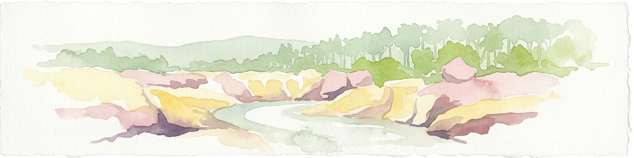
Watercolor painting of a river flowing between rocky cliffs with forest in the background
National parkNew South Wales
About 33 km away#1 closest

South

Kwiambal National Park: New South Wales National Park with Granite Landscapes and River Confluence

Explore the dramatic scenery of MacIntyre Falls and surrounding protected terrain.

Kwiambal National Park is a significant protected area in New South Wales, Australia, celebrated for its unique granite outcrops and the spectacular confluence of the Severn and Macintyre Rivers at MacIntyre Falls. This national park provides a clear example of regional protected landscape identity, offering valuable context for atlas-driven discovery of Australia's natural geography and mapped terrain. The park's distinctive features contribute to its importance as a conservation reserve within the New England region.

Area
65.17 km²
Established
2000
IUCN
II
Scope
Terrestrial
National parkGoondiwindi Region
About 64 km away#2 closest

Northwest

Bendidee National Park: Protected Landscape and Geographic Context

National park within the Goondiwindi Region, Australia

Bendidee National Park serves as a key protected area in the Goondiwindi Region of Australia. This detail page provides an atlas-focused perspective, detailing the park's mapped geographic extent and its significance as a natural landscape. Gain structured insights into Bendidee National Park's protected status and its place within the broader regional geography for informed exploration.

Area
9.3 km²
Established
1979
IUCN
II
Relief
Lowland
National parkSouthern Downs Region
About 70 km away#3 closest

East

Sundown National Park: National Park with Mapped Protected Boundaries

Southern Downs Region's Protected Landscape Geography

Investigate Sundown National Park, a designated national park in Australia's Southern Downs Region. This resource details its protected landscape identity and geographic setting, offering precise information on its mapped boundaries and regional context for atlas exploration and understanding its conservation value.

Area
160 km²
Established
1977
IUCN
II
Relief
Mountain
National parkQueensland
About 84 km away#4 closest

North

Wondul Range National Park: Queensland Protected Area and Landscape Mapping

Discover the geographic context and mapped boundaries.

Wondul Range National Park offers a unique protected landscape within Queensland, Australia, serving as a key point for geographic and atlas-based exploration. Delve into its specific regional context, understand its mapped park boundaries, and appreciate its role as a designated national park. This entry provides detailed insights into its natural geography and protected-area significance for comprehensive landscape discovery.

Area
35.55 km²
Established
1992
IUCN
II
Scope
Terrestrial
National parkNew South Wales
About 92 km away#5 closest

Southeast

Kings Plains National Park: National Park Protected Area and Geographic Context

Explore mapped boundaries and landscape details for this New South Wales park.

Kings Plains National Park represents a distinct protected area entity within New South Wales, Australia. This national park serves as a focal point for understanding specific geographic features and its mapped boundaries. Users engaging with this park profile can uncover its regional landscape context and explore its significance as part of a larger atlas of protected natural areas. The focus remains on its geographic identity and atlas-based discovery value.

Area
57 km²
Established
1988
IUCN
II
Access
Moderate access
National parkQueensland
About 99 km away#6 closest

East

Girraween National Park: Queensland's Protected National Park Landscape for Atlas Exploration

Mapped geography and protected natural terrain.

Delve into Girraween National Park, a significant protected national park located in Queensland, Australia. This detailed entry provides essential information for understanding its geographic features, mapped boundaries, and the unique natural landscape it preserves. Discover how Girraween National Park fits into the wider Australian atlas and explore its specific regional geography and protected land context.

Area
117 km²
Established
1966
IUCN
II
Relief
Mountain
National parkNew South Wales
About 113 km away#7 closest

East

Bald Rock National Park: Detailed National Park Atlas and Protected Landscape Context

Explore its mapped boundaries and natural terrain within New South Wales.

Bald Rock National Park serves as a key protected area for understanding regional geography and mapped landscapes in New South Wales. This page offers an atlas-centric view of the park, detailing its protected boundaries and providing context for its natural terrain. It is designed for users seeking structured information about national parks and their geographic significance, contributing to a comprehensive understanding of Australia's conservation lands.

Area
88.83 km²
Established
1971
IUCN
II
Relief
Mountain
National parkNew South Wales
About 120 km away#8 closest

East

Maryland National Park: A Detailed Map and Protected Landscape Overview

Explore the geography and mapped boundaries of this national park.

Maryland National Park represents a distinct protected area within New South Wales, Australia, offering rich geographic context for exploration. This page details its role as a national park, focusing on its mapped terrain, landscape character, and position within the regional geography. Users seeking to understand the park's protected boundaries and natural setting will find valuable atlas-style information here, providing a concrete foundation for further geographic study.

Area
9 km²
Established
1999
IUCN
Ia
Relief
Upland
National parkNew South Wales
About 123 km away#9 closest

East

Boonoo Boonoo National Park: New South Wales National Park Atlas Entry

Explore mapped park boundaries and regional terrain.

This entry provides detailed information on Boonoo Boonoo National Park, a key protected area within New South Wales. Discover its specific geographic context, landscape features, and its role as a national park within the MoriAtlas geographic discovery platform. Understand the park's unique regional setting and mapped characteristics for informed atlas exploration.

Area
43.77 km²
Established
1982
IUCN
II
Relief
Upland
National parkNew South Wales
About 123 km away#10 closest

East

Basket Swamp National Park: New South Wales National Park and Protected Landscape Mapping

Geographic context and mapped boundaries within Australia.

Basket Swamp National Park represents a significant protected area within New South Wales, Australia. This page offers a geographic exploration of its specific location, mapped boundaries, and its role as a national park. Delve into the landscape context and atlas-level understanding of this natural reserve, distinct within the broader regional geography.

Area
28.2 km²
Established
1999
IUCN
II
Relief
Lowland
National parkNew South Wales
About 126 km away#11 closest

Southeast

Capoompeta National Park National Park: Protected Landscape and Regional Geography

Explore mapped boundaries and natural terrain in New South Wales.

Capoompeta National Park represents a key protected landscape entity within New South Wales, Australia. This detail page provides focused geographic information, emphasizing its status as a national park and its contribution to the regional atlas. Users can investigate the park's mapped terrain, understand its protected land characteristics, and grasp its geographical setting within the Australian context.

Area
39 km²
Established
1999
IUCN
II
Relief
Mountain
National parkQueensland
About 128 km away#12 closest

Northwest

Southwood National Park: Queensland Protected Area and National Park Atlas Entry

Mapped protected landscape and regional geographic context for Southwood National Park.

Southwood National Park serves as a vital component of Queensland's protected lands network, offering a focused view for atlas exploration. Users can examine its specific mapped boundaries and understand its role within the broader geographic context of northeastern Australia. This detailed entry supports structured discovery of the park's natural landscape and its significance as a national park.

Area
71.2 km²
Established
1970
Relief
Lowland
Climate
Arid
National parkNew South Wales
About 129 km away#13 closest

Southeast

Washpool National Park National Park: Protected Area Atlas and New South Wales Geography

Explore the mapped boundaries and natural landscape context.

Washpool National Park represents a significant protected area within the geographic landscape of New South Wales. This entry provides a structured exploration of its identity as a national park, focusing on its mapped boundaries, regional distribution, and the natural terrain it encompasses. Understand its role within a broader atlas of protected lands and its unique geographic characteristics.

Area
587 km²
Established
1983
IUCN
II
Relief
Mountain
National parkNew South Wales
About 132 km away#14 closest

Southeast

Butterleaf National Park: National Park Protected Landscape with Regional Geographic Context

Mapped boundaries and terrain within New South Wales.

Butterleaf National Park represents a distinct national park entity within the geographic landscape of New South Wales. This resource provides a focused atlas view, detailing the park's protected boundaries and its specific contribution to the regional terrain. Users can explore the mapped geography and understand the park's identity as a significant protected natural area, offering foundational data for landscape context and conservation analysis.

Area
30 km²
Established
1999
IUCN
II
Scope
Terrestrial
Nature reserveNew South Wales
About 133 km away#15 closest

Southwest

Gamilaroi Nature Reserve: Conservation Landscapes and Rare Woodland Geography in New South Wales

Specialized botanical protection in the inland Brigalow Belt

Gamilaroi Nature Reserve is a compact, science-oriented protected area in the North West Slopes of New South Wales. Defined by its ferruginous sandstone and quartzite substrates, the reserve maintains a distinct ecological blend of belah and white box woodland, serving as a primary site for the conservation of rare native ooline trees.

Area
1.13 km²
Established
1994
IUCN
IV
Relief
Lowland
National parkNew South Wales
About 142 km away#16 closest

South

Single National Park National Park: A Protected Landscape within New South Wales

Explore mapped boundaries and regional geography.

Single National Park represents a vital protected area, contributing significantly to the natural landscape of New South Wales. This entry offers a deep dive into its geographic scope, detailing mapped park boundaries and the surrounding regional context. It serves as a foundational piece for understanding the park's identity as a protected natural asset and its place within Australia's broader conservation geography.

Area
25.63 km²
Established
1999
IUCN
II
Relief
Mixed relief
National parkNew South Wales
About 144 km away#17 closest

South

Indwarra National Park: New South Wales National Park Protected Landscape and Geographic Context

Explore mapped park boundaries and regional geography.

Indwarra National Park is identified as a significant protected area within New South Wales, Australia, offering a unique focus for geographic exploration. As a national park, its mapped boundaries define a distinct natural landscape. This page provides detailed atlas-style information, enabling a deeper understanding of its terrain, regional context, and protected-area significance for structured discovery.

Area
9 km²
Established
1999
IUCN
Ia
Relief
Mountain
National parkNew South Wales
About 151 km away#18 closest

East

Koreelah National Park: Protected Landscape with Dramatic Gorges and Wildlife

Explore the mapped terrain and regional geography of this New South Wales national park.

Koreelah National Park is a protected national park located in northern New South Wales, Australia, celebrated for its rugged topography and significant natural features. The park's landscape is defined by spectacular gorges, sheer cliffs, and impressive waterfall systems, creating a remote wilderness experience. It serves as a vital protected area, offering refuge to diverse wildlife, including platypus and koalas, and is recognized for its importance within the Scenic Rim Important Bird Area. Discover its mapped boundaries and unique geographic context for a deeper understanding of Australian protected lands.

Area
53 km²
Established
1999
IUCN
II
Relief
Upland
National parkNorthern Rivers
About 153 km away#19 closest

East

Tooloom National Park: National Park Exploration and Geographic Mapping

Mapped protected area and regional landscape context.

Tooloom National Park offers a focused area for protected landscape discovery within Australia's Northern Rivers region. This entry provides essential details on its designation as a national park, its geographic setting, and its mapped outlines, enabling detailed atlas-style exploration. Understand how Tooloom National Park contributes to the regional conservation geography and its specific mapped terrain for dedicated study.

Area
43.8 km²
Established
1995
IUCN
II
Climate
Subtropical
National parkNew South Wales
About 153 km away#20 closest

Southeast

Barool National Park: National Park Discovery and Geographic Context

Mapped protected area within New South Wales.

Barool National Park is identified as a protected national park, contributing to the rich tapestry of natural landscapes across New South Wales. Understanding its specific location and mapped boundaries is essential for appreciating its role within the regional geography of Australia. This entry provides a factual basis for exploring the park's identity as a defined protected area, offering a unique point of reference for geographic discovery.

Area
112.44 km²
Established
1999
IUCN
II
Climate
Temperate
Distance methodology

Geographic measurements, not driving distances

How nearby park distances are calculated

Distances use park boundaries whenever the available geometry allows it. When one or both boundaries are missing, the mapped park locations provide a clearly labelled estimate. Every value represents straight-line geographic separation and does not use roads or routing.

Boundary distance

Calculated between the nearest points of both park boundaries.

Location-to-boundary estimate

Estimated from one mapped park location to the nearest boundary of the other park.

Mapped-location estimate

Estimated between the mapped locations of both parks.

MoriAtlas Explorer

Continue Exploring Dthinna Dthinnawan National Park's Geographic Atlas and Protected Landscape

Deepen your understanding of Dthinna Dthinnawan National Park by examining its specific geography and protected boundaries. This detailed view aids in mapping its natural terrain and understanding its significance within Australia's network of protected areas. Continue your atlas exploration to uncover the rich geographic context of this Australian national park.