Mori Atlas logo
Nearby park discovery

Mapping the geographic distribution of protected landscapes in the Valdai Hills

National Parks and Protected Areas Surrounding Valdaysky National Park in Russia

Identify protected areas and wilderness regions positioned within the geographical catchment of Valdaysky National Park. This overview provides spatial context for the glacial lake districts and forest ecosystems spanning the northern Novgorod Oblast. Trace the regional distribution of conservation lands surrounding this significant Russian biosphere reserve.

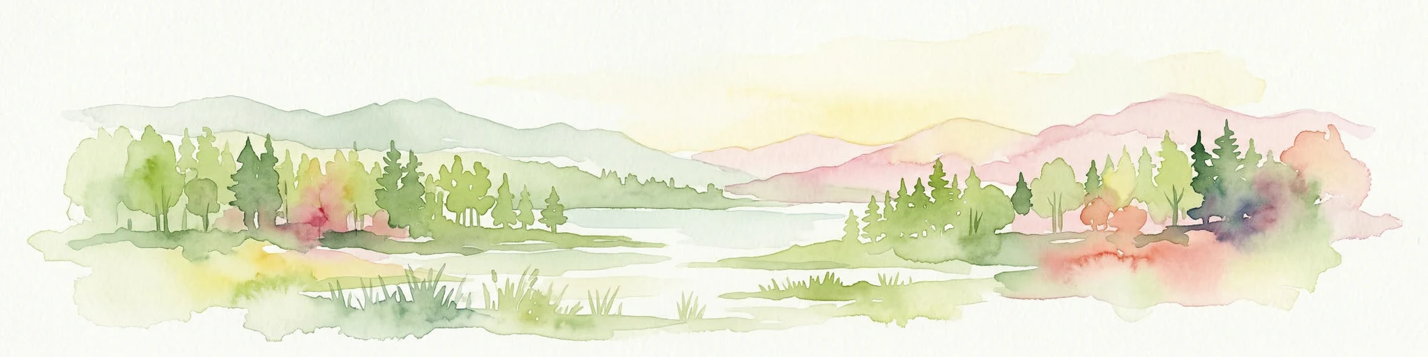
Digital illustration showing a lake scene with reeds in the foreground, forested shoreline, and a sun in a pastel sky

Glacial lake district and historic monastery heartland of central Russia

Valdaysky National Park

Valdaysky National Park is a protected natural area in the northern part of Novgorod Oblast, approximately 400 kilometers northwest of Moscow. The park occupies a landscape of exceptional glacial heritage in the highest reaches of the Valdai Hills, a region shaped during the last Ice Age and now characterized by a complex network of lakes, forest, and moraine terrain. Established in 1990, the park encompasses over 1,500 square kilometers and has held UNESCO Biosphere Reserve status since 2004, recognizing its ecological significance within the broader European landscape. The park is notable for containing the town of Valday along with significant lakes including Lake Valdayskoye and the northern reaches of Lake Seliger, creating a destination that combines natural exploration with cultural heritage. This combination of ecological preservation and historic significance has made Valdaysky one of the most visited protected areas in central Russia, drawing approximately 60,000 visitors annually to experience its forests, lakes, and the legacy of the Valday Iversky Monastery.

Location
Russia
Park type
National park
Established
1990
Area
1,585 km²
Valdaysky National Park Protected Area
Regional park map

See the ranked park cluster in its geographic setting

Nearby parks around Valdaysky National Park

This regional map shows the same 20 nearby parks ranked below around Valdaysky National Park. Select a ranked marker to highlight that park’s boundary where boundary data is available.
Reference park: Valdaysky National ParkRanked nearby park20 nearby parks shown
20 nearby parks

Geographic proximity and regional environment comparison for Valdaysky National Park

Ranked Nearby Parks and Protected Areas Surrounding Valdaysky National Park

Spatial proximity measurements rank surrounding protected areas by straight-line distance from Valdaysky National Park to reveal regional conservation patterns. Structured environmental records and country context allow researchers to compare adjacent terrain features without assuming identical ecosystems.
National parkNovgorod Oblast
About 1.4 km away#1 closest

South

Valday National Park: Geography and Protected Landscapes of the Valdai Hills

Glacial lakes, mixed forests, and historic heritage in Novgorod Oblast

Valday National Park encompasses 1,585 square kilometers of glacial upland terrain in northwestern Russia. The park acts as a significant conservation landscape where dense forest stands meet extensive wetlands and dozens of freshwater lakes. This atlas entry details the regional geography of the Valdai Hills, from its historic archaeological sites and monastery heritage to the complex moraine and drumlin terrain characteristic of this protected Russian wilderness.

Area
1,585 km²
Established
1990
IUCN
II
Relief
Upland
Watercolor illustration of a lake surrounded by forests and mountains under a light sky
National parkTver Oblast
About 245 km away#2 closest

Southeast

Zavidovo National Park: Geographic and Protected Landscape Atlas of Tver Oblast

Exploring river floodplains and mixed forest terrain.

Zavidovo National Park represents a distinctive protected landscape within Russia, characterized by its flat glacial moraine terrain and complex water systems. The park protects critical wetlands, peat bogs, and river corridors that sustain diverse game and avian populations. Explore the geographic boundaries and ecological features that define this notable natural zone situated in the heart of Tver Oblast.

Area
1,329 km²
Established
2015
IUCN
II
Relief
Lowland
National parkMoscow Oblast
About 246 km away#3 closest

Southeast

Zavidovo National Park: Mapping the Protected Landscapes of the Upper Volga Lowland

A study of glacial plains, forest mosaics, and riverine habitats.

Zavidovo National Park occupies a sprawling area of the Upper Volga Lowland, characterized by gentle relief and an exceptional concentration of water-based habitats. The park serves as a prime example of a managed conservation territory that integrates river valleys, lowland forests, and marshlands. Its geographic identity remains deeply rooted in the glacial history of central Russia, supporting a continuous protected block within the Moscow Oblast.

Area
1,250 km²
Established
1972
IUCN
II
Relief
Lowland
National parkSmolensk Oblast
About 295 km away#4 closest

Southwest

Smolenskoye Poozerye National Park: Protected Landscape and Regional Geography

Explore mapped boundaries and geographic context within Smolensk Oblast.

Smolenskoye Poozerye National Park is a protected natural area offering valuable insights into the geography of Smolensk Oblast. As a national park, its mapped boundaries define a significant landscape within Central Russia. This resource provides detailed information for atlas-based exploration, allowing users to understand the park's protected status and its place within the regional natural terrain.

Area
1,462 km²
Established
1992
IUCN
II
Visitors
250K annual
Watercolor painting of a lake with green forested islands and distant mountains under a pastel sky
National parkPskov Oblast
About 345 km away#5 closest

Southwest

Sebezhsky National Park: National Park within Pskov Oblast's Regional Geography

Mapped protected landscape and regional context

Sebezhsky National Park is a designated national park offering a distinct protected landscape within the Pskov Oblast of northwestern Russia. This page provides essential details for atlas exploration, focusing on the park's mapped boundaries, its role as a protected area, and its contribution to the regional geography of the Pskov Oblast. Users can understand its place within a broader mapping of Russia's natural territories and protected lands.

Area
500.21 km²
Established
1996
IUCN
II
Relief
Highland
A horizontal watercolor painting depicting a calm lake with grassy banks and soft rolling hills in the background.
National parkЯмало-Ненецкий автономный округ
About 356 km away#6 closest

East

Плещеево озеро National Park: Glacial Lake Geography and Protected Area Atlas

Mapped terrain, forest mosaic, and Upper Volga basin protected landscapes.

Плещеево озеро National Park centers on a significant glacial lake, framed by an ecological mosaic of boreal and broadleaf forests, extensive peat bogs, and coastal wetlands. This protected area within the Upper Volga basin offers a look at a layered natural environment where diverse bird populations, endemic fish, and historical landmarks meet across the East European Plain.

Area
237.9 km²
Established
1988
IUCN
II
Relief
Lowland
Watercolor painting showing a lake with grasses in the foreground and distant shoreline
National parkYaroslavl Oblast
About 356 km away#7 closest

East

Pleshcheyevo Ozero National Park: National Park Mapping and Regional Protected Area Atlas

Discover its protected landscape and geographic setting.

Pleshcheyevo Ozero National Park is a key protected area within the geography of Yaroslavl Oblast, Russia. This page offers detailed insights into the park's specific landscape character, its mapped boundaries, and its significance as a national park. It serves as an entry point for understanding the protected lands of the region and exploring its natural terrain within a broader atlas context.

Area
238 km²
Established
1997
IUCN
II
Relief
Lowland
Watercolor illustration of a winding river, trees, and hills in the background
National parkMoscow Oblast
About 359 km away#8 closest

Southeast

Losiny Ostrov National Park: Mapping the Boundaries of a Unique Urban Wilderness

Protected forest and wetland geography in Moscow Oblast.

Spanning over 116 square kilometers, Losiny Ostrov National Park represents a significant conservation effort as Europe's largest urban national park. Its geography encompasses dense mixed forests, the Upper Yauza Swamps, and a convergence of regional watersheds, providing a rare study of wilderness persistence within a densely populated metropolitan environment.

Area
116 km²
Established
1983
IUCN
II
Relief
Lowland
Watercolor illustration of a soft forest landscape with green trees, rolling hills, and a winding path in muted green and yellow tones.
National parkMoscow
About 359 km away#9 closest

Southeast

Losiny Ostrov National Park: Geography and Protected Landscapes in Moscow, Russia

Mapped forest terrain, wetland systems, and urban conservation zones.

Spanning from the Moscow city fringe into the surrounding landscape, Losiny Ostrov National Park protects a vital mixture of peat bogs, river headwaters, and dense mixed forests. This historic terrain offers a deep look at how large-scale conservation survives within a metropolitan environment, hosting free-roaming moose and diverse mammals while preserving ancient woodland corridors.

Area
128.81 km²
Established
1983
IUCN
II
Relief
Lowland
A soft watercolor illustration of a tranquil lake surrounded by rolling green hills, a forest of evergreen trees, and wetlands with patches of reddish flora in the foreground.
National parkVologda Oblast
About 361 km away#10 closest

Northeast

Russky Sever National Park: Glacial Lake Systems and Boreal Forests in Vologda Oblast

Regional landscape context and protected area mapping

Russky Sever National Park stands as a vital protected area in Vologda Oblast, bridging the hydrological divide between the Caspian and White Sea basins. Its territory is shaped by a complex interplay of low-lying ridges, interconnected lake chains, and ancient forest massifs like Shalgo-Bodunovsky Bor. This atlas record provides a clear overview of the park's distinct natural character and its structural place within the broader Russian North landscape.

Area
1,680 km²
Established
1992
IUCN
II
Relief
Upland
Watercolor illustration of a lake, forests, and hills
National parkEstonia
About 367 km away#11 closest

West

Alutaguse National Park: Eastern Estonia's Vast Peat Bog and Forest Protected Landscape

Mapping Protected Wetlands and Boreal Ecosystems in Estonia

Alutaguse National Park, a newly established national park in eastern Estonia, offers a unique atlas perspective on extensive peat bog ecosystems and boreal forests. Covering over 443 square kilometers, it represents some of the most intact wetland landscapes in the country. The park's creation unified eleven protected areas, safeguarding a critical habitat for rare species and showcasing the distinctive geography of the Alutaguse Lowland.

Area
443.31 km²
Established
2018
IUCN
II
Relief
Lowland
Watercolor illustration of a landscape with trees, hills, and water
National parkVologda Oblast
About 377 km away#12 closest

Northeast

Russky Sever National Park: Glacial Landscapes and Historical Protected Areas

Regional geography in the Vologda Oblast of Russia

Situated in the Vologda Oblast, Russky Sever National Park encompasses extensive forests, glacial hills, and riverine ecosystems. This protected area stands out for its deep connection to medieval Russian architecture, featuring preserved monasteries within a landscape shaped by long-standing agricultural and religious traditions.

Area
1,664 km²
Established
1992
IUCN
II
Relief
Highland
Watercolor illustration showing a lake, trees, and distant hills
National parkLatgale
About 383 km away#13 closest

Southwest

Rāzna National Park: Protected Landscape and Regional Geography in Latgale

Explore the mapped terrain of Latvia's largest lake region.

Rāzna National Park, situated in the Latgale region, provides an essential focal point for understanding eastern Latvia's protected landscapes. This national park, recognized for its extensive glacial terrain and the significant Lake Rāzna, offers a distinct geographic profile. Users can explore its mapped boundaries, discover its role as a vital protected area, and understand its landscape context within the broader atlas of Latvia's natural heritage.

Area
596.14 km²
Established
2007
IUCN
II
Relief
Highland
Watercolor illustration showing rolling hills, meadows, wildflowers, and distant mountains
National parkEstonia
About 394 km away#14 closest

West

Karula National Park: Detailed Map and Protected Landscape Context in Southern Estonia

Explore Karula Uplands' rolling terrain, lakes, and forests.

Karula National Park, Estonia's smallest national park, presents a densely clustered landscape of rolling hills, over 40 lakes, and extensive forest cover across the Karula Uplands. This protected area is a vital component of southern Estonia's natural geography, offering a rich mosaic of habitats. MoriAtlas facilitates a structured exploration of its mapped boundaries and the diverse ecosystems that define this distinctive natural landscape.

Area
123.64 km²
Established
1979
IUCN
II
Relief
Upland
Watercolor illustration showing a lake with forested shores and mountains in the background
National parkRepublic of Karelia
About 396 km away#15 closest

North

Ladoga Skerries National Park: National Park Protected Landscape & Geography

Mapped boundaries and regional context in the Republic of Karelia.

Discover Ladoga Skerries National Park, a key protected area recognized as a national park within the Republic of Karelia. This page provides essential context for understanding its mapped boundaries, the natural terrain it encompasses, and its geographical significance within the broader regional landscape. Utilize this information for structured atlas exploration of protected natural environments, focusing on the distinct identity of Ladoga Skerries National Park.

Area
1,220 km²
Established
2017
IUCN
II
Relief
Lowland
A soft, pale green and blue watercolor illustration showing several rocky islands with sparse vegetation surrounded by water, with faint hills in the background.
National parkЯмало-Ненецкий автономный округ
About 396 km away#16 closest

North

Ладожские шхеры National Park: Mapped Geography and Protected Archipelago Boundaries

Coastal skerry landscapes and Lake Ladoga regional terrain

Defined by the ancient Baltic Shield, Ладожские шхеры National Park protects a dense network of rocky islands and glacially carved inlets. This landscape serves as a vital ecological hotspot within Karelia, preserving clean lake waters and forested summits that stand as a geographic exception in the European Russian landscape.

Area
1,220.08 km²
Established
2017
IUCN
II
Relief
Lowland
Watercolor painting of a coastal scene with islands, rocky shores, and scattered trees under a pale sky
National parkKymenlaakso
About 428 km away#17 closest

Northwest

Eastern Gulf of Finland National Park: Kymenlaakso's National Park and Coastal Geography

Explore protected lands and mapped terrain.

The Eastern Gulf of Finland National Park is a designated national park located in the Kymenlaakso region of southeastern Finland. This entry provides specific geographic context for the park, detailing its role as a protected landscape and its mapped boundaries within the coastal atlas of the Gulf of Finland. Understanding its regional setting within Kymenlaakso allows for a more structured exploration of Finland's protected natural areas and their unique geographic identities.

Area
6 km²
Established
1982
IUCN
II
Visitors
15.8K annual
National parkEstonia
About 441 km away#18 closest

Northwest

Lahemaa National Park: Explore Estonia's Coastal Geography and Protected Landscape Atlas

Mapped terrain, bogs, and coastal peninsulas of a major protected area.

Delve into the detailed geography of Lahemaa National Park, Estonia's largest national park situated on the southern coast of the Gulf of Finland. This protected landscape encompasses a diverse range of terrain, from the deeply indented coastline and ancient glacial boulders to expansive raised bogs and rolling boreal forests. Understand the park's mapped boundaries and its significance as a premier destination for exploring distinct Baltic natural environments and historical coastal villages. The park's unique blend of natural features and cultural heritage makes it a key point of reference in any protected-area atlas.

Area
747 km²
Established
1971
IUCN
II
Relief
Lowland
Watercolor painting showing a river flowing through a valley with green fields, scattered trees, and mountain ranges in the background
National parkRussia
About 456 km away#19 closest

Southeast

Ugra National Park: Explore Russia's Protected Landscape and National Park Atlas

Mapped boundaries and regional geographic context.

Ugra National Park represents a crucial protected area within Russia, offering detailed geographic context for atlas-based exploration. This entry details the park's specific identity as a national park, highlighting its mapped boundaries and landscape character. Engage with the structured data to understand Ugra National Park's position within Russia's geography and its significance as a protected natural landscape, facilitating comprehensive map exploration.

Area
986,245 km²
Established
1997
IUCN
II
Relief
Lowland
Watercolor painting showing a lake surrounded by trees and rolling hills
National parkBelarus
About 462 km away#20 closest

Southwest

Braslaw Lakes National Park: Protected Glacial Lake Landscape Atlas

Mapped boundaries and terrain of a key Belarusian protected area.

Braslaw Lakes National Park presents a fascinating protected landscape defined by its extensive glacial lake chain, lush forests, and vital wetland ecosystems. As a significant natural region in northern Belarus, it offers valuable insights into lacustrine environments and glacially formed terrain. This park serves as a prime example of protected land within the Vitebsk Region, ideal for exploring its mapped geography, understanding its ecological importance, and appreciating the unique character of Eastern Europe's lake districts through a structured atlas lens.

IUCN
II
Distance methodology

Geographic measurements, not driving distances

How nearby park distances are calculated

Distances use park boundaries whenever the available geometry allows it. When one or both boundaries are missing, the mapped park locations provide a clearly labelled estimate. Every value represents straight-line geographic separation and does not use roads or routing.

Boundary distance

Calculated between the nearest points of both park boundaries.

Location-to-boundary estimate

Estimated from one mapped park location to the nearest boundary of the other park.

Mapped-location estimate

Estimated between the mapped locations of both parks.

MoriAtlas Explorer

Continue Exploring Valdaysky National Park's Geographic and Protected Landscape Details

Deepen your understanding of Valdaysky National Park by examining its specific mapped outlines and the surrounding regional geography. MoriAtlas facilitates structured discovery, allowing you to see how this protected landscape fits within a broader geographic context. Investigate the park's distinct natural terrain and its place in the national atlas of protected areas.