
South
Eravikulam National Park
Understanding its geographic setting and landscape identity.
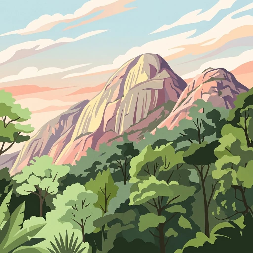
Eravikulam National Park, in Kerala, India. Landscapes: mountains, plateaus, and grasslands.
- Area
- 97 km²
- Established
- 1978
- IUCN
- II
- Visitors
- 148.4K annual

Regional geography and mapped landscape context for surrounding conservation areas
Examine the geographic distribution of protected lands in proximity to Anaimalai Tiger Reserve. This assessment provides a clear spatial overview of nearby wilderness areas, mountain forests, and wildlife reserves across the diverse terrain of the Western Ghats.

Western Ghats tiger sanctuary in the Anaimalai Hills of Tamil Nadu
Anaimalai Tiger Reserve is a protected area in the Anaimalai Hills of the Western Ghats in Tamil Nadu, India. The reserve encompasses a significant tract of tropical forest ecosystem in the mountain ranges of southern India, serving as a critical conservation area within one of the world's biodiversity hotspots. The reserve is named after the Anaimalai Hills, a prominent subrange of the Western Ghats known for their rich ecological diversity. The area supports substantial populations of large mammals including tigers and elephants, making it an important stronghold for megafauna conservation in peninsular India.
See the ranked park cluster in its geographic setting
Distance-ranked conservation areas and surrounding regional park geography in southern India

South
Understanding its geographic setting and landscape identity.
Eravikulam National Park, in Kerala, India. Landscapes: mountains, plateaus, and grasslands.

Southeast
Explore unique high-altitude ecosystems and regional landscape context.
Anamudi Shola National Park is a compact yet ecologically significant protected area situated in the Western Ghats of Kerala, India. Covering around 7.5 square kilometers, the park preserves rare montane shola forests at elevations exceeding 2,100 meters. Its identity as a critical wildlife corridor, connecting contiguous protected zones, is fundamental to its conservation value. The park's landscape, defined by its unique ecosystems and regional geographic position, offers valuable insights for atlas-driven exploration of protected natural areas.

Southeast
Explore mapped terrain and geographic context for this national park.
Gain insight into Pampadum Shola National Park, a key protected area within India's geography. This park detail provides essential information on its designation as a national park, its mapped boundaries, and its contribution to the regional landscape. It serves as a vital point for understanding the distribution and character of protected lands across India, offering a foundation for structured geographic research and atlas-based discovery of natural environments.

South
Discover its protected landscape and regional context.
Mathikettan Shola National Park, a designated national park in the Idukki region, offers a focal point for understanding protected landscapes and their geographic distribution. This entry details the park's mapped boundaries and its specific setting within the regional geography, providing an atlas-level view of its conservation value. Users can explore the structured geographic identity of this protected natural area, enriching their understanding of India's park network.

South
Mapped protected lands and regional landscape exploration in Kerala.
Discover Periyar National Park as a distinct protected landscape offering rich geographic context for atlas exploration. This entry details its mapped boundaries and its significance within the broader regional geography of Kerala. Understand the natural terrain and protected-area distribution that makes Periyar National Park a key element in India's conservation mapping.

Southwest
An extensive inland lake system featuring tidal lagoons, islets, and below-sea-level agricultural plains.
Spanning over 96 kilometers, Vembanad forms a sprawling wetland environment that acts as the primary drainage basin for much of Kerala. Analyze the geography of its intricate shorelines, mangrove patches, and historic islets like Pathiramanal. This protected zone provides a critical habitat for thousands of waterbirds while illustrating the complex relationship between coastal estuaries and human-managed landscapes.

Northwest
Explore mapped boundaries and regional terrain in South India.
Silent Valley National Park stands as a key protected area within Kerala, India, offering rich insights into its geographic setting. This destination provides an atlas-driven view of the park's mapped boundaries, its integration with the surrounding regional geography, and the character of its natural landscapes. Users can engage with detailed information designed for structured exploration of protected natural areas and their mapped contexts.

Northwest
Explore a vital refuge for the endangered Nilgiri tahr.
Mukurthi National Park, situated in the Nilgiri District of India, is an essential protected area celebrated for its distinctive montane landscape. This national park plays a critical role in the survival of the endangered Nilgiri tahr, protecting the rare shola-grassland ecosystem where they thrive. Its dramatic terrain, high elevations, and unique ecological associations make it a focal point for understanding conservation geography and the mapped boundaries of protected lands within the Western Ghats.

North
Discover mapped terrain and diverse forest ecosystems in South India.
Bandipur National Park, in Karnataka, India. Landscapes: forests, woodlands, and grasslands.

Northwest
Mapped protected area and natural terrain details for this key Indian park.
Delve into the specific geographic identity of Mudumalai National Park, a protected national park situated in the Nilgiri District. This detail page provides access to its mapped natural landscape, helping users understand its protected boundaries and regional geographic significance. It serves as a foundational point for exploring the park's unique terrain within India's atlas of natural protected areas.

South
Kerala's largest freshwater wetland and basin landscape
Investigate the territorial profile of Sasthamkotta Lake, an important Ramsar site in Kerala. This resource maps the lake's sheltered basin, shoreline hill contours, and connection to the alluvial plains of the Kallada River, highlighting its critical role in the regional hydrologic network.

South
Mapping the eight-armed estuary and coastal wetland landscape
Ashtamudi Lake is a major estuarine system in Kerala, defined by its branching topography and significant tidal influence. This atlas entry provides a clear perspective on the park's protected boundaries, including its mangrove patches, inland navigation channels, and island clusters that form the core of the regional wetland geography.

Northwest
Explore mapped boundaries and regional landscape context.
Nagarahole National Park stands as a distinct national park entity within the state of Karnataka, India. This section focuses on its specific geographic footprint and the protected landscape it encompasses, offering valuable data for users engaged in atlas-based discovery of India's conservation areas and natural terrains. Understand its mapped geography and regional significance.

Southeast
Explore India's vital marine national park and its coral reef ecosystems.
Gulf of Mannar Marine National Park is a designated national park located in Tamil Nadu, India, protecting a chain of 21 islands and their surrounding marine environments. This protected area is renowned for its extensive coral reefs, crucial seagrass meadows supporting dugongs, and diverse fish species, making it a key site for marine conservation and geographic exploration. The park's unique island landscape and intertidal zones offer a distinct perspective on coastal protected areas within the Indian Ocean, providing rich material for atlas-style discovery and understanding regional marine geography.

North
Explore the protected landscape and regional terrain context.
Bannerghatta National Park is an important protected area within the state of Karnataka, India. Its designation as a national park signifies its role in preserving regional natural landscapes and providing valuable geographic context for atlas exploration. Users can examine its mapped boundaries and understand its placement within the diverse terrain characteristic of South India and the Western Ghats, contributing to a structured understanding of protected lands.
East
Mapped boundaries and regional atlas context for this national park.
Delft National Park is a protected natural area situated in Sri Lanka's Northern Province, designated as a national park. This page offers an atlas-focused view of its protected boundaries, helping to contextualize its geographic setting and landscape character. Understanding Delft National Park involves exploring its specific location within the Northern Province and its role as a distinct entity in the study of mapped natural environments and regional geography.

East
Coastal wetlands, sand dunes, and tidal geography
Located at the tip of the Nagapattinam District, Point Calimere Wildlife and Bird Sanctuary functions as a critical wetland complex along the central Asian flyway. The protected area features a unique intersection of salt swamps, dry evergreen forest fragments, and open coastal horizons. This map-focused profile examines the sanctuary's diverse terrain and its role as a vital sanctuary for blackbuck and thousands of migratory waterbirds.
Southeast
Mapped marine geography and protected island ecosystems.
Adam's Bridge Marine National Park is a protected national park in Sri Lanka's Northern Province, notable for encompassing the legendary Adam's Bridge. This marine protected area safeguards critical shallow-water habitats, including seagrass meadows and sand dunes, which are vital for migratory birds, dugongs, and sea turtles. The park's unique geographic identity as a chain of limestone shoals and islands offers a distinct landscape for atlas-based discovery and understanding of coastal conservation significance.

Northeast
Essential insights into regional elephant habitat and plateau ecosystems
Koundinya Wildlife Sanctuary serves as the primary elephant reserve of Andhra Pradesh, protecting a rugged mosaic of dry deciduous woodlands and rocky valleys along the Kolar Plateau. This sanctuary provides critical sanctuary space characterized by seasonal waterfalls, dry forest canopy, and a diverse range of terrain that facilitates the movement of significant Asian elephant populations within this distinct southern Indian ecological zone.

Northwest
Explore the geography of shola forests and grasslands.
Kudremukh National Park is a pivotal protected landscape in Karnataka, India, recognized for its distinctive montane grasslands and shola forests. This national park is a critical source for three major rivers: the Tunga, Bhadra, and Nethravathi, highlighting its ecological and geographic significance within the Western Ghats. The park's terrain features rolling hills and steep western slopes, contributing to its unique biodiversity and landscape character for atlas-based discovery.
Geographic measurements, not driving distances
Calculated between the nearest points of both park boundaries.
Estimated from one mapped park location to the nearest boundary of the other park.
Estimated between the mapped locations of both parks.
Deepen your understanding of Anaimalai Tiger Reserve by examining its specific protected area boundaries and its place within India's natural geography. This detailed exploration reveals the unique landscape characteristics and the conservation significance of this vital wildlife reserve. Continue your atlas journey to grasp the full regional context and mapped terrain of Anaimalai Tiger Reserve.