Mori Atlas logo
Nearby park discovery

Regional geographic distribution and protected landscape analysis in Ukraine

National Parks and Protected Areas Surrounding Bile Ozero National Nature Park

Examine the geographic distribution of protected areas and national parks located near Bile Ozero National Nature Park. This regional overview provides context for the wetland and forest landscapes characterizing the Dnieper River basin and surrounding Ukrainian terrain.

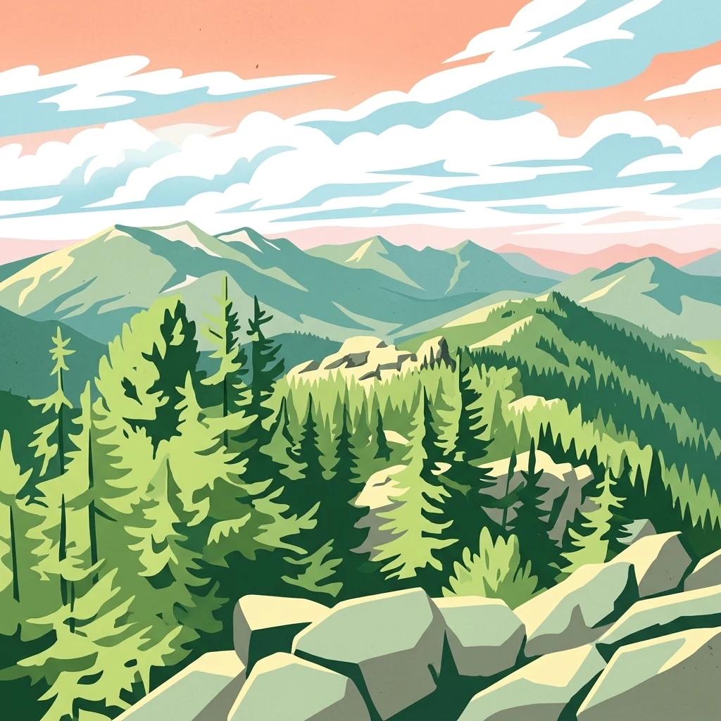
Stylized illustration of forested mountains with rocks in the foreground under a partly cloudy sky

Central Ukraine's wetland sanctuary protecting the White Lake ecosystem

Bile Ozero National Nature Park

Bile Ozero National Nature Park is a protected area in north-central Ukraine, spanning portions of Kyiv Oblast and Cherkasy Oblast. Established in December 2009, the park covers approximately 7,014 hectares of state-owned forest land formerly managed by the State Organization "Forestry Bile Ozero." The park derives its name from the Ukrainian phrase meaning "White Lake," reflecting the prominent aquatic feature that forms all or part of the park's identity. Located within the Dnieper River basin region, the area represents a blend of wetland, forest, and lacustrine ecosystems characteristic of central Ukrainian terrain. The park was designated under IUCN Category II, recognizing its national significance for biodiversity conservation and natural landscape preservation.

Location
Ukraine
Park type
National park
Established
2009
Area
70.1 km²
Bile Ozero National Nature Park National Park
Regional park map

See the ranked park cluster in its geographic setting

Nearby parks around Bile Ozero National Nature Park

This regional map shows the same 20 nearby parks ranked below around Bile Ozero National Nature Park. Select a ranked marker to highlight that park’s boundary where boundary data is available.
Reference park: Bile Ozero National Nature ParkRanked nearby park20 nearby parks shown
20 nearby parks

Distance-ranked protected landscapes and regional conservation geography

Parks and Protected Areas Geographically Near Bile Ozero National Nature Park

Geographic separation values and directional metrics organize surrounding protected areas relative to Bile Ozero National Nature Park for systematic comparison. Country context and recorded environmental characteristics reveal broader regional park patterns without implying identical habitats or driving routes.
Watercolor illustration showing a river flowing through a valley with green hills and trees
National parkPoltava Oblast
About 76 km away#1 closest

Northeast

Pyriatyn National Nature Park: Detailed Atlas View of Ukrainian River Valley Protected Landscapes

Explore Poltava Oblast's unique wetland and floodplain ecosystems.

Pyriatyn National Nature Park provides an exceptional case study of a complete river valley ecosystem within Ukraine's Poltava Oblast. This protected area showcases a distinct topographic sequence, transitioning from upland terraces to extensive floodplain wetlands and the meandering Udai River. Discover the park's significant role in conserving boreal plant species at their southern range limits and its importance as a mapped natural landscape for geographic atlas exploration.

Area
120 km²
Established
2009
IUCN
II
Relief
Lowland
Watercolor artwork showing tall trees, green foliage, and distant mountains under a soft sky
National parkUkraine
About 85 km away#2 closest

Northwest

Holosiiv National Nature Park: Ukraine's Protected Area and Mapped Landscape

Explore geographic boundaries and regional context.

Holosiiv National Nature Park represents a significant protected natural landscape within Ukraine. This detail page offers in-depth atlas exploration of the park's mapped boundaries and its integration into the country's regional geography. Understand the value of this protected area through structured geographic data and visual context, enabling a deeper appreciation of its unique landscape identity within the national park system.

Area
45.255 km²
Established
2007
IUCN
II
Relief
Lowland
Watercolor illustration of a river landscape with green hills, reeds, and water lilies
National parkUkraine
About 101 km away#3 closest

Northwest

Zalissia National Nature Park: Protected Forest Atlas and Regional Geography

Mapping Ukraine's temperate hardwood and pine forest ecosystems.

Delve into Zalissia National Nature Park, a significant protected landscape in Ukraine renowned for its vast temperate hardwood forests and ancient pine stands. This atlas entry details the park's mapped boundaries, its position within the Desna River floodplain, and the unique geographic context of its forest ecosystems. Understanding Zalissia National Nature Park offers insight into the conservation of northern Ukraine's natural heritage and its place in the broader regional geography.

Area
148 km²
Established
2009
IUCN
II
Relief
Lowland
Watercolor painting of rolling hills, forests, and wildflowers in a landscape
National parkUkraine
About 114 km away#4 closest

Northeast

Ichnia National Nature Park: A Protected Landscape with Geographic Identity in Ukraine

Explore the mapped boundaries and regional natural context of this national park.

Ichnia National Nature Park represents a significant protected landscape within Ukraine, providing users with a focused entry point for geographic discovery. This page details its designation as a national park, highlighting its mapped features and regional setting. It serves as a foundational resource for understanding the park's specific landscape character and its contribution to the broader atlas of Ukraine's protected natural areas, offering detailed geographic context for further exploration.

Area
97 km²
Established
2004
IUCN
II
Relief
Lowland
Watercolor depiction of a river flowing through wetlands with green vegetation, trees, and distant hills under a soft sky
National parkPoltava Oblast
About 121 km away#5 closest

East

Lower Sula National Nature Park: Protected Wetlands and River Floodplain Atlas Explorer

Mapped boundaries and geography of this Ukrainian national park.

Discover the detailed geography and protected landscape features of Lower Sula National Nature Park, located in Poltava Oblast, Ukraine. This page provides an atlas-level view of its critical wetland habitats, including marshes and shallow lakes, which are vital for waterfowl and fish spawning. Explore the park's unique position within the Sula River floodplain and its ecological significance as a national nature park, offering rich context for geographic study.

Area
186 km²
Established
2010
IUCN
II
Relief
Lowland
Watercolor illustration showing a winding river through a grassy field with wildflowers and distant hills under a soft sky
National parkChernihiv Oblast
About 209 km away#6 closest

North

Mezyn National Nature Park: Protected Area with Paleolithic Heritage in Chernihiv Oblast

Explore ancient forests, river wetlands, and prehistoric landscapes.

Mezyn National Nature Park in Chernihiv Oblast, Ukraine, represents a significant protected area where natural landscapes meet profound archaeological discoveries. This national park encompasses diverse terrain, from the expansive Desna River floodplain dotted with oxbow lakes to ancient oak forests and rolling upland areas shaped by glacial activity. It is particularly noted for the Mezyn Paleolithic site, offering insights into Ice Age human life with remarkable artifacts and bone dwellings, making it a unique destination for atlas-driven discovery of protected lands and prehistoric geography.

Area
310 km²
Established
2004
IUCN
II
Relief
Lowland
Watercolor illustration showing mountains, forests, and fields.
National parkMykolaiv Oblast
About 212 km away#7 closest

South

Bug Gard National Nature Park: Mapped Protected Landscape in Mykolaiv Oblast

Explore National Park Geography and Boundaries

Delve into Bug Gard National Nature Park, a designated national park situated in Mykolaiv Oblast, Ukraine. This detailed view highlights the park's protected landscape, offering insights into its geographic distribution and mapped boundaries. Understand its place within the regional terrain and access structured information for atlas-based exploration of this significant natural area.

Area
61.38 km²
Established
2009
IUCN
II
Relief
Mixed relief
Watercolor depiction of a river landscape with grassy plains, distant trees, and hills
National parkSumy Oblast
About 252 km away#8 closest

East

Hetman National Nature Park: National Park Geography and Protected Landscape Atlas

Mapped protected area within Sumy Oblast, Ukraine.

Explore Hetman National Nature Park, a designated national park situated in Sumy Oblast, Ukraine. This page offers a detailed look at its geographic setting, mapped boundaries, and role as a protected landscape. Understand its place within the regional geography of northeastern Ukraine and utilize MoriAtlas for structured map-based discovery of this significant natural area.

Area
234 km²
Established
2009
IUCN
II
Relief
Lowland
Watercolor illustration of a landscape with green fields, a body of water, and distant mountains
National parkKharkiv Oblast
About 262 km away#9 closest

East

Sloboda National Nature Park: National Park Protected Landscape in Kharkiv Oblast

Mapped Boundaries and Regional Geography Exploration

Investigate Sloboda National Nature Park, a recognized national park situated within Ukraine's Kharkiv Oblast. This page offers detailed insights into its protected landscape, focusing on its geographic setting and mapped terrain. Understand how this park contributes to the regional geography of Sloboda Ukraine and explore its mapped boundaries for a structured atlas discovery experience.

Area
52.44 km²
Established
2009
IUCN
II
Relief
Mixed relief
National parkSumy Oblast
About 284 km away#10 closest

Northeast

Desna, Stara Huta National Nature Park: Key Protected Area and Regional Geographic Context in Ukraine

Explore mapped landscapes of river floodplains and boreal forests.

This page details Desna, Stara Huta National Nature Park, a significant protected area within Ukraine's Sumy Oblast. It showcases a landscape defined by the Desna River floodplain, unique wetlands, and the southernmost extension of the Bryansk Forest. Users can explore its geographic identity, protected status, and its role in the atlas of Eastern European natural regions, focusing on landscape diversity and mapped boundaries.

Area
162 km²
Established
1999
IUCN
II
Relief
Lowland
Watercolor illustration of a winding river through a landscape with hills and trees
National parkOrhei District
About 339 km away#11 closest

Southwest

Orhei National Park: Explore Moldova's Inaugural National Park Landscape

Mapped protected boundaries and regional geography in Orhei District.

As Moldova's first national park, Orhei National Park offers a rich exploration of the Codri region's characteristic hilly terrain and extensive deciduous forests. Situated within Orhei District, this protected area encompasses the meandering Răut River valley and notable landscape reserves. Its designation highlights a crucial commitment to preserving both the natural beauty and the significant cultural heritage, including the UNESCO candidate site of Old Orhei, making it a key destination for understanding Moldova's protected lands and regional geography.

Area
337.92 km²
Established
2013
IUCN
II
Relief
Highland
Watercolor painting showing a lake surrounded by trees with distant hills under a colorful sky
National parkUkraine
About 341 km away#12 closest

West

Lower Polissia National Nature Park: Ukraine's Mapped Protected Wetland Landscape

National Park in Ukraine's Polissia region.

The Lower Polissia National Nature Park is a crucial protected area covering 8,762 hectares in western Ukraine. This park offers a detailed geographic profile, showcasing its extensive wetland habitats, forest complexes, and the Horyn, Viliia, and Hnylyi Rih river valleys. As a key component of the Polissia landscape zone, the park provides essential context for understanding the protected natural terrain and regional ecology of Eastern Europe through structured map exploration.

Area
87.62 km²
Established
2013
IUCN
II
Relief
Lowland
Watercolor painting of a river valley surrounded by forests and mountains
National parkBelarus
About 344 km away#13 closest

Northwest

Prypyatski National Park: Belarus Protected Area and Mapped Landscape Context

National park details for geographic exploration.

Delve into the specifics of Prypyatski National Park, a designated national park in Belarus. This detailed entry focuses on its protected landscape characteristics, mapped geographic boundaries, and its significance within the broader atlas of European protected areas. Understand the terrain and regional context of this important natural conservation zone.

IUCN
II
Watercolor illustration showing a valley with a winding river, green trees, and distant purple mountains under a light sky
National parkKharkiv Oblast
About 344 km away#14 closest

East

Homilsha Woods National Nature Park: National Park & Protected Landscape Atlas

Ancient oak woodlands and river valley geography in Kharkiv Oblast.

Delve into the protected natural heritage of Homilsha Woods National Nature Park, a significant national park situated in Ukraine's Kharkiv Oblast. This park preserves exceptional examples of ancient oak forests, some hundreds of years old, set within a complex geographic transition zone between steppe and forest ecosystems. Its diverse terrain, including hilly uplands and riverine plains, provides a compelling subject for mapped landscape discovery and understanding regional protected area distribution.

Area
143 km²
Established
2004
IUCN
II
Relief
Upland
National parkRivne Oblast
About 365 km away#15 closest

West

Derman, Ostroh National Nature Park: Geographic Atlas of a Ukrainian National Park

Explore its protected boundaries and landscape context.

Delve into the detailed atlas information for Derman, Ostroh National Nature Park, a designated national nature park located in Ukraine's Rivne Oblast. This resource illuminates the park's specific geographic footprint, its protected land status, and its contribution to the regional landscape. Understand its terrain and mapped features, offering a clear point of discovery for those interested in the geography of Ukrainian protected areas.

Area
16 km²
Established
2009
IUCN
II
Relief
Mixed relief
Watercolor painting showing a river, green vegetation, trees, and distant snow-capped mountains under a light sky
National parkMykolaiv Oblast
About 374 km away#16 closest

South

Ivory Coast of Sviatoslav National Nature Park: National Park Identity and Regional Geography

Mapped protected area in Mykolaiv Oblast, Ukraine.

Gain a structured understanding of Ivory Coast of Sviatoslav National Nature Park, a designated national park in the Mykolaiv Oblast region of Ukraine. This entry focuses on its protected landscape identity and its position within the broader regional geography. Explore the mapped outlines and discover its significance as a key protected territory for atlas-based research and geographic context.

Area
352 km²
Established
2009
IUCN
II
Relief
Lowland
Watercolor illustration of a landscape with rolling hills, a body of water, and greenery
National parkZaporizhzhia Oblast
About 376 km away#17 closest

Southeast

Grand Meadow National Nature Park: National Park Protected Landscape and Regional Geography

Explore the mapped boundaries and natural terrain.

Grand Meadow National Nature Park represents a distinct protected landscape within Zaporizhzhia Oblast, Ukraine. As a national park, its designation signifies an area managed for conservation and geographic study. This entry on MoriAtlas details the park's physical presence, offering users the opportunity to explore its mapped terrain, understand its role in regional geography, and place it within the broader atlas of Ukrainian protected areas. It is ideal for users seeking concrete landscape context and precise geographic data.

Area
168 km²
Established
2006
IUCN
II
Relief
Lowland
Watercolor illustration of a landscape with grassy fields, trees, a river, and distant hills.
National parkKherson Oblast
About 385 km away#18 closest

South

Oleshky Sands National Nature Park: Mapping Ukraine's Distinctive Semi-Arid Dune Landscape

Explore protected sandy steppe, dunes, and conservation areas in Kherson Oblast.

Oleshky Sands National Nature Park is a critical protected landscape in Kherson Oblast, Ukraine, renowned for its unusual semi-arid terrain dominated by expansive sand dunes and sandy steppe. This page provides detailed geographic context for the park, highlighting its unique mapped boundaries, the contrast between its Radensk and Burkut zones, and its ecological importance as part of the Pontic-Caspian steppe. Understand the specific landscape features and regional geography that make this national park a significant natural asset within Ukraine's protected area network.

Area
80.2 km²
Established
2010
IUCN
II
Relief
Mixed relief
Watercolor painting of a river, hills, and trees in a natural landscape.
National parkKhmelnytskyi Oblast
About 392 km away#19 closest

West

Podilski Tovtry National Nature Park: Mapped Limestone Ridges and Regional Geography

Explore this protected national park in Khmelnytskyi Oblast.

Podilski Tovtry National Nature Park is a vast protected area in western Ukraine, recognized for its distinctive Tovtry limestone ridge and intricate river canyon systems. This national park offers a rich geographic context for understanding the natural landscape of Khmelnytskyi Oblast, featuring unique geological formations and diverse habitats. Its protected status highlights the importance of its conservation value and its role within regional natural resource management, making it a key destination for atlas-based geographic discovery.

Area
2,613.16 km²
Established
1996
IUCN
II
Relief
Highland
A minimalist watercolor painting showing rolling green hills and distant mountain ridgelines in soft pastel tones of green and violet against a white background.
Protected areaAlbania
About 393 km away#20 closest

West

Primeval Beech Forests of the Carpathians and Other Regions of Europe: Protected Area and Forest Atlas

A transnational network of old growth beech forest reserves across Europe.

Examine the geographic distribution and protected boundaries of the Primeval Beech Forests of the Carpathians and Other Regions of Europe. This site highlights the continent's most intact beech forest ecosystems, illustrating essential ecological processes from the Balkans and Carpathians to the Alps and Western Europe.

Area
583.53 km²
Established
2007
Relief
Mountain
Access
Access unknown
Distance methodology

Geographic measurements, not driving distances

How nearby park distances are calculated

Distances use park boundaries whenever the available geometry allows it. When one or both boundaries are missing, the mapped park locations provide a clearly labelled estimate. Every value represents straight-line geographic separation and does not use roads or routing.

Boundary distance

Calculated between the nearest points of both park boundaries.

Location-to-boundary estimate

Estimated from one mapped park location to the nearest boundary of the other park.

Mapped-location estimate

Estimated between the mapped locations of both parks.

MoriAtlas Explorer

Continue exploring Bile Ozero National Nature Park's geographic context and mapped landscape

To deepen your understanding of Bile Ozero National Nature Park, continue exploring its specific geographic attributes and protected area significance. This detailed park entry provides a foundation for understanding its boundaries and landscape within Kyiv Oblast. Utilize MoriAtlas to further navigate the mapped terrain and regional geography surrounding this important Ukrainian national park.