Mori Atlas logo
Nearby park discovery

Geographic mapping of wetlands and coastal protected lands in the vicinity of the reserve

Surrounding Protected Areas and Regional Park Landscapes Near 海南东寨港国家级自然保护区

Examine the geographic distribution of protected areas situated near 海南东寨港国家级自然保护区. By mapping the spatial relationships between coastal reserves and regional wetlands, this view provides context for the diverse landscape patterns across northern Hainan. Discover how these adjacent natural territories contribute to the broader environmental character of the regional coastline.

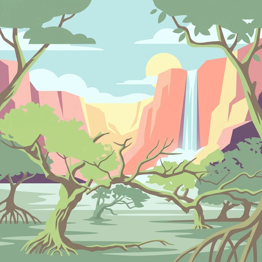
A flat vector illustration of a forest with mangrove roots in the foreground, a canyon with steep walls in the middle distance, and a tall waterfall flowing into a pool below.

China's first protected mangrove wetland, on the northern coast of Hainan Island.

Dongzhaigang National Nature Reserve

Dongzhaigang National Nature Reserve protects one of the most important mangrove ecosystems in China, located on the northern coast of Hainan Island near the city of Haikou. Established in 1986, it was the first nature reserve in China to be created specifically for the protection of mangrove wetlands, marking an early milestone in the country's wetland conservation framework. The reserve encompasses an irregular coastal bay formed by ancient seismic activity, with extensive intertidal flats, tidal channels, and brackish swamps that support dense stands of mangrove forest. The protected area combines mangrove habitat with shallow marine and tidal wetlands, creating a productive transition zone between land and sea. Because of its ecological importance, Dongzhaigang was included as one of the earliest Chinese sites placed on the international list of important wetlands, and it has also been added to UNESCO's tentative list of World Heritage sites. Today it remains a key reference point for mangrove research, migratory bird conservation, and coastal wetland protection in tropical southern China. Beyond its ecological role, the reserve reflects the broader significance of mangrove forests in stabilizing shorelines, supporting fisheries, and sheltering biodiversity. Its location near Haikou also makes it one of the most accessible large mangrove systems in the country, linking conservation, education, and regional identity on Hainan's northern coast.

Location
China
Park type
Nature reserve
Established
1986
Area
33.4 km²
海南东寨港国家级自然保护区 Map and Geography
Regional park map

See the ranked park cluster in its geographic setting

Nearby parks around Dongzhaigang National Nature Reserve

This regional map shows the same 20 nearby parks ranked below around Dongzhaigang National Nature Reserve. Select a ranked marker to highlight that park’s boundary where boundary data is available.
Reference park: Dongzhaigang National Nature ReserveRanked nearby park20 nearby parks shown
20 nearby parks

Distance ranked regional park geography and surrounding protected landscapes

Parks and Protected Areas Geographically Near 海南东寨港国家级自然保护区

Spatial proximity rankings evaluate the geographic separation between 海南东寨港国家级自然保护区 and adjacent protected terrain. Recorded environmental profiles establish structured comparison signals across regional conservation zones and coastal ecosystems.
Nature reserveGuangxi
About 184 km away#1 closest

Northwest

Guangxi Hepu Dugong National Nature Reserve: Coastal Geography and Marine Protected Area

Protected marine landscape in the Gulf of Tonkin, China.

Gain insights into the geographic extent and marine environment of Guangxi Hepu Dugong National Nature Reserve. This protected area in the Beibu Gulf anchors regional conservation efforts through its distinct seagrass beds, tidal flats, and extensive shallow-water habitats that support rare marine life.

Area
350 km²
Established
1992
Relief
Lowland
Climate
Subtropical
Watercolor painting showing a coastal landscape with distant islands, green vegetation, and a horizon line
National parkQuảng Ninh Province
About 331 km away#2 closest

West

Bái Tử Long National Park: Protected Island Archipelago and Marine Landscape Discovery

Explore the geography and mapped protected boundaries.

Bái Tử Long National Park, located in Vietnam's Quảng Ninh Province, is a protected national park distinguished by its archipelago of approximately 40 limestone islands and significant marine environments. As one of Vietnam's few national parks designated to protect both land and sea, it provides critical atlas-level insights into coastal karst topography, marine biodiversity, and the interconnectedness of island ecosystems. Discover the park's unique geographic features and its role as a vital protected landscape within the broader regional context.

Area
157.83 km²
Established
2001
IUCN
II
Relief
Mixed relief
National parkVietnam
About 365 km away#3 closest

West

Cát Bà National Park: Vietnam's Critically Endangered Species Sanctuary & Karst Landscape

Mapped protected area with diverse terrestrial and marine ecosystems.

As a critical national park in Vietnam, Cát Bà National Park protects a remarkable limestone karst landscape central to the Hạ Long Bay region. This area is renowned for its steep peaks, narrow valleys, and coastal mangrove environments, supporting a uniquely diverse array of flora and fauna. Its status as a protected area highlights its global importance for conservation, particularly as the exclusive habitat of the Cát Bà langur. Explore the mapped geography and ecological significance of this vital Vietnamese protected land.

Area
161.968 km²
Established
1986
IUCN
II
Relief
Highland
Watercolor illustration of a wetland landscape with green trees and a pale sky
National parkNam Định Province
About 425 km away#4 closest

West

Xuân Thủy National Park: Protected Landscape Identity and Mapped Geography in Nam Định

Explore the national park's protected boundaries and regional landscape.

Xuân Thủy National Park serves as a vital protected landscape within Nam Định Province, Vietnam, offering users a clear point of entry for understanding its geographic identity. This page facilitates detailed exploration of its mapped park boundaries and the surrounding natural terrain, providing essential context for anyone interested in the regional geography of protected areas. Discover the specific landscape characteristics that define this national park and its place within Vietnam's conservation network.

Area
7,100 km²
Established
2003
IUCN
II
Relief
Lowland
National parkVietnam
About 501 km away#5 closest

Southwest

Bach Ma National Park: Protected Area and Mountain Landscape in Vietnam

Explore the biodiversity and unique geography of this vital national park.

Bach Ma National Park in Vietnam is a protected area defined by its steep, granite-rich mountainous terrain within the Annamite Range. The park’s location at a significant biogeographical crossroads contributes to its exceptional biodiversity, particularly its documented birdlife and varied forest ecosystems. Understanding Bach Ma National Park through its mapped landscape provides critical insight into Vietnam's natural heritage and the ecological dynamics shaped by its unique regional geography.

Area
220 km²
Established
1986
IUCN
II
Relief
Mountain
National parkNinh Bình Province
About 521 km away#6 closest

West

Cúc Phương National Park: National Park Atlas and Mapped Protected Landscape Details

Explore its geographic setting and protected area boundaries.

Gain structured insight into Cúc Phương National Park, a designated national park in Vietnam situated within Ninh Bình Province. This entry provides detailed geographic context, focusing on the park's mapped boundaries and its identity as a protected landscape. It is designed to support atlas-driven exploration and understanding of Vietnam's natural geography.

Established
1962
Relief
Mountain
Climate
Tropical
Access
Moderate access
Watercolor illustration of a river flowing through a valley with green forests and distant mountains
National parkVietnam
About 522 km away#7 closest

Southwest

Phong Nha, Kẻ Bàng National Park: Vietnam's Karst Terrain and Subterranean World

Explore protected landscapes, cave systems, and geological wonders.

Phong Nha, Kẻ Bàng National Park in Vietnam is a globally significant protected landscape, recognized by UNESCO for its exceptional karst topography and extensive cave networks. This national park features dramatic limestone mountains, deep river gorges, and some of the world's most impressive subterranean formations, offering a rich atlas of natural history and geological wonders to explore.

Area
857.54 km²
Established
2001
IUCN
II
Visitors
740K annual
National parkThanh Hóa Province
About 528 km away#8 closest

West

Ben En National Park: Vietnam National Park Geography and Mapped Landscape Context

Explore protected area boundaries and regional terrain.

Ben En National Park represents a key protected natural area within Thanh Hóa Province, Vietnam. This detail page facilitates a structured discovery of its geographic features, mapped extent, and its significance as a national park. Dive into the atlas context to understand the park's landscape and its regional setting, offering a factual foundation for geographic exploration.

Area
147.35 km²
Established
1992
IUCN
II
Visitors
6.6K annual
National parkVĩnh Phúc Province
About 529 km away#9 closest

West

Tam Dao National Park: Vietnam's Mountain National Park and Biodiversity Hotspot

Explore mapped boundaries and regional landscape context.

Tam Dao National Park is a key protected area in northern Vietnam, defined by its rugged mountain terrain featuring over 20 peaks exceeding 1,000 meters. This national park is a vital habitat for diverse flora and fauna, including numerous endemic species, and showcases transitional forest ecosystems from tropical to montane zones. Understanding Tam Dao National Park involves exploring its geographic setting within Vĩnh Phúc Province and appreciating its role as a significant protected landscape.

Area
368.83 km²
Established
1996
IUCN
II
Relief
Mountain
National parkHanoi
About 557 km away#10 closest

West

Ba Vì National Park: Ancient Volcanic Mountains and Protected Landscape Near Hanoi

Discover the mapped geography and biodiversity of this national park.

Ba Vì National Park, a protected natural area near Hanoi, showcases a dramatic landscape shaped by ancient volcanic activity. The park features three significant peaks, including Vua Mountain, creating a distinct topographical profile. Spanning over 10,800 hectares, it is recognized for its ecological diversity, harboring a wealth of plant and animal species. This national park serves as a vital protected landscape, offering a unique opportunity for geographic exploration and understanding the natural terrain surrounding the Vietnamese capital.

Area
108.15 km²
Established
1991
IUCN
II
Relief
Mountain
Watercolor painting depicting a lake with green hills and vegetation
National parkBắc Kạn Province
About 571 km away#11 closest

Northwest

Ba Bể National Park: Vietnam's Largest Freshwater Karst Lake and Protected Landscape

Discover the mapped geography of this unique protected wetland in Bắc Kạn.

Ba Bể National Park is distinguished by Vietnam's largest natural freshwater lake, a perennial karst water body set within a dramatic limestone landscape. This national park in Bắc Kạn Province protects a vital wetland ecosystem and its surrounding highland forests, offering a rich geographic context for atlas exploration. Explore the park's unique terrain, mapped boundaries, and the remarkable biodiversity it preserves, making it a cornerstone of regional natural landscape discovery.

Area
100.48 km²
Established
1992
IUCN
II
Relief
Mixed relief
National parkHà Tĩnh Province
About 575 km away#12 closest

West

Vũ Quang National Park: Protected Landscape Identity and Geographic Context in Hà Tĩnh

National Park Discovery and Mapped Terrain Exploration

Investigate Vũ Quang National Park, a key protected area situated in Hà Tĩnh Province. This page provides detailed insight into the park's designation as a national park, focusing on its mapped boundaries, surrounding natural landscapes, and contribution to the regional geography. It serves as a vital resource for understanding the park's protected landscape characteristics and its place within Vietnam's atlas of conservation areas.

Area
550.28 km²
Established
2002
IUCN
II
Relief
Mountain
National parkPhú Thọ Province
About 591 km away#13 closest

West

Xuân Sơn National Park: Protected Mountain Landscape and Regional Geography

Mapping the southeastern edge of the Hoang Lien Mountains.

Delve into the protected landscape of Xuân Sơn National Park, a key national park situated in Phú Thọ Province, Vietnam. This area, covering about 150 square kilometers, is defined by its rugged mountainous terrain, featuring steep forested slopes and distinct ridgelines that contribute to the region's varied topography. As a protected national park, Xuân Sơn plays a crucial role in preserving the natural characteristics of the southeastern Hoang Lien Mountains. Its geographic setting is significant, acting as a transition zone between higher montane environments and the nearby lowland river systems, offering a unique perspective on Vietnam's diverse natural heritage.

Area
150.48 km²
Established
1986
IUCN
II
Relief
Mountain
Protected areaSavannakhet Province
About 620 km away#14 closest

Southwest

Phou Xang He National Protected Area: Geographic Overview and Forest Landscape Mapping

Protected forest ecosystems in Savannakhet Province, Laos

Phou Xang He National Protected Area encompasses a vast, relatively undisturbed forest expanse in central Laos. This detailed look at the park's physical geography highlights its characteristic mix of deciduous and evergreen woodlands, serving as a vital habitat within the Annamite foothills region. Understand the spatial distribution of this protected landscape and its regional importance to conservation efforts across Savannakhet Province.

Area
1,180 km²
Established
1993
IUCN
VI
Access
Access unknown
National parkTaiwan
About 621 km away#15 closest

East

Dongsha Atoll National Park: Taiwan's South China Sea Protected Coral Atoll Landscape

Explore mapped marine geography and vital seagrass ecosystems.

Dongsha Atoll National Park is a protected coral atoll in Taiwan, situated in the northern South China Sea. This national park is distinguished by its circular atoll structure, encompassing extensive shallow reef systems and vital seagrass beds. Its marine geography is central to its identity, supporting diverse aquatic life and serving as a crucial protected landscape for regional ecological connectivity. Users can delve into the mapped context and distinct protected-area characteristics of this unique atoll.

Area
3,537 km²
Established
2007
IUCN
II
Relief
Lowland
National parkNghệ An Province
About 630 km away#16 closest

West

Pù Mát National Park: National Park Protected Landscape and Geographic Mapping

Explore Nghệ An Province's protected area context.

Pù Mát National Park is a key protected area situated in Nghệ An Province, Vietnam. This entry focuses on its role as a national park, detailing its mapped boundaries and geographic features. It serves as a vital point for understanding the distribution of protected lands and the natural landscape context within the broader regional atlas. Discover the specific geographic identity and atlas significance of Pù Mát National Park.

Area
911.13 km²
Established
2001
IUCN
II
Relief
Mountain
National parkVietnam
About 651 km away#17 closest

South

Kon Ka Kinh National Park: Vietnam National Park Protected Landscape Atlas

Explore mapped geography and protected area details.

Kon Ka Kinh National Park is a protected natural area situated in Vietnam, designated as a national park to preserve its unique geographic and landscape features. This entry serves as a focused point for atlas-driven discovery, detailing the park's mapped boundaries and its significance within the broader context of Vietnam's regional geography. Understand the protected land's identity and its role in mapping natural landscapes.

Area
417.8 km²
Established
2002
IUCN
II
Relief
Mountain
Wildlife reserveKhammouane Province
About 657 km away#18 closest

West

Phou Hin Poun National Biodiversity Conservation Area: Khammouane Province Landscapes

Tower karst geology and Annamite Range biodiversity

Delve into the geography of Phou Hin Poun National Biodiversity Conservation Area, where dramatic stone ridges and dense forest patches define a unique karst ecosystem. Located in Khammouane Province, this wildlife reserve stands as a major center for scientific discovery and protected habitat monitoring in central Laos.

Area
1,801.49 km²
Established
1993
IUCN
VI
Relief
Mountain
National parkRatanakiri province
About 668 km away#19 closest

Southwest

Virachey National Park: Cambodia's Vast Highland Protected Landscape in Ratanakiri

Explore its remote montane forest ecosystems and diverse terrain.

Virachey National Park, Cambodia's largest national park, offers a profound glimpse into one of mainland Southeast Asia's last great wildernesses. Spanning remote highland terrain in Ratanakiri province, it features dramatic elevation changes from 400 to 1,500 meters, supporting diverse ecosystems including dense lowland forests, unique montane cloud forests, and upland savannahs. Its recognition as an ASEAN Heritage Park underscores its critical regional conservation value, making it a significant destination for understanding protected landscapes and their geographic context.

Area
3,380.57 km²
Established
1993
IUCN
II
Relief
Mountain
National parkKon Tum Province
About 672 km away#20 closest

Southwest

Chư Mom Ray National Park: A Mapped Protected Landscape in Kon Tum Province, Vietnam

Explore National Park Geography and Protected Boundaries

Chư Mom Ray National Park is a vital national park located in Vietnam's Kon Tum Province. This page offers an atlas-style exploration of its protected landscape, detailing its geographic setting and mapped boundaries. Discover how Chư Mom Ray National Park fits into the regional geography of Vietnam and understand its significance as a distinct conservation area within the broader landscape.

Area
566.21 km²
Established
2002
IUCN
II
Access
Access unknown
Distance methodology

Geographic measurements, not driving distances

How nearby park distances are calculated

Distances use park boundaries whenever the available geometry allows it. When one or both boundaries are missing, the mapped park locations provide a clearly labelled estimate. Every value represents straight-line geographic separation and does not use roads or routing.

Boundary distance

Calculated between the nearest points of both park boundaries.

Location-to-boundary estimate

Estimated from one mapped park location to the nearest boundary of the other park.

Mapped-location estimate

Estimated between the mapped locations of both parks.

MoriAtlas Explorer

Continue Exploring the Protected Landscapes of 海南东寨港国家级自然保护区

Trace the intricate tidal channels and mangrove habitats that define this important nature reserve on the Hainan coast. Use the MoriAtlas platform to analyze the regional geography, wetland boundaries, and the ecological importance of this unique coastal bay.