Mori Atlas logo
Country parks

Discover and compare protected lands, from boreal forests to lake districts across Finland.

Finland National Parks: A Mapped Browse of Protected Areas and Natural Landscapes

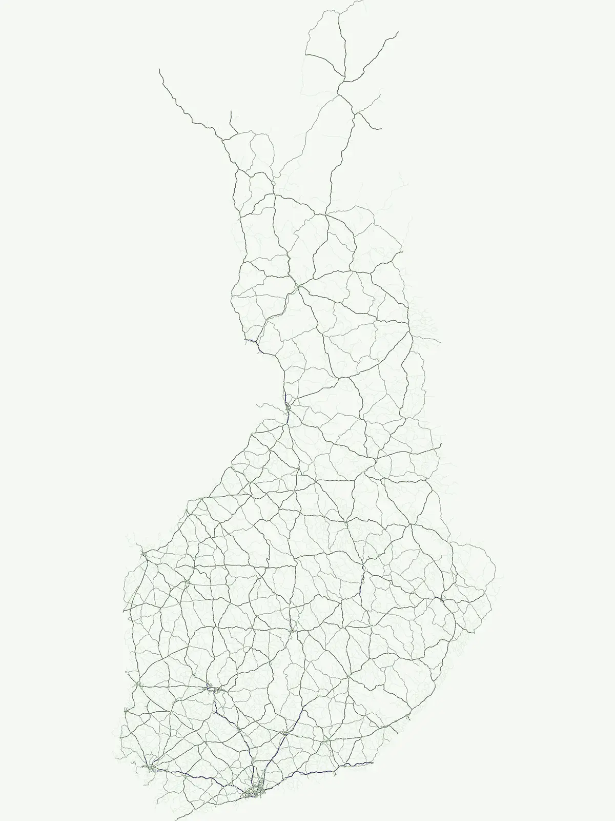
Begin your geographic exploration of Finland with a comprehensive browse of its national parks and protected natural areas. This atlas-style view provides detailed insights into the mapped boundaries and distribution of conservation landscapes throughout the country. Understand the unique geography of Finland's diverse natural regions, from its vast boreal forests to its iconic lake districts, all accessible through this dedicated country-level park discovery surface.

Finland National Parks: A Mapped Browse of Protected Areas and Natural Landscapes

Explore the geographic spread of Finland's national parks, nature reserves, and conservation areas, mapping its unique Nordic landscapes.

National Parks in Finland: Browse the Full Country-Wide List of Protected Areas

Browse a comprehensive list of Finland's national parks, nature reserves, and diverse protected areas, spanning its expansive boreal forests, vast lakelands, and rugged coastal zones. This dedicated country-wide atlas view provides essential geographic context for understanding Finland's conservation landscapes and planning further park discovery.

Showing 1 to 20 of 42 parks

Watercolor illustration of a winding river flowing past a small island with coniferous and deciduous trees under a soft pink and yellow sky.
National parkLapland

Oulanka National Park

Explore mapped boundaries and regional terrain.

Discover Oulanka National Park as a distinct protected landscape entity within the extensive northern region of Lapland, Finland. This page provides structured geographic information, focusing on the park's mapped area, its regional setting, and its identity as a national park. MoriAtlas facilitates an atlas-driven understanding of Oulanka National Park's place in Finland's protected lands and its inherent natural terrain.

270 km²1956BorealModerate access
Watercolor painting showing green coniferous trees, a mountain range, a body of water with reflections, and a waterfall
National parkLaplandMountain

Urho Kekkonen National Park

Discover Finland's expansive Arctic wilderness and fell terrain.

Urho Kekkonen National Park represents a significant portion of Finland's protected Arctic landscape, offering a rich opportunity for geographic and atlas-based discovery. This national park in Lapland showcases dramatic fell formations, boreal forests, and extensive wetlands, with mapped boundaries that define its wild eastern reaches and more accessible western trails. Users can explore the unique terrain and understand its place within the broader regional geography, appreciating the vastness of this protected natural area.

2,550 km²1983BorealRemote access
Watercolor illustration of mountains, lake, and sky with green, blue, and pink hues
National parkLaplandMountain

Pallas-Yllästunturi National Park

Explore its ancient mountain geography and mapped protected area.

Pallas-Yllästunturi National Park presents a unique atlas of Lapland's ancient geography, characterized by a vast chain of rounded fells that are the remnants of three-billion-year-old mountains. As Finland's most popular national park, it offers a deep dive into protected landscape discovery, showcasing diverse boreal forests, mires, and exceptional fell terrain. Understand its geographic scope and protected boundaries for comprehensive map-based exploration.

1,020 km²2005SubpolarEasy access
Watercolor painting of a river with a rocky outcrop and forested hills in the background
National parkFinland

Lemmenjoki National Park

Explore mapped park boundaries and regional natural context.

Lemmenjoki National Park is a vital protected area situated within Finland's vast northern geography. This page details its designation as a national park, offering a clear view of its mapped boundaries and landscape character. Users can explore the park's geographic context within Finland and understand its contribution to the region's network of conservation lands, facilitating structured atlas-style discovery.

2,850 km²1956SubpolarRemote access
Watercolor painting showing a green hill with trees, a pinkish lake, and yellow sky
National parkNorth KareliaMountain

Koli National Park

Explore mapped landscape and regional geography.

Koli National Park represents a significant protected area within the eastern Finnish region of North Karelia. This page offers detailed geographic context and insight into the park's mapped landscape, essential for understanding its place within the broader atlas of Finland's natural terrain. Discover the protected boundaries and regional setting of this key national park.

30 km²1991BorealModerate access
Watercolor painting of a lake surrounded by trees with a mountain in the background.
National parkUusimaa

Nuuksio National Park

Mapped boundaries and geographic context for a Finnish National Park.

Access detailed geographic information and mapped boundaries for Nuuksio National Park, a protected national park within the Uusimaa region. This MoriAtlas entry provides context for understanding its landscape within Finland, focusing on atlas-style exploration and the identification of protected natural areas.

53 km²1994BorealModerate access
Watercolor illustration showing a coastal scene with pink and yellow wildflowers in the foreground, green rolling hills, and a body of water in the background
National parkFinlandMarine

Archipelago National Park

Explore protected area boundaries and natural terrain.

Archipelago National Park represents a vital component of Finland's protected lands. This page serves as an atlas-focused entry point, detailing the park's specific geographic context, its mapped protected area boundaries, and the nature of its landscape. Understand how this national park contributes to the broader regional geography of Finland and the Nordic region, aiding structured discovery through maps and geographic data.

500 km²1983TemperateModerate access
Watercolor painting showing a mountain peak with green trees and a winding path reflected in water
National parkFinland

Repovesi National Park

Explore mapped terrain and regional geography.

Repovesi National Park represents a significant protected natural area in southeastern Finland, showcasing a landscape characterized by dense boreal forests, rolling hills, and numerous lakes. As one of Finland's most visited national parks, it offers a compelling example of conserved wilderness and natural terrain. This page details the park's protected landscape identity, its geographic setting within Finland, and the atlas-driven insights available for exploring its mapped boundaries and natural features.

15 km²2003BorealModerate access
Watercolor illustration of a waterfall flowing into a river surrounded by green forested hills
National parkLaplandMountain

Pyhä-Luosto National Park

Explore Lapland's southernmost large fell system and deep gorges.

Pyhä-Luosto National Park offers a unique window into Finland's deep geological past and its boreal ecosystems. As a protected area, it encompasses a prominent chain of twelve fells composed of two-billion-year-old quartzite, showcasing the southernmost large fell system in the country. The park's landscape is further defined by features like Isokuru, Finland's deepest gorge, and extensive old-growth forests, providing rich context for map-based discovery and regional geographic understanding within Lapland.

142 km²2005BorealII
Watercolor illustration of a river flowing through a forested landscape with mountains in the background.
National parkFinland

Hossa National Park

Explore mapped boundaries and regional context within Finland.

Delve into the protected landscape of Hossa National Park, a designated national park in Finland. This page provides structured geographic information, focusing on its mapped boundaries and position within the country's natural terrain. Understand how Hossa National Park contributes to the atlas of protected areas in Northern Europe, offering insights into its specific landscape character and regional significance for geographic discovery.

2017II
Watercolor illustration of green hills with pink and yellow trees on a white background
National parkLaplandMountain

Riisitunturi National Park

Mapped boundaries of a national park in northern Finland.

Delve into the protected landscape of Riisitunturi National Park, a key national park situated in the expansive region of Lapland, Finland. This MoriAtlas entry provides detailed geographic context, focusing on the park's mapped boundaries and its role within the natural terrain of northern Finland. Understand its identity as a protected area and its significance within a broader atlas of natural landscapes.

77 km²1982IIMinor water
Watercolor painting of an island with pine trees and a reflection in calm water
National parkSouth Savo

Linnansaari National Park

Explore the mapped boundaries of this Finnish national park.

Discover Linnansaari National Park, a distinct national park located in South Savo, Finland. This page provides detailed information focused on its protected landscape identity, mapped geography, and atlas context. Understand its significance as a conservation area and how its boundaries contribute to the regional natural landscape. Explore the geographic positioning of Linnansaari National Park within South Savo, offering insights for structured map-based discovery.

38 km²1956BorealModerate access
Watercolor painting showing a lake, birch trees, and a pink rowboat on a grassy shore
National parkSouthwest Finland

Teijo National Park

Explore the geographic context and protected landscape of Teijo National Park.

Teijo National Park is a designated national park within Southwest Finland, offering a distinct protected landscape for atlas exploration. This entry focuses on its geographic identity, mapped park boundaries, and its place within the broader regional geography. Discover the structured details of Teijo National Park as a key protected area, providing valuable context for understanding natural landscapes and conservation efforts in Finland.

34 km²2015BorealModerate access

Watercolor illustration depicting green hills, a winding river, and forested areas
National parkLapland

Salla National Park

Explore its geographic context and protected area identity.

Understand Salla National Park as a distinct protected landscape situated within the expansive northern Finnish region of Lapland. This MoriAtlas entry focuses on its identity as a national park, detailing its mapped boundaries and geographic setting. Discover how Salla National Park contributes to the atlas of protected areas, offering a specific point of reference for exploring the natural terrain and regional geography of this subarctic territory.

99.83 km²2022BorealModerate access

National parkLaplandMarine

Bothnian Bay National Park

Protected landscape and mapped terrain in northern Finland.

Delve into Bothnian Bay National Park, a key protected area situated in the Lapland region of Finland. This page serves as an atlas gateway to understanding the park's specific geographic features, its mapped boundaries as a national park, and its role within the broader context of Finland's protected natural landscapes.

157 km²1991Remote accessII
Watercolor painting of green mountains and pine trees with a soft pastel sky background
National parkFinlandMountain

Syöte National Park

Explore Finland's southernmost fell and diverse northern wilderness.

Delve into the protected territory of Syöte National Park, a key national park in northern Finland. This page highlights the park's distinct geographic features, including its southernmost fell, Iso-Syöte, alongside expansive mire systems and old-growth boreal forests. Understand the mapped boundaries and the unique ecological transition zone it represents within the Finnish atlas, offering a comprehensive view of its landscape context and protected area status.

299 km²2000BorealModerate access

Watercolor depiction of green hills, pine trees, a stream, and a pink flower under a yellow sun
National parkUusimaa

Sipoonkorpi National Park

Explore Finland's key national park and its natural terrain.

Discover Sipoonkorpi National Park, a vital protected landscape in Finland's Uusimaa region. This page offers detailed insight into its mapped boundaries, diverse boreal forests, extensive swamp areas, and the unique terrain that defines this significant natural area. Understand its role as one of the last undeveloped green spaces near the Helsinki metropolitan area and explore its geographic context within southern Finland.

18.57 km²2011BorealModerate access

National parkPäijät-Häme

Päijänne National Park

Explore unique glacial geology and boreal island wilderness.

Päijänne National Park presents a compelling protected landscape for atlas discovery, focusing on its distinct archipelago character within Lake Päijänne, Southern Finland. This national park features numerous islands showcasing ancient geological formations, from rocky outcrops to sandy beach ridges and moraine formations. Its mapped terrain offers insights into glacial processes and the development of boreal island ecosystems. Navigate its unique island settings to understand the geographic context of this protected area in the Päijät-Häme region.

14 km²1993IIMajor water bodies
National parkEtelä-Savo

Kolovesi National Park

Explore its geographic identity and mapped park boundaries.

Kolovesi National Park is a significant protected area located in the Etelä-Savo region of Finland, characterized by its presence within the Finnish lake district. This detailed page provides an atlas-centric view, emphasizing the park's mapped geographic features and its status as a protected natural landscape. Users engaging with MoriAtlas can understand Kolovesi National Park's unique landscape context and its precise location within the regional geography of southeastern Finland.

61 km²1990BorealModerate access

National parkUusimaaMarine

Ekenäs Archipelago National Park

Protected marine area with island geography in Uusimaa, Finland.

Delve into the unique protected landscape of Ekenäs Archipelago National Park, a premier example of a Baltic Sea marine protected area. Located in the Uusimaa region, this national park encompasses a vast expanse of coastal waters dotted with hundreds of rocky islets and skerries. MoriAtlas provides detailed geographic context, allowing for exploration of its mapped boundaries, island formations, and critical role as a sanctuary for breeding aquatic birds. Understand its place within Finland's protected areas atlas and appreciate its distinctive marine archipelago character.

52 km²1989TemperateRemote access
Other countries

Compare Finland's diverse protected landscapes with the national parks of neighboring Nordic and European countries on the MoriAtlas.

Explore National Parks and Protected Areas Beyond Finland, Discovering Nearby Countries

After exploring Finland's extensive boreal forests and lakeland protected areas, continue your geographic discovery by browsing national parks and diverse conservation landscapes across other countries. This country-level atlas view provides a structured, factual approach to compare distinct park geographies and expand your understanding of global protected-area networks.

Denmark National Parks and Protected Landscapes: A Geographic Atlas Overview

This atlas entry for Denmark allows for the exploration of its national parks and protected areas, focusing on their geographic distribution and mapped boundaries. Understand the context of these protected lands within the broader landscape of Denmark, facilitating structured discovery of natural terrain and conservation areas through an intuitive, map-aware interface.

87 parks

Norway Protected Areas and National Parks Geographic Atlas Explorer

Discover the breadth of Norway's protected natural areas with MoriAtlas. This country-level atlas entry point allows you to explore the geographic distribution of national parks and conservation landscapes. Understand the spatial context of protected areas across Norway's diverse terrains, from the mainland Scandinavian Peninsula to its arctic territories, all within a structured, map-aware framework.

55 parks

Explore Sweden's National Parks and Protected Areas: A Geographic Atlas View

Navigate Sweden's rich collection of national parks and protected areas through MoriAtlas. This platform provides a structured overview of their geographic distribution, allowing for detailed map-based exploration of protected lands. Understand the landscape context and regional geography of Sweden's natural reserves, facilitating a comprehensive discovery of its conservation areas.

29 parks

Explore National Parks and Protected Areas: Lithuania's Geographic Landscape Atlas

MoriAtlas offers a comprehensive view of Lithuania's protected natural areas, focusing on their geographic distribution and mapped boundaries. This resource serves as a crucial atlas entry point for understanding the country's protected landscapes, enabling users to navigate and discover the extent of national parks and reserves within their regional context.

18 parks

Discover National Parks and Protected Areas Across Estonia | Geographic Atlas Overview

Navigate Estonia's protected natural areas, from national parks to conservation zones, with a geography-first approach. MoriAtlas presents a structured atlas view, highlighting the mapped boundaries and regional context of these important landscapes. This resource is ideal for understanding the geographic spread and ecological significance of protected lands within Estonia.

7 parks

Latvia's National Parks and Protected Areas: A Geographic Atlas Overview

Navigate the protected natural areas of Latvia through a comprehensive geographic lens. This atlas-focused resource details the mapped boundaries and distribution of national parks and protected lands, providing essential context for understanding the country's conservation efforts and natural terrain. Discover Latvia's diverse protected landscapes and explore their regional placement within Northern Europe.

4 parks

Belarus National Parks and Protected Landscapes: Geographic Atlas Overview

MoriAtlas offers a detailed atlas view of Belarus, focusing on its national parks and protected areas. Understand the geographic spread and mapped boundaries of conserved regions, providing essential context for exploring the nation's natural landscapes. This resource is designed for users seeking structured information on protected lands and their spatial relationships.

4 parks

Kosovo National Parks and Protected Areas: Geographic Atlas and Landscape Context

Navigate the protected natural areas of Kosovo through an atlas lens. This entry provides a comprehensive geographic overview, highlighting the distribution of national parks and protected lands. Understand the unique landscape features and regional context of conservation efforts within Kosovo, ideal for structured map-based exploration.

2 parks

Protected area types

Continue Exploring Finland's Protected Area Designations and Landscape Context

Deepen your understanding of Finland's natural geography by continuing to explore its park designation categories. Discover how different classifications shape the protected landscape and offer unique insights into the country's conservation efforts. This route provides a classification-focused lens for examining Finland's significant natural heritage sites.

Finland Park Designations Index
MoriAtlas Explorer

Continue Your Search and Comparison of Finland's Protected Area Geography

Deepen your understanding of Finland's protected lands by continuing your search and comparison. Use refined filters to explore the mapped geography and specific landscape contexts of national parks and conservation areas across the country. This route empowers focused discovery within Finland's unique natural heritage.

Global natural geography