Mori Atlas logo
Nearby park discovery

Mapping the geographic landscape and surrounding wilderness of northeastern Botswana

Regional Protected Areas and National Parks near Makgadikgadi Pans National Park

This geographic overview highlights protected areas and national parks located within the broader region surrounding Makgadikgadi Pans National Park. Examine the spatial distribution of these distinct natural landscapes to understand their relationship within the interior of Botswana. The collection focuses on mapped terrain and protected land boundaries to provide a clear view of the regional geography.

Related tags

salt pansKalahariwetlandsbirdwatchingseasonal wildlife

Vast salt pan wilderness in the heart of the Kalahari

Makgadikgadi Pans National Park

Makgadikgadi Pans National Park is a protected area in northeastern Botswana encompassing one of the largest salt pan complexes in the world. The park sits within the broader Makgadikgadi region, a landscape of immense salt flats that represent the remnants of an ancient mega-lake that once covered much of the area during the Pleistocene epoch. The stark, white expanse of the pans creates a distinctive visual signature unlike any other protected area in southern Africa. The surrounding Kalahari sandveld supports a surprising diversity of wildlife that congregates around seasonal water sources, particularly during the wet season when the pans fill with shallow water and attract enormous flocks of waterfowl. This remote wilderness offers a fundamentally different safari experience from the better-known Okavango Delta, emphasizing the raw, semi-arid character of Botswana's interior.

Location
Botswana
Park type
National park
Makgadikgadi Pans National Park Botswana Atlas
Regional park map

See the ranked park cluster in its geographic setting

Nearby parks around Makgadikgadi Pans National Park

This regional map shows the same 20 nearby parks ranked below around Makgadikgadi Pans National Park. Select a ranked marker to highlight that park’s boundary where boundary data is available.
Reference park: Makgadikgadi Pans National ParkRanked nearby park20 nearby parks shown
20 nearby parks

Distance ranked collection and surrounding regional park geography in southern Africa

Parks and Protected Areas Geographically Near Makgadikgadi Pans National Park

Examine the ranked collection of protected areas situated geographically near Makgadikgadi Pans National Park by linear boundary separation and directional context. Structured comparison signals reveal broader regional landscape patterns across neighboring environments without implying shared habitats or travel routes.
National parkBotswana
About 70 km away#1 closest

Northwest

Nxai Pan National Park: Botswana's Iconic Baobab Forests and Salt Pan Landscape

Explore mapped boundaries and unique regional geography.

Nxai Pan National Park offers a compelling glimpse into Botswana's unique semi-arid ecosystems, characterized by the expansive, salt-crusted Nxai Pan itself and the iconic Baines Baobabs dotting its edges. As a protected national park, it represents a significant conservation landscape within the Kalahari Desert region. Understanding its geography involves appreciating the stark visual contrasts, seasonal wetland transformations, and the vast openness of the salt pan environment.

Area
2,578 km²
Established
1992
IUCN
Ib
Relief
Lowland
National parkMatabeleland North
About 163 km away#2 closest

Northeast

Hwange National Park: Explore its Mapped Boundaries and Protected Landscape in Matabeleland North

National Park with distinct geographic and landscape context.

Gain a structured understanding of Hwange National Park, a designated national park within the Matabeleland North region of Zimbabwe. This detailed entry focuses on its precise mapped boundaries and its contribution to the regional geography. Ideal for atlas-based discovery, it highlights Hwange National Park as a key protected landscape for understanding conservation and natural terrain distribution.

Area
14,651 km²
Established
1961
IUCN
II
Relief
Lowland
National parkBotswana
About 206 km away#3 closest

North

Chobe National Park: Botswana National Park Atlas and Mapped Landscape Explorer

Discover Botswana's diverse protected areas and unique savanna wetlands.

Chobe National Park represents a cornerstone of protected land discovery in Botswana, offering an unparalleled glimpse into a landscape shaped by dynamic water systems and iconic wildlife. This national park is not merely a destination; it is a vital ecosystem supporting vast elephant populations and showcasing a remarkable variety of terrain from riverine floodplains to savanna marshes. Understanding Chobe National Park through its mapped boundaries and regional geographic context reveals its significance as a protected natural area with diverse habitats supporting critical conservation efforts.

Area
11,700 km²
Established
1967
IUCN
II
Relief
Mixed relief
National parkZimbabwe
About 272 km away#4 closest

North

Kazuma Pan National Park: Zimbabwe National Park Atlas and Protected Landscape Exploration

Unique plains landscape with reliable dry-season wildlife viewing.

Kazuma Pan National Park offers a rare glimpse into Zimbabwe's expansive grassy plains and vital pans, creating a unique protected landscape. This national park is critical for understanding regional wildlife migrations and the geographic context of conservation areas in northwestern Zimbabwe, providing an essential entry point for atlas-based exploration of its terrain and ecological significance.

Area
313 km²
Established
1975
IUCN
II
Relief
Lowland
National parkMatobo District
About 315 km away#5 closest

East

Matobo National Park: Detailed Protected Area and Landscape Geography in Matobo District

Explore its mapped boundaries and regional context.

Delve into the protected landscape of Matobo National Park, a significant national park situated in Matobo District, Zimbabwe. This entry focuses on providing a structured atlas view, highlighting the park's mapped boundaries and its integration within the regional geography. Understand Matobo National Park as a distinct protected area entity, perfect for users seeking detailed geographic context and landscape insights for map-based discovery and conservation analysis.

Area
424 km²
Established
1926
IUCN
II
Relief
Mountain
National parkZimbabwe
About 315 km away#6 closest

North

Victoria Falls National Park: A Protected Landscape Within Zimbabwe's Geography

Atlas exploration of park boundaries and natural terrain.

Victoria Falls National Park is a key component of Zimbabwe's protected natural areas. This page provides structured information ideal for atlas-based exploration, detailing the park's geographic position and mapped landscape features. Understand its significance as a national park and its contribution to the region's conservation geography.

Area
23.4 km²
IUCN
II
Relief
Mixed relief
Climate
Tropical
National parkNamibia
About 319 km away#7 closest

Northwest

Nkasa Rupara National Park: A Protected Landscape within Namibia's Geography

Explore the mapped protected area and its regional landscape context.

Nkasa Rupara National Park represents a distinct protected landscape within Namibia. This entry provides detailed geographic context, focusing on the park's mapped boundaries and its role as a national park. Understand how this protected area contributes to the broader regional geography, offering a focal point for atlas-based exploration of Namibia's natural lands.

Area
320 km²
Established
1990
IUCN
II
Relief
Lowland
National parkHwange District
About 320 km away#8 closest

North

Zambezi National Park: National Park within Hwange District's Geographic Landscape

Explore mapped boundaries and protected area context.

Delve into Zambezi National Park, a designated national park situated in Hwange District. This entry provides foundational geographic and landscape context, highlighting the park's protected status and its position within the regional terrain. Understand the atlas significance and mapped features of this conservation landscape for informed discovery.

Area
560 km²
Established
1979
Relief
Lowland
Climate
Subtropical
National parkSouthern Province
About 329 km away#9 closest

North

Mosi-oa-Tunya National Park: National Park Exploration and Geographic Atlas

Mapped boundaries and protected landscape context in Southern Province, Zambia.

Gain a comprehensive understanding of Mosi-oa-Tunya National Park, a designated national park in Zambia's Southern Province. This entry focuses on its protected area identity, mapped geographic scope, and its position within the regional atlas. Discover the essential landscape context and the structured geographic information that defines this important conservation area, providing a factual foundation for atlas-based exploration.

Area
66 km²
IUCN
II
Climate
Subtropical
Access
Easy access
National parkCaprivi Region
About 350 km away#10 closest

Northwest

Mudumu National Park National Park: Discover its Protected Landscape and Geographic Boundaries

Mapping the protected area and regional landscape context in Caprivi Region.

Navigate the protected geography of Mudumu National Park, a designated national park situated within the Caprivi Region. This entry provides a structured atlas view of its mapped boundaries and landscape context. Gain a clear understanding of its protected status and its place within the regional geographic framework, offering essential detail for map-based exploration of natural areas in Namibia.

Area
737 km²
Established
1990
Relief
Lowland
Climate
Tropical
National parkZambezi Region
About 377 km away#11 closest

Northwest

Bwabwata National Park: National Park in the Zambezi Region, Namibia

Explore savanna ecosystem and riverine landscapes.

Bwabwata National Park represents a significant protected landscape in Namibia's Zambezi Region, notable for its integrated community conservation model and its function as a vital wildlife corridor. This national park spans the Caprivi Strip, featuring savanna woodlands and crucial riparian zones along the Okavango and Kwando rivers. As a key component of the Kavango-Zambezi Transfrontier Conservation Area, it facilitates significant elephant migrations, providing rich opportunities for atlas-based exploration of mapped protected areas and regional geography.

Area
6,274 km²
Established
2007
IUCN
II
Relief
Lowland
National parkZambia
About 399 km away#12 closest

Northwest

Sioma Ngwezi National Park: Zambia's National Park, Mapped Protected Landscape Explorer

Discover the geographic context and protected area boundaries of Sioma Ngwezi National Park.

Sioma Ngwezi National Park is a key protected area within Zambia, offering significant opportunities for geographic discovery. This national park's mapped boundaries define a significant natural landscape, providing crucial context for regional atlas exploration. Users can explore the park's specific identity as a conservation territory and understand its placement within Zambia's diverse terrain. The focus here is on the park's structured geographic data and its role in mapping protected lands across Southern Africa.

Area
5,000 km²
Relief
Lowland
Climate
Subtropical
Access
Remote access
National parkAngola
About 404 km away#13 closest

Northwest

Luengue-Luiana National Park: Angola's Premier Protected Woodland and Floodplain Ecosystem

Mapping crucial habitats for large mammals and avian wildlife.

Luengue-Luiana National Park is a vital protected landscape in southeastern Angola, covering an immense area that transitions from open woodland ecosystems to vast, seasonal floodplain grasslands. As a cornerstone of the Kavango-Zambezi Transfrontier Conservation Area, it facilitates critical wildlife movements and supports significant populations of large mammals. Its geography provides essential habitat, particularly within the extensive wetland wilderness and riparian zones along the Cuando River, making it a significant site for regional biodiversity and atlas exploration.

Area
42,000 km²
Established
2011
IUCN
II
Relief
Lowland
Biosphere reserveLimpopo
About 422 km away#14 closest

Southeast

Waterberg Biosphere: A Protected Sandstone Massif in Limpopo Province South Africa

Geology, mapping, and ecological zones of the Waterberg range

The Waterberg Biosphere stands as a major protected region in South Africa, formed by ancient sandstone layers sculpted into mesas and deep gorges. This massif bridges ecological zones from highland savanna to riverine habitats, anchoring a network of game reserves and wilderness areas through its distinctive geological and historical landscape identity.

Area
6,540.33 km²
Established
2001
Relief
Mountain
Climate
Subtropical
Protected areaSouth Africa
About 427 km away#15 closest

East

Greater Mapungubwe Transfrontier Conservation Area: A Transboundary Protected Landscape in South Africa

Mapped savanna ecosystems and rich cultural heritage at the Limpopo River confluence.

The Greater Mapungubwe Transfrontier Conservation Area, situated in South Africa, stands as a remarkable example of collaborative conservation across national borders. This protected area protects diverse savanna landscapes, particularly around the confluence of the Shashe and Limpopo Rivers, and holds immense cultural value as home to the Mapungubwe Cultural Landscape, a UNESCO World Heritage Site. By examining its mapped geography and protected area status, users gain insight into the ecological corridors vital for wildlife and the ancient archaeological heritage preserved within this significant transfrontier initiative.

Area
4,872 km²
Established
2009
IUCN
VI
Relief
Upland
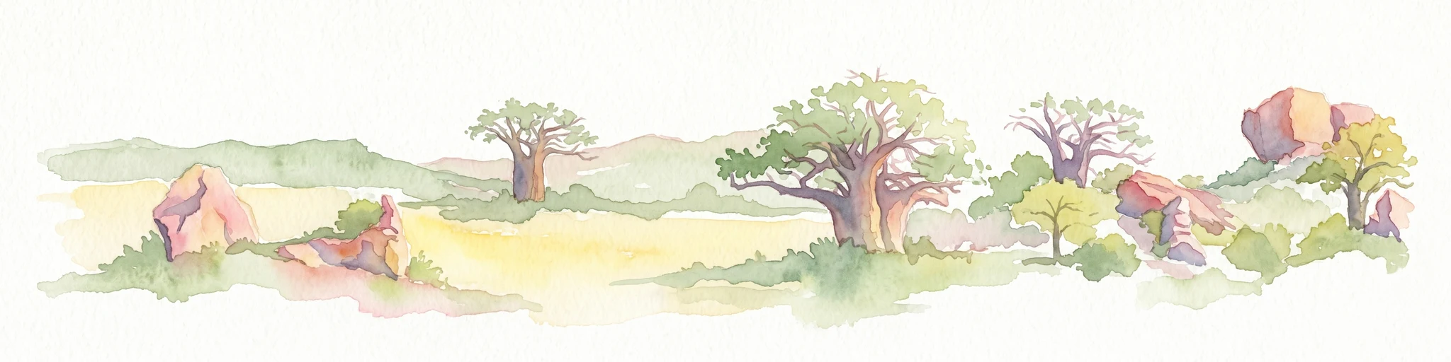
Watercolor illustration of a savanna landscape with scattered trees and rock formations
National parkLimpopo
About 427 km away#16 closest

Southeast

Mapungubwe National Park: National Park with Rich Iron Age Archaeology and Savanna Landscapes

Explore Limpopo's unique protected area at the three-nation border.

Mapungubwe National Park is a vital protected area in South Africa's Limpopo region, renowned for its dual significance as a major archaeological site and a diverse natural landscape. This national park protects a significant portion of savanna ecosystems, including unique riparian forests and mopane woodlands, surrounding the historic Mapungubwe Hill. As part of the Greater Mapungubwe Transfrontier Conservation Area, it plays a crucial role in regional conservation, offering a distinct geographic perspective at the confluence of South Africa, Botswana, and Zimbabwe, and serving as a focal point for atlas-based discovery of protected lands.

Area
280 km²
Established
1998
IUCN
II
Relief
Lowland
Wildlife reserveLimpopo
About 432 km away#17 closest

Southeast

Mapesu Private Game Reserve: Atlas of Protected Landscapes and Savannah Geography

Limpopo Province, South Africa Wildlife Reserve

Mapesu Private Game Reserve serves as a significant conservation entity in South Africa, defined by undulating mopane plains and rocky outcrops. The reserve functions as an ecological extension of the neighbouring Mapungubwe World Heritage Site, safeguarding a mosaic of thirteen distinct plant communities and supporting a rich variety of mammal and avian populations in a remote, protected bushveld setting.

Area
125 km²
Established
2014
Relief
Upland
Climate
Subtropical
National parkLimpopo Province
About 444 km away#18 closest

Southeast

Marakele National Park: National Park Protected Landscape and Geographic Context

Explore its Limpopo Province regional setting and mapped boundaries.

Marakele National Park represents a vital protected national park within the diverse geography of Limpopo Province, South Africa. This entry provides detailed atlas-style information on its protected landscape, focusing on mapped geographic boundaries and its context within the regional natural terrain. It serves as a key resource for understanding the park's specific role as a conservation area and its place within the broader atlas of South African protected lands.

Area
670 km²
Established
1994
Relief
Mountain
Climate
Subtropical
Nature reserveLimpopo
About 444 km away#19 closest

South

Atherstone Nature Reserve: Mapping the Savannah and Bushveld of Limpopo, South Africa

A collaborative conservation landscape of plains and grasslands

Atherstone Nature Reserve features a distinctive blend of classic bushveld thickets and open Kalahari-influenced grasslands. Situated in Limpopo, the 23,500 hectare protected area serves as a primary hub for large mammal conservation and savannah ecology, offering researchers and atlas enthusiasts a focused look at South Africa’s northern provincial wilderness.

Area
235 km²
Established
1994
Relief
Upland
Climate
Subtropical
National parkZimbabwe
About 450 km away#20 closest

Northeast

Chizarira National Park: Zimbabwe's Remote Protected Landscape on the Zambezi Escarpment

Explore rugged mountains, deep gorges, and unique woodland ecosystems.

Chizarira National Park offers an unparalleled exploration of wilderness and dramatic geography within Zimbabwe. Situated along the imposing Zambezi Escarpment, its landscape is characterized by a 600-meter drop, rugged mountains, and deep river gorges carved by perennial streams. This protected area, known for its remote appeal and rich leopard populations, provides a distinct view of miombo and mopane woodlands, contributing to its unique ecological identity within the regional geography.

Area
2,000 km²
Established
1975
IUCN
II
Relief
Mountain
Distance methodology

Geographic measurements, not driving distances

How nearby park distances are calculated

Distances use park boundaries whenever the available geometry allows it. When one or both boundaries are missing, the mapped park locations provide a clearly labelled estimate. Every value represents straight-line geographic separation and does not use roads or routing.

Boundary distance

Calculated between the nearest points of both park boundaries.

Location-to-boundary estimate

Estimated from one mapped park location to the nearest boundary of the other park.

Mapped-location estimate

Estimated between the mapped locations of both parks.

MoriAtlas Explorer

Continue Your Atlas Exploration of Makgadikgadi Pans National Park's Geography

Delve deeper into the structured geographic data and map context for Makgadikgadi Pans National Park. Understanding its protected landscape and regional setting within Botswana provides valuable insights for broader atlas exploration and geographic discovery, revealing how this protected area fits into the larger landscape of Southern Africa.