Mori Atlas logo
Nearby park discovery

Map-based regional geography and proximity analysis for surrounding protected lands

Protected Areas and National Park Landscapes Near Norra Kvill National Park in Sweden

Discover the network of protected areas and national parks located within the regional geographic context of Norra Kvill National Park in Sweden. This collection traces nearby conservation landscapes, providing a spatial overview of natural terrain and protected land distribution across the Småland province and surrounding areas. Gain insight into the regional geography surrounding this significant old-growth forest site.

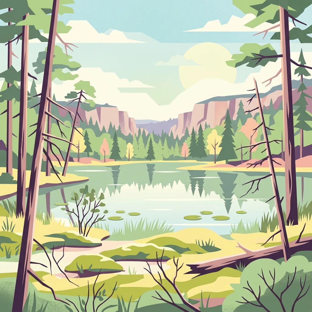
Stylized illustration showing a forest scene with a lake reflecting the sky and surrounding trees

Ancient coniferous forest reserve in the heart of Småland

Norra Kvill National Park

Norra Kvill National Park is a compact but significant protected area in southeastern Sweden, located in the historic province of Småland near the town of Vimmerby. Established in 1927 and expanded in 1994, the park protects one of the few remaining tracts of old-growth coniferous forest in southern Sweden. The 114-hectare reserve sits on the Småland plateau at approximately 230 meters above sea level, characterized by steep terrain formed by fault scarps in the granite bedrock. The forest here has remained essentially untouched by commercial logging for over 150 years, making it a rare example of natural forest ecosystem in a region where such woodlands have largely disappeared. The park features two small lakes, Stora Idgölen and Lilla Idgölen, surrounded by an intricate network of marshlands, boulder fields, andravine systems.

Location
Sweden
Park type
National park
Established
1927
Area
1.1 km²
Norra Kvill National Park Protected Landscape
Regional park map

See the ranked park cluster in its geographic setting

Nearby parks around Norra Kvill National Park

This regional map shows the same 20 nearby parks ranked below around Norra Kvill National Park. Select a ranked marker to highlight that park’s boundary where boundary data is available.
Reference park: Norra Kvill National ParkRanked nearby parkSelected boundary: Norra Kvill National Park20 nearby parks shown
20 nearby parks

Distance-ranked collection of surrounding reserves and natural landscapes

Protected areas and regional park geography near Norra Kvill National Park

Geographic proximity measurements establish a structured sequence of protected areas surrounding Norra Kvill National Park based on direct boundary separation rather than road routing. Examining these nearby park environments reveals regional ecological patterns across the surrounding plateau landscape without assuming shared terrain features.
Watercolor illustration of a mountain range with trees and a winding path
National parkSweden
90 km away#1 closest

Southeast

Blå Jungfrun National Park: Baltic Sea Island National Park with Blue Granite Cliffs

Explore its mapped boundaries and distinct coastal terrain.

Blå Jungfrun National Park is a distinctive Swedish national park situated on a Baltic Sea island, immediately recognizable by its prominent blue-hued granite cliffs. As a protected landscape, it offers a unique glimpse into island ecosystems and rugged coastal geography. MoriAtlas provides detailed context for its mapped boundaries, showcasing the natural and geological significance of this solitary protected area within the regional atlas.

IUCN
II
Relief
Mixed relief
Access
Moderate access
Scope
Mixed
Watercolor painting of a landscape featuring mountains, wetland, and forest
National parkJönköping County
104 km away#2 closest

Southwest

Store Mosse National Park: Explore Sweden's Largest Bog Landscape & Protected Area

Detailed park map, geography, and peatland ecosystem context.

Delve into Store Mosse National Park, a significant protected landscape in Jönköping County, Sweden, celebrated for its vast peat bog, the largest south of Lapland. This page provides detailed geographic context, mapping its unique wetland terrain, interspersed lakes like Kävsjön, and surrounding pine forests. Understand the park's ecological importance as a Ramsar site and its place within the South Småland peneplain for structured natural area discovery.

Area
78.5 km²
Established
1982
IUCN
II
Relief
Lowland
Watercolor illustration of a forest landscape with rocks, trees, and distant hills
National parkSweden
117 km away#3 closest

Northwest

Tiveden National Park: Sweden's Protected Granite Landscape and Ancient Forest

Explore protected wilderness, fracture valleys, and geological heritage.

Tiveden National Park is a protected area in southern Sweden renowned for its ancient forests and rugged granite landscape. The park's terrain features deep fracture valleys, formed by ancient geological events, and stands as one of the last large remnants of older forest in the region. Discover the park's unique topography, mapped boundaries, and its significance as a protected natural landscape for atlas-based exploration.

Area
20.3 km²
Established
1983
IUCN
II
Relief
Mixed relief
Watercolor painting of a coastal landscape featuring rocky shore, trees, and distant island under pink and blue sky
National parkVästra Götaland County
170 km away#4 closest

Northwest

Djurö National Park: Sweden's Lake Archipelago National Park in Västra Götaland County

Mapped island geography and protected aquatic landscapes.

Djurö National Park stands as a singular example of Sweden's protected natural areas, characterized by its unique position as a national park comprising a complete archipelago within Lake Vänern. This page focuses on the geographic identity of Djurö National Park, detailing its island distribution, protected land status, and the distinct landscape it preserves. Users will find context for its place within Västra Götaland County, facilitating an atlas-based understanding of this exceptional aquatic environment and its mapped boundaries.

Area
24 km²
Established
1991
IUCN
II
Relief
Mixed relief
Watercolor illustration of a forest landscape with pink flowers, green trees, and a yellow sky
National parkÖrebro County
172 km away#5 closest

North

Garphyttan National Park: Pioneer Protected Landscape and Historic Swedish Terrain

Explore meadows, forests, and historic geography in Örebro County.

Garphyttan National Park, established in 1909, is a testament to early Swedish nature conservation efforts. This protected landscape features rolling forested terrain and distinctive flower-rich meadows, maintained through traditional practices that highlight Sweden's cultural heritage. Located within Örebro County, the park offers valuable insights into regional geography and the formation of mapped protected areas, making it a key destination for understanding historical landscape preservation.

Area
1.11 km²
Established
1909
IUCN
II
Relief
Lowland
Watercolor illustration showing a coastal landscape with green vegetation in the foreground, light-colored water or sand in the middle ground, and pastel sky colors in the background
National parkSweden
222 km away#6 closest

East

Gotska Sandön National Park: Unique Baltic Island Protected Landscape & Dune Atlas

Mapped geography and ancient pine forests on a Swedish island.

Delve into Gotska Sandön National Park, a distinct national park encompassing an entire Baltic island renowned for its significant sand dune systems and ancient pine forests. This protected area showcases a rare sandy island ecosystem and a unique landscape shaped by coastal influences. MoriAtlas provides structured geographic context to understand the mapped boundaries and natural terrain of Gotska Sandön, highlighting its role as a vital protected natural landscape in the Scandinavian region.

Established
1963
IUCN
II
Scope
Terrestrial
Water
Minor water
National parkStockholm County
About 223 km away#7 closest

Northeast

Tyresta National Park: Explore Protected Old-Growth Forest and Rift Valley Landscape

Stockholm County National Park, Sweden

Tyresta National Park stands as a crucial protected area, showcasing one of southern Sweden's largest expanses of old-growth coniferous forest, featuring trees up to 400 years old. Its distinctive rift valley terrain, lakes, and post-fire recovery zones offer a rich geographic profile for atlas exploration. Within Stockholm County, this national park provides essential context for understanding the preservation of ancient forest ecosystems and unique geological formations.

Area
20 km²
Established
1993
IUCN
II
Relief
Mixed relief
National parkSweden
238 km away#8 closest

Southwest

Söderåsen National Park: A Protected Ridge Landscape in Southern Sweden's Geography

Mapped protected area with varied terrain and dense forest cover.

Delve into the protected landscape of Söderåsen National Park, a national park in Southern Sweden distinguished by its unique ridge topography, steep slopes, and extensive forests. This site serves as a key point for atlas-based exploration of natural terrain and regional geography, offering a clear view of its mapped boundaries and ecological significance within the Southern Swedish highlands. Understand the character of this protected area and its place in the broader mapped landscape.

Established
2001
IUCN
II
Scope
Terrestrial
Watercolor illustration of a landscape with green hills, water, and vegetation
National parkSkåne County
246 km away#9 closest

South

Stenshuvud National Park: Discover Skåne County's Distinctive Baltic Headland National Park

Explore broadleaf forests, heathlands, and panoramic coastal geography.

Stenshuvud National Park is a notable national park in Sweden's Skåne County, characterized by a prominent hill that rises 97 meters above the Baltic Sea. This protected landscape offers a rich diversity of habitats within a small area, including dense broadleaf forests, open heathlands, and coastal terrains. Its unique geographic position and varied ecosystems make it a key destination for exploring protected natural areas, mapped terrain, and regional landscape context within the MoriAtlas platform.

Area
3.9 km²
Established
1986
IUCN
II
Relief
Lowland
Watercolor illustration of a river, forested area, and mountains
National parkVästra Götaland County
261 km away#10 closest

Northwest

Tresticklan National Park: Preserved Old-Growth Forest on Rocky Heathland

Explore the geographic context and mapped boundaries of this vital protected area.

Tresticklan National Park is a vital protected landscape in Västra Götaland County, Sweden, safeguarding one of southern Scandinavia's most significant old-growth forest ecosystems. The park's terrain is defined by exposed granite bedrock, sparse heath pine forests, and a wild, remote character. MoriAtlas provides a structured overview of Tresticklan National Park, detailing its geographic setting and protected area status for explorers and cartographers.

Area
28.97 km²
Established
1996
IUCN
II
Relief
Upland
Watercolor illustration of a river flowing through a forested landscape with hills in the background.
National parkVästmanland County
267 km away#11 closest

North

Färnebofjärden National Park: Protected River Landscape and Birdlife Atlas

Explore Västmanland County's unique riverine protected area and mapped terrain.

Färnebofjärden National Park offers a unique geographic perspective as a protected national park situated in Sweden's Västmanland County. This page details the park's distinct riverine landscape, characterized by the Dalälven River's intricate network of channels, wetlands, and islands, and its position at a critical ecological frontier. Discover the mapped boundaries and regional context of this important protected area, renowned for its exceptional bird populations and diverse natural habitats.

Area
101 km²
Established
1998
IUCN
II
Relief
Lowland
Watercolor painting showing a green and tan coastal marshland with low hills in the distance.
Nature reserveLæsø
About 268 km away#12 closest

West

Østdelen af Læsø Nature Reserve: Mapped Coastal Geography and Protected Danish Island Terrain

Explore active dune systems, beach ridges, and coastal heath-mire habitats

Østdelen af Læsø features a distinct interplay of coastal geology and traditional heathland vegetation across its 266 hectares. The reserve spans from the elevated Danzigmand dunes to the dynamic, growing barrier islands of Store Knot and Lille Knot, offering a comprehensive look at Denmark's shifting coastal margins and vital seabird nesting grounds.

Area
2.66 km²
Established
1963
Relief
Lowland
Climate
Temperate
A wide panoramic watercolor illustration showing a pale landscape of rolling green and pink hills dotted with small green shrubs against a white background.
Protected areaDenmark
About 268 km away#13 closest

Southwest

Anholt og havet nord for (Natura 2000-område nr. 46) Landscape and Protected Terrain

Integrated island dunes and marine wilderness in the Kattegat

Examine the geography of Anholt og havet nord for (Natura 2000-område nr. 46), a unique Danish site defined by shifting sand dunes and protected Kattegat marine waters. The area maintains a rare combination of active dune systems and essential coastal habitats, functioning as an integrated ecological landscape that serves as a vital refuge for breeding seal colonies and diverse migratory seabirds.

Area
478.78 km²
Relief
Lowland
Water
Water-dominated
Watercolor painting of green trees on rolling hills under a pink and orange sunset
National parkSweden
270 km away#14 closest

Southwest

Dalby Söderskog National Park: Explore Southern Sweden's Smallest Protected Deciduous Forest

Unique limestone geology, spring flowers, and mapped terrain.

Dalby Söderskog National Park, though only 36 hectares, offers exceptional botanical discovery rooted in its fertile limestone soils. This protected area in Scania, Sweden, showcases a dense deciduous forest ecosystem with remarkable diversity, particularly evident in its vibrant spring wildflower displays. Use MoriAtlas to explore the park's mapped boundaries and understand its significant role within the regional geography and broader protected landscape atlas.

Area
0.36 km²
Established
1918
IUCN
II
Relief
Lowland
Watercolor painting of a low-lying coastal landscape with grasses, shrubs, and soft, hazy distant hills.
Nature reserveLæsø
About 275 km away#15 closest

West

Bovet Nature Reserve and Coastal Habitat Geography in Læsø, Denmark

A protected coastal corridor of heathland and salt marsh

Bovet is a 65-hectare nature reserve on the island of Læsø that safeguards a pristine 2.5 km stretch of Danish coastline. Characterized by a flat, open topography of heath, beach meadow, and reedbed, the site is defined by its sweeping views across Bovet Bugt and scattered glacial erratics. Its status as a bird protection area and Ramsar wetland highlights its importance as a habitat for breeding and resting waders within the Kattegat region.

Area
0.65 km²
Established
1964
Relief
Lowland
Climate
Temperate
Watercolor painting of a grassy field with trees and a soft sky
National parkStockholm County
276 km away#16 closest

Northeast

Ängsö National Park: Flower-Rich Cultural Landscape in Stockholm County's Archipelago

Mapped protected area and historic island geography

Ängsö National Park, a protected national park in Stockholm County, offers a rare glimpse into a flower-rich cultural landscape shaped by history and nature. The island's mapped boundaries encompass idyllic meadows, mature deciduous forests, and a unique archipelago setting. MoriAtlas highlights its significance as one of Sweden's earliest national parks, providing context for its distinctive natural terrain and protected landscape identity within the Roslagen region.

Area
1.68 km²
Established
1909
IUCN
II
Relief
Lowland
Nature reserveLæsø Municipality
279 km away#17 closest

West

Nordre Rønner: Protected Island Landscapes and Geographic Mapping of Læsø Municipality

Remote coastal nature reserve and marine habitat within the Danish Kattegat sea

Nordre Rønner represents a significant cluster of islets in the Kattegat, showcasing the interplay of post-glacial land rise and coastal ecology. Managed within Læsø Municipality, these eleven hectares of protected land include essential nesting grounds for terns and harbor seals. This resource outlines the physical geography, mapped island connections, and the status of this unique maritime nature reserve.

Area
0.11 km²
Relief
Lowland
Climate
Temperate
Access
Moderate access
Watercolor illustration of a coastal landscape with islands, grassy areas, and water
National parkVästra Götaland County
280 km away#18 closest

Northwest

Kosterhavet National Park: A Marine National Park Exploring Unique Archipelago Geography

Discover its mapped underwater terrain and rich marine biodiversity.

Kosterhavet National Park, located in Västra Götaland County, is Sweden's first marine national park, dedicated to protecting the unique aquatic environment of the Koster Islands. This protected area is renowned for its exceptional marine biodiversity, including rare cold-water coral reefs and the country's largest seal colony, all situated within a dramatic underwater geography characterized by deep fjords. Use MoriAtlas to explore the mapped extent of this vital marine protected landscape and understand its significant place in regional and national conservation efforts.

Area
388.78 km²
Established
2009
IUCN
II
Visitors
90K annual
Watercolor illustration of green hills, a body of water, and vegetation
National parkDenmark
About 285 km away#19 closest

Southwest

Kongernes Nordsjælland National Park: Protected Landscape Geography and Map Context

Explore North Zealand's protected natural terrain.

Delve into the protected landscape of Kongernes Nordsjælland National Park, a significant national park in Denmark's North Zealand region. This section provides a structured overview of its mapped boundaries and geographic setting, allowing for a detailed atlas-style discovery of its natural terrain. Understand how this protected area contributes to the region's conservation landscape and mapped geography.

IUCN
II
Nature reserveGentofte Kommune
About 291 km away#20 closest

Southwest

Brobæk Mose Nature Reserve: Protected Wetland and Glacial Geography in Gentofte Kommune

Mapped wetland habitat and natural terrain analysis.

Brobæk Mose serves as a primary example of a spring-fed wetland within the glacial landscapes of Gentofte Kommune. The area preserves rich fens and developing natural forest, offering a clear view of post-glacial valley geography and protected ecological zones surrounded by the Copenhagen suburban environment.

Established
1988
Water
Major water bodies
Distance methodology

Geographic measurements, not driving distances

How nearby park distances are calculated

Distances use park boundaries whenever the available geometry allows it. When one or both boundaries are missing, the mapped park locations provide a clearly labelled estimate. Every value represents straight-line geographic separation and does not use roads or routing.

Boundary distance

Calculated between the nearest points of both park boundaries.

Location-to-boundary estimate

Estimated from one mapped park location to the nearest boundary of the other park.

Mapped-location estimate

Estimated between the mapped locations of both parks.

MoriAtlas Explorer

Continue Exploring Norra Kvill National Park's Unique Geographic and Landscape Context

Delve deeper into the atlas perspective of Norra Kvill National Park, understanding its position within Kalmar County and its exceptional protected landscape. MoriAtlas helps you navigate the mapped geography and uncover the ecological narratives of this ancient forest. Continue your structured discovery of its natural terrain and regional significance, gaining a comprehensive geographic overview of this rare Swedish national park.