Mori Atlas logo
Nearby park discovery

Regional geography and mapped surroundings in the Grèce-Occidentale landscape

Protected Areas and Natural Landscapes Near Parc national de Missolonghi-Etolikó

Discover protected areas and diverse natural landscapes located in the geographic vicinity of Parc national de Missolonghi-Etolikó. This regional overview highlights surrounding wetlands, coastal systems, and limestone terrain to provide context for the wider environment of western Greece. Analyze spatial distributions and geographical relationships between nearby conservation sites.

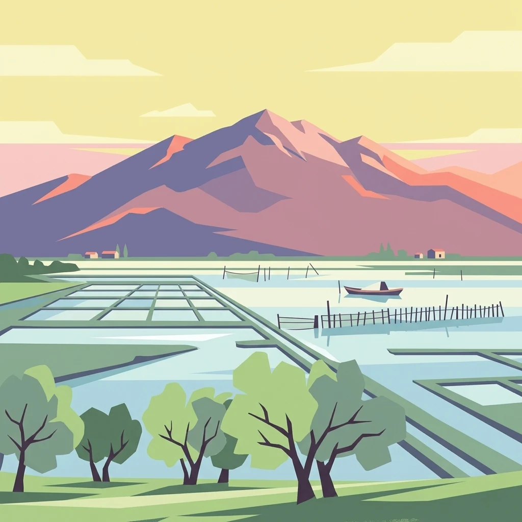
A stylized vector illustration of a tranquil lagoon with geometric salt pans in the foreground, a small boat on the water, and large mountains in the background under a soft sunrise or sunset sky.

A mosaic of lagoons, river deltas, islands, and limestone gorges on the northwestern Gulf of Patras.

Missolonghi-Etoliko National Park

The Missolonghi-Etoliko National Park covers a wide and varied territory on the northwestern edge of the Gulf of Patras in western Greece. It encompasses the country's largest lagoon complex, the deltas of two major rivers, a chain of offshore islands, dramatic limestone gorges, and forested lowlands, all within a single protected area. The park's identity is shaped by water. The Acheloos, one of the longest rivers in Greece, and the Evinos river together feed a network of coastal lagoons, riverine forests, deltaic plains, and brackish habitats that drive much of the area's biodiversity and traditional economy. Inland, the limestone mass of Mount Varasova, the gorges of Klisoura, and the ash forest of Lesini add a vertical and wooded counterpoint to the flat, shimmering wetlands. Beyond its ecological value, the park is closely tied to the cultural and historical identity of the region. It surrounds the historic town of Missolonghi, a symbol of Greek independence, and lies within easy reach of important ancient sites such as Calydon, Pleuron, and Oeniadae.

Location
Greece
Park type
National park
Established
2006
Area
360.7 km²
Parc national de Missolonghi-Etolikó Park Atlas
Regional park map

See the ranked park cluster in its geographic setting

Nearby parks around Missolonghi-Etoliko National Park

This regional map shows the same 20 nearby parks ranked below around Missolonghi-Etoliko National Park. Select a ranked marker to highlight that park’s boundary where boundary data is available.
Reference park: Missolonghi-Etoliko National ParkRanked nearby park20 nearby parks shown
20 nearby parks

Explore surrounding regional park geography, distance rankings, and related protected landscapes

Parks and Protected Areas Geographically Near Parc national de Missolonghi-Etolikó

Examine the ranked collection of protected areas situated near Parc national de Missolonghi-Etolikó to evaluate regional separation and spatial patterns. Analyzing these surrounding natural environments provides structured geographic context for comparing adjacent conservation landscapes.
Protected areaAetolia-Acarnania
About 38 km away#1 closest

Northwest

Lake Amvrakia Protected Area: Atlas of a Tectonic Freshwater Basin in Aetolia-Acarnania

Mapped geography of a unique karstic semipolje in western Greece.

Lake Amvrakia is a distinct tectonic basin located in western Greece. This protected area represents a complex karstic landscape formed in Mesozoic limestone, supporting diverse birdlife and endemic species. The geography reveals a stark contrast between agricultural eastern shores and the preserved riparian zones of the west, marking it as a significant case of human-environment interaction in the region.

Area
13.6 km²
Relief
Lowland
Climate
Mediterranean
Access
Access unknown
A watercolor painting showing a wide view of the Foloi plateau with rolling hills, a small grove of deciduous trees, and a winding stream, set against a pale background.
Protected areaElis
About 84 km away#2 closest

Southeast

Foloi Oak Forest Protected Area and Plateau Landscape in Elis, Greece

Deciduous mountain woodland and regional plateau geography

Examine the geographic profile of the Foloi Oak Forest, a rare seed-regenerated deciduous woodland spread across an elevated plateau in the Elis region. This protected landscape forms an essential ecological boundary in the western Peloponnese, featuring a dense canopy of Hungarian oak and deep gorges that define the surrounding mountain terrain and local drainage systems.

Area
42 km²
Relief
Upland
Climate
Mediterranean
Access
Moderate access
Watercolor illustration of a mountain range with greenery and distant peaks under a light sky
Marine protected areaGreece
About 91 km away#3 closest

Southwest

National Marine Park of Zakynthos: Detailed Protected Marine Area & Geographic Context

Mapping Zakynthos's protected marine territory and regional geography

Investigate the National Marine Park of Zakynthos, a distinguished marine protected area situated in Greece. This dedicated page provides detailed insights into its protected landscape, focusing on its mapped geographic extent and its significance within the Mediterranean. Users can explore the specific boundaries of this protected marine territory and understand its place in the wider regional geography, enhancing atlas-based discovery of Greece's conservation areas.

IUCN
II
Scope
Marine
Water
Water-dominated
A soft, watercolor painting of a mountain range in the distance, featuring a band of evergreen trees in the midground and a grassy foreground on a plain white background.
National parkGreece
About 111 km away#4 closest

East

Parc national du Mont Parnasse: Mapping the Limestone Massif and Alpine Geography of Greece

A protected national park blending karst geology and mountain ecosystems.

Parc national du Mont Parnasse stands as a prominent protected landscape in Central Greece, defined by its fractured limestone geology and subalpine forests. This national park serves as a vital ecological refuge that preserves karst terrain, sinkholes, and diverse Mediterranean mountain habitats rising toward steep alpine summits.

Relief
Mountain
Climate
Mediterranean
Scope
Terrestrial
Water
Minor water
National parkGreece
About 126 km away#5 closest

North

Parc national de Tzoumérka-Achelóos-Ágrafa-Météores National Park: Geography and Landscape Atlas

Central Greece Pindus mountain protected wilderness zone

An extensive protected landscape bridging Thessaly and Epirus, this national park showcases the ecological and geological diversity of the central Pindus Mountains. Analyze the geographic layout of the Athamanian ranges, the Acheloos river corridor, and the unique conglomerate formations at Meteora through a detailed protected-area lens.

Area
3,379.94 km²
Established
2009
IUCN
VI
Relief
Mountain
Watercolor illustration of a mountainous landscape with a river, forests, and distant hills
National parkGreece
About 164 km away#6 closest

North

Pindus National Park: A Protected Greek Mountain Wilderness with Ancient Forests

Explore its rugged terrain, biodiversity, and alpine landscape.

MoriAtlas presents Pindus National Park, a significant protected area in Greece known for its dramatic mountainous terrain, deep valleys, and ancient old-growth forests. This page details its geographic context, featuring rugged highland landscapes, serpentine soils, and vital habitats for species like the Eurasian brown bear. Understand its place within the Pindus mountain range and its importance as a mapped wilderness area for conservation.

Area
69.27 km²
Established
1966
IUCN
II
Relief
Mountain
A soft watercolor painting of a coastal lagoon featuring dunes, grassy vegetation, and a distant treeline under a light sky.
Protected areaIonian Islands
About 168 km away#7 closest

Northwest

Korission Lagoon Protected Area: Coastal Wetlands and Dune Geography in Corfu, Greece

A coastal landscape defined by sand dunes, freshwater, and juniper forests

Korission Lagoon represents a rare ecological convergence on the Ionian Islands, where a tall sand dune barrier separates a freshwater lagoon from the open sea. This protected area supports an intricate mosaic of reed beds and unique juniper woodlands, providing a crucial habitat for a vast array of bird species and endemic wildlife within the coastal plains of Corfu.

Area
4.27 km²
Relief
Lowland
Climate
Mediterranean
Access
Easy access
National parkGreece
About 179 km away#8 closest

North

Vikos-Aoös National Park: Deepest Gorge and Protected Mountain Landscape Atlas

Discover protected area boundaries and regional geography in Epirus.

Vikos-Aoös National Park in Greece's Pindus mountains is a premier destination for exploring dramatic natural geography. Best known for the Vikos Gorge, considered the world's deepest canyon relative to its width, the park also features towering alpine peaks like Mount Tymphe, glacial lakes such as Drakolimni, and rich botanical diversity. As a UNESCO Geopark and part of the Natura 2000 network, it safeguards critical habitats, including significant brown bear populations. This park offers a profound look into protected landscapes, offering detailed geographic context and mapped terrain for atlas-based discovery.

Area
126 km²
Established
1973
IUCN
II
Visitors
100K annual
A watercolor painting showing a river winding through a mountainous gorge with a stone arch bridge on the right bank.
National parkEpirus
About 179 km away#9 closest

North

Northern Pindus National Park: A Geographic Survey of Mountain Landscapes in Epirus Greece

Mapped terrain, karst river gorges, and alpine forest ecosystems.

Northern Pindus National Park preserves an extensive mountain environment characterized by steep limestone ridges, the profound Vikos Gorge, and glacial lake basins. Located in the Pindus range of Epirus, this area offers deep insight into the intersection of geological processes, rare wildlife habitats, and traditional human settlements integrated into the mountainous terrain.

Area
157.4 km²
Established
2005
IUCN
II
Relief
Mountain
Watercolor landscape painting showing a lake, distant mountains, and vegetation
National parkVlorë County
About 181 km away#10 closest

Northwest

Butrint National Park: Archaeological Heritage and Mediterranean Wetland Landscape

Explore its unique geography and protected park boundaries.

Butrint National Park presents a singular opportunity for geographic and protected-area discovery, showcasing an unparalleled fusion of ancient history and ecological richness. Located in Albania's Vlorë County, this national park encompasses Lake Butrint, coastal lagoons, and vital wetland habitats, recognized internationally for their biodiversity. Through MoriAtlas, users can explore the mapped extent of this unique landscape, understand its role within regional geography, and uncover the interplay between its preserved archaeological sites and the surrounding Mediterranean environment.

Area
94.244 km²
Established
2000
IUCN
II
Relief
Lowland
A soft, horizontal watercolor painting showing a serene landscape with a body of water in the foreground, surrounded by grasses and bushes, with rolling hills in the background.
Natural monumentVlorë County
About 193 km away#11 closest

Northwest

Blue Eye Natural Monument: Protected Karst Geography in Vlore County

A study of Albania's most prominent karst spring and woodland ecosystem.

The Blue Eye is a protected natural monument in southern Albania featuring a powerful, deep karst vent and vivid blue basin. This site acts as the headwater for the Bistrice River and supports a diverse forest ecosystem of oak and sycamore. The surrounding karst terrain and hydrology offer a focused look at the environmental geography of the Ionian watershed.

Area
1.8 km²
Established
1996
IUCN
III
Relief
Upland
Watercolor painting of a mountain range, pine trees, and a small stream in the foreground against a light, misty background.
National parkThessaly
About 203 km away#12 closest

Northeast

Olympus National Park: Protected Mountain Landscapes and Geographic Mapping of Northern Greece

High mountain terrain, forest zones, and protected boundaries

Olympus National Park preserves the towering summit of Mount Olympus and its surrounding canyons. This record highlights the park's geologic structure, its diverse vegetation zones ranging from Bosnian pine to alpine grasslands, and its status as a cornerstone of the natural geography spanning the borders of Thessaly and Central Macedonia.

Area
39.88 km²
Established
1938
IUCN
II
Visitors
180K annual
A horizontal watercolor painting showing a soft mountain landscape with green forests and a central light-colored area under a pale sky.
National parkGreece
About 209 km away#13 closest

East

Parc national du Parnès: Geographic Overview of the Attica Peninsula's Protected Massif

Explore the karst gorges, high-altitude fir forests, and protected red deer habitats

Parc national du Parnès dominates the northern skyline of Attica with a complex limestone massif featuring deep ravines like the Keladonas gorge. This atlas entry provides geographic insights into the park's summit network, karst features, and its critical role in Mediterranean forest resilience. Understand the rugged terrain and natural boundaries that define this essential protected area within Greece.

Area
38.16 km²
Established
1961
Relief
Mountain
Climate
Mediterranean
Watercolor painting of a landscape with green fields, scattered trees, and rolling hills under a light sky
National parkGjirokastër County
About 223 km away#14 closest

North

Fir of Hotovë-Dangëlli National Park: Ancient Forests & Mountain Wilderness Atlas

Explore a premier protected landscape in Gjirokastër County, Albania.

Fir of Hotovë-Dangëlli National Park stands as a monumental protected area, celebrated for its exceptional old-growth Hotova Fir forests, which are a rare Mediterranean plant relic. This national park in Gjirokastër County offers a detailed look at a vast mountainous terrain, featuring dramatic canyons like Lengarica Canyon, and serving as a critical habitat for diverse wildlife. MoriAtlas provides structured geographic context for this significant landscape, highlighting its mapped boundaries and role as a key component of regional protected area networks.

Area
360.038 km²
Established
2008
IUCN
II
Relief
Mountain
Watercolor illustration of a coastal landscape with hills, trees, and a body of water
Marine protected areaGreece
About 225 km away#15 closest

Northeast

National Marine Park of Alonnisos Northern Sporades: Protected Marine Landscape and Aegean Geography

Explore Greece's largest marine protected area and its vital ecosystems.

Investigate the National Marine Park of Alonnisos Northern Sporades, an extensive marine protected area situated in the northern Aegean Sea. This protected landscape is internationally significant for its role in conserving the Mediterranean monk seal and for its healthy Posidonia oceanica seagrass meadows. Understanding this park's geographic scope and its protected marine terrain offers crucial insights into Mediterranean island ecosystems and conservation efforts within the region.

Area
2,260 km²
Established
1992
IUCN
II
Relief
Mixed relief
Watercolor painting showing a river valley with mountain ranges in the background and green fields
National parkGjirokastër County
About 229 km away#16 closest

Northwest

Vjosa Wild River National Park: Europe's Pioneer Free-Flowing River Protected Area

Mapping dynamic canyons and vital river ecosystems in Gjirokastër County.

Vjosa Wild River National Park is recognized as Europe's first Wild River National Park, a groundbreaking designation protecting an entire river system from source to sea. This protected area in Gjirokastër County preserves remarkable topography, including dramatic canyons, natural rapids, and meandering islands, all shaped by the free flow of the Vjosa River and its tributaries. Explore the mapped boundaries and unique landscape context of this significant biodiversity hotspot, offering a crucial case study for river conservation and atlas discovery.

Area
127.27 km²
Established
2023
IUCN
II
Relief
Mixed relief
Protected landscapeKorçë County
About 241 km away#17 closest

North

Fir of Drenovë-Sinicë Protected Landscape: Forest and Geological Map of Korçë County

Mapping Albania's protected Silver fir woodland ecosystems

Explore the structured geography of the Fir of Drenovë-Sinicë Protected Landscape, a diverse expanse in Korçë County defined by its ancient Silver fir stands and karst cave systems. This area showcases a varied landscape of rocky monoliths, mountain lakes, and tectonic valleys that serve as a vital ecological record for the southeastern Albanian mountains.

Area
10.3 km²
Established
1966
IUCN
V
Relief
Mountain
Watercolor painting of a river flowing through a valley with mountains and greenery
National parkKorçë County
About 249 km away#18 closest

North

Prespa National Park: Protected Landscape and High-Altitude Lakes in Korçë County, Albania

Explore the geography and mapped boundaries of this vital national park.

Prespa National Park, located in Korçë County, Albania, is a protected area characterized by its significant high-altitude tectonic lakes, dramatic mountain landscapes, and vital wetland habitats. This entry provides a structured atlas-style overview of the park's geographic identity, its protected landscape features, and its ecological importance, serving as a key point of reference for understanding this unique Balkan region.

Area
276.131 km²
Established
1999
IUCN
II
Relief
Mountain
Watercolor painting depicting mountains, forests, and valleys
National parkVlorë County
About 250 km away#19 closest

Northwest

Llogara National Park: Vlorë County's Dramatic Ceraunian Mountain Protected Landscape

Explore Albania's rugged national park geography and mapped terrain.

Llogara National Park stands as a vital protected area within Vlorë County, Albania, renowned for its spectacular Ceraunian Mountain topography. This page provides access to detailed geographic information, highlighting the park's unique landscape characteristics, from alpine peaks to coastal vistas. Discover the mapped extent of this national park and its significance within the regional geography, perfect for structured atlas exploration.

Area
17.69 km²
Established
1966
IUCN
II
Relief
Mountain
National parkGreece
About 250 km away#20 closest

East

Sounio National Park: Protected Coastal Geography and Mediterranean Terrain in Greece

A rugged maritime landscape on the Attica headland

Sounio National Park occupies the dramatic southernmost tip of the Attica peninsula in Greece. The protected area features vertical limestone cliffs, scrub-covered coastal hills, and a strategic headland overlooking the Aegean. This atlas entry provides a detailed look at the park boundaries, surrounding maritime geography, and the unique integration of classical heritage sites within an exposed Mediterranean conservation zone.

Area
0.75 km²
Established
1974
Relief
Upland
Climate
Mediterranean
Distance methodology

Geographic measurements, not driving distances

How nearby park distances are calculated

Distances use park boundaries whenever the available geometry allows it. When one or both boundaries are missing, the mapped park locations provide a clearly labelled estimate. Every value represents straight-line geographic separation and does not use roads or routing.

Boundary distance

Calculated between the nearest points of both park boundaries.

Location-to-boundary estimate

Estimated from one mapped park location to the nearest boundary of the other park.

Mapped-location estimate

Estimated between the mapped locations of both parks.

MoriAtlas Explorer

Continue Exploring the Protected Landscapes of Parc national de Missolonghi-Etolikó

Deepen your understanding of the park's geographic complexity, from the shimmering lagoons and river deltas to the abrupt limestone peaks of the Arakinthos massif. Use MoriAtlas to trace these unique protected boundaries and examine how freshwater and marine systems interact within this vital Greek wilderness.