
Mori Atlas logo
Countries

Browse Israel's protected lands and trace their geographic distribution across diverse natural terrain.

Israel National Parks and Protected Areas: A Geographic Atlas of Mapped Landscapes

Embark on a geographic exploration of Israel through its network of national parks and protected natural areas. This atlas provides a structured gateway to understanding the distribution of protected landscapes across the country, from desert canyons to coastal regions. Utilize detailed mapping and geographic context to discover the scope and placement of Israel's natural heritage, offering a clear view of its protected terrain.

Israel National Parks and Protected Areas: A Geographic Atlas of Mapped Landscapes
Park system

Israel Park System: Mapping Sizes, Designations, and Protected Areas

Evaluating the historical age, regional climate zones, and diverse habitat spread of known reserves

Analyzing known records for national parks in Israel helps clarify the balance between coastal Mediterranean reserves and arid desert landscapes. Evaluating records across historical age, median size, and official classifications provides a clear comparison of diverse regional habitats based on available dataset evidence.

Known protected area

123 km²

Area data available for 6 of 37 parks.

Median park size

4.2 km²

Median across 6 parks with known area.

Oldest known park

Established in 1960.

Largest known park

Recorded area: 100 km².

Designation distribution

National park36
Nature reserve1

Habitat distribution

Desert habitat7
Riverine habitat7
Grassland4
Wetland4
Shrubland3

18 more categories represented

Climate distribution

Arid9
Mediterranean6
About

Explore Israel's Diverse Protected Areas, Mapping Geographic Distribution from Mediterranean Shores to Desert Canyons

Explore National Parks in Israel and Discover Protected Landscapes Across the Middle East

Browse national parks and protected areas across Israel, encompassing a diverse range of conservation landscapes from its Mediterranean coast to the arid Negev Desert. Uncover the mapped geography and regional context of these significant protected landscapes, offering a structured entry point for deeper park discovery within the Southern Levant.

Israel is a parliamentary republic in the Southern Levant, established in 1948 as a Jewish homeland. It borders Lebanon, Syria, Jordan, and Egypt, with Mediterranean coastline and access to the Red Sea. Jerusalem is the capital, though its status is contested, while Tel Aviv is the largest urban area. The country has a high-income economy with strong technology and innovation sectors.

Israel, officially the State of Israel, is a country in the Southern Levant region of West Asia. It declared independence on May 14, 1948, following the end of the British Mandate for Palestine. The country serves as a homeland for the Jewish people and has a diverse population including Arab citizens. Israel occupies territories including the West Bank, Gaza Strip, and Golan Heights, though these are subject to ongoing political dispute. The economy is highly developed with strong technology, agriculture, and manufacturing sectors.

Largest city:Jerusalem
Currency code:ILS
ISO code:IL
Parks count
37
Capital
Jerusalem
Area
20,770 km²
Population
10,147,200 (2,026)

Coastal
Island
Mountainous
Landlocked
Park atlas37 parks

Discover Israel's Diverse Conservation Landscapes, from Mediterranean Coasts to Negev Desert Terrains

Explore National Parks and Protected Areas in Israel, Mapped by Geography

Browse national parks and significant protected areas spanning Israel's diverse terrain, including ancient archaeological sites, desert canyons, and unique riparian oases. This country-level park atlas provides structured geographic context for exploration, revealing conservation landscapes from the Mediterranean coastline to the arid Negev Desert.
National parkIsrael

Masada National Park: Explore Israel's Iconic Protected Desert Fortress and Landscape

Discover mapped boundaries and archaeological significance in the Judean Desert.

Masada National Park preserves a remarkable historical fortress and palace complex set within the dramatic desert terrain of Israel's Judean Desert. This protected area is renowned for its archaeological importance, showcasing sophisticated ancient engineering and its role as the final stronghold of the Jewish revolt. The stark, beautiful landscape surrounding the plateau offers significant geographic context, allowing for an atlas-style exploration of its terrain, mapped boundaries, and the wider Dead Sea region.

IUCN
V
Scope
Terrestrial
Water
Minor water
Season
Year-round
Watercolor painting of a landscape with mountains, water, and vegetation
National parkIsrael

Qumran National Park: National Park Atlas Exploration and Geographic Context in Israel

Mapped terrain and protected landscape identity in Israel.

Delve into Qumran National Park, a significant national park situated in Israel. This detailed exploration focuses on its protected landscape identity, mapped boundaries, and its place within the country's diverse geography. Understand the unique natural context and regional significance of Qumran National Park through an atlas-driven perspective.

Relief
Lowland
Climate
Arid
Access
Moderate access
Scope
Terrestrial
National parkIsrael

Tel Hazor National Park: Protected Landscape Details and Geographic Atlas Context

Explore the mapped boundaries and regional character of this Israeli national park.

Tel Hazor National Park is a protected national park entity situated within the geography of Israel. This page provides detailed information on its protected landscape, emphasizing its mapped boundaries and contribution to regional natural landscape context. Discover the geographic identity of Tel Hazor National Park and its significance for atlas exploration of protected areas in the Levant.

Relief
Upland
Scope
Mixed
Water
Minor water
Watercolor illustration of a landscape with green vegetation, a river, and distant hills under a pale sky
Nature reserveIsrael

Ein Gedi Nature Reserve: Protected Area Exploration and Regional Geography in Israel

Mapped natural terrain and protected landscape context.

Ein Gedi Nature Reserve represents a distinct natural area offering specific geographic discovery. Users can explore its mapped boundaries, understand its unique landscape character, and appreciate its protected status within the diverse terrain of Israel. This page serves as a gateway to understanding the reserve's ecological and geographic significance, providing structured data for those interested in the mapped context of protected lands.

Area
14 km²
Established
1971
Visitors
1M annual
Relief
Lowland
National parkGolan Heights

Hermon National Park: National Park with Distinct Protected Landscape in Golan Heights

Explore its mapped boundaries and regional geographic context.

Hermon National Park is a designated national park contributing to the rich tapestry of protected landscapes within the Golan Heights. This entity offers a focused entry into understanding its specific geographic setting, mapped terrain, and its significance as a protected area. Users can explore the natural features and regional context that define Hermon National Park, enhancing their atlas-based discovery of Israel's conservation lands.

IUCN
V
Watercolor illustration showing a landscape with green trees, a winding river, and distant mountains under a light sky
National parkIsrael

Beit She'arim National Park: Historic Jewish Necropolis and Limestone Landscape Atlas

Discover the protected geography of ancient burial sites in Israel.

Beit She'arim National Park offers a detailed exploration of a significant ancient Jewish necropolis carved into the soft limestone hills of Israel's Lower Galilee. This protected area preserves remarkable burial caves, catacombs, and sarcophagi adorned with intricate carvings and inscriptions from antiquity. As a UNESCO World Heritage Site, it stands as a landmark of Jewish historical and cultural continuity, providing invaluable insights into the region's past inhabitants and their traditions through its unique archaeological landscape.

IUCN
V
Relief
Upland
Climate
Mediterranean
Access
Moderate access
National parkIsrael

Makhtesh Ramon National Park: Israel's Premier Erosion Cirque & Geological Wonder

Discover dramatic desert terrain and ancient, colorful rock formations.

Makhtesh Ramon National Park in Israel's Negev Desert is the world's largest erosion cirque, a vast 40-kilometer depression revealing millions of years of geological history. Its striking landscape features colorful clay hills, ancient volcanic remnants, fossil beds, and unique sandstone formations, making it an unparalleled destination for understanding Earth's past through its protected natural terrain. Explore the mapped boundaries and regional context of this extraordinary desert formation.

Relief
Mountain
Climate
Arid
Access
Moderate access
Scope
Terrestrial
National parkIsrael

Shivta National Park National Park: An Atlas View of Israel's Protected Landscapes

Mapped terrain and regional geographic context for Shivta National Park.

Shivta National Park represents a key protected area, offering a focused entry into Israel's broader geographic and landscape atlas. This page provides specific details about the park's identity as a national park, its mapped terrain, and its placement within the regional context of the country. Users can explore the structured information that defines Shivta National Park's role as a protected landscape, contributing to a deeper understanding of its geographic significance and mapped features.

Climate
Arid
Access
Easy access
Scope
Terrestrial
Water
No major water
National parkIsrael

Tel Megiddo National Park: Israel's Protected National Park Landscape

Explore the mapped geography and protected area context.

Delve into the specific geographic features and protected landscape identity of Tel Megiddo National Park, a key national park within Israel. This atlas entry focuses on the park's mapped boundaries and its contribution to the regional conservation context, offering a clear view of its terrain and natural setting for dedicated geographic discovery.

National parkIsrael

Tel Be'er Sheva National Park: Mapped Boundaries and Protected Landscape Identity

Discover its geographic context within Israel's natural terrain.

This MoriAtlas detail page for Tel Be'er Sheva National Park provides focused insights into its identity as a protected landscape. Users can explore its specific geographic setting within Israel, understand its mapped boundaries, and gain a clearer appreciation for its natural terrain. The content is designed to support detailed atlas-based discovery, offering a comprehensive view of the park's protected area characteristics and regional geographic significance.

National parkIsrael

Beit She'an National Park: A Protected Landscape in Israel's National Park Atlas

Mapped geographic context and protected area boundaries.

Beit She'an National Park offers a unique perspective on protected lands within Israel. This detail page provides users with insights into the park's specific geographic setting and its role as a mapped natural landscape. Delve into the structured data surrounding Beit She'an National Park to understand its protected status and its contribution to the broader atlas of conservation areas in the region, offering a grounded view of its terrain and spatial significance.

National parkIsrael

Zippori National Park: Explore Israel's Protected Landscape and Roman Period History

Mapped geography and protected terrain in the heart of the Levant.

Zippori National Park presents a fascinating protected landscape within Israel, offering insights into its historic terrain and geographic context. As a designated national park, its mapped boundaries delineate an area significant for its archaeological sites, particularly those from the Roman period. This entry provides structured information on the park's protected status and its place within the broader atlas of the Levant, emphasizing discovery through its landscape and historical geography.

IUCN
V
Scope
Terrestrial
Landscape and environment

Understand how Israel is shaped by terrain, ecosystems, and seasonal conditions

Israel geography, nature, climate, and landscape context for park-focused travel research

Explore the physical geography, natural setting, and climate patterns of Israel through a location-first overview built for travel research, national park discovery, and broader regional context. This section helps explain how landscapes, habitats, and environmental conditions shape what people search for, where they travel, and how they experience protected areas in Israel.

Israel geography and landscape

Israel occupies the Southern Levant region of West Asia. It is bordered by Lebanon to the north, Syria to the northeast, Jordan to the east, and Egypt to the southwest. The western coast lies on the Mediterranean Sea, while the southern tip reaches the Red Sea. The eastern border includes the Dead Sea, Earth's lowest point. The country occupies the West Bank, Gaza Strip, and Golan Heights.

Israel nature and environment

Israel features diverse terrain including the coastal plain along the Mediterranean, the Negev desert in the south, mountainous regions in the north including the Galilee, and the Jordan Rift Valley. The country has limited natural water resources and relies heavily on desalination. Wildlife includes various Mediterranean and desert species, with several nature reserves and national parks.

Israel climate and seasonal conditions

Israel has a Mediterranean climate with hot, dry summers and mild, wet winters. Northern regions receive more rainfall, while the southern Negev desert is arid. Coastal areas are humid, while inland regions experience greater temperature variation.

Explore this place

Related topics and popular queries

Ways to explore Israel

Useful phrases, related topics, and discovery prompts connected to Israel.
where is israel locatedwhat is israelisrael population and areaisrael geography and climateisrael neighboring countriescapital of israelisrael economy gdpisrael demographicsisrael countrystate of israelmiddle east countrywest asiaholy landisrael geographyisrael populationisrael economymediterranean countryzionist state
Park map

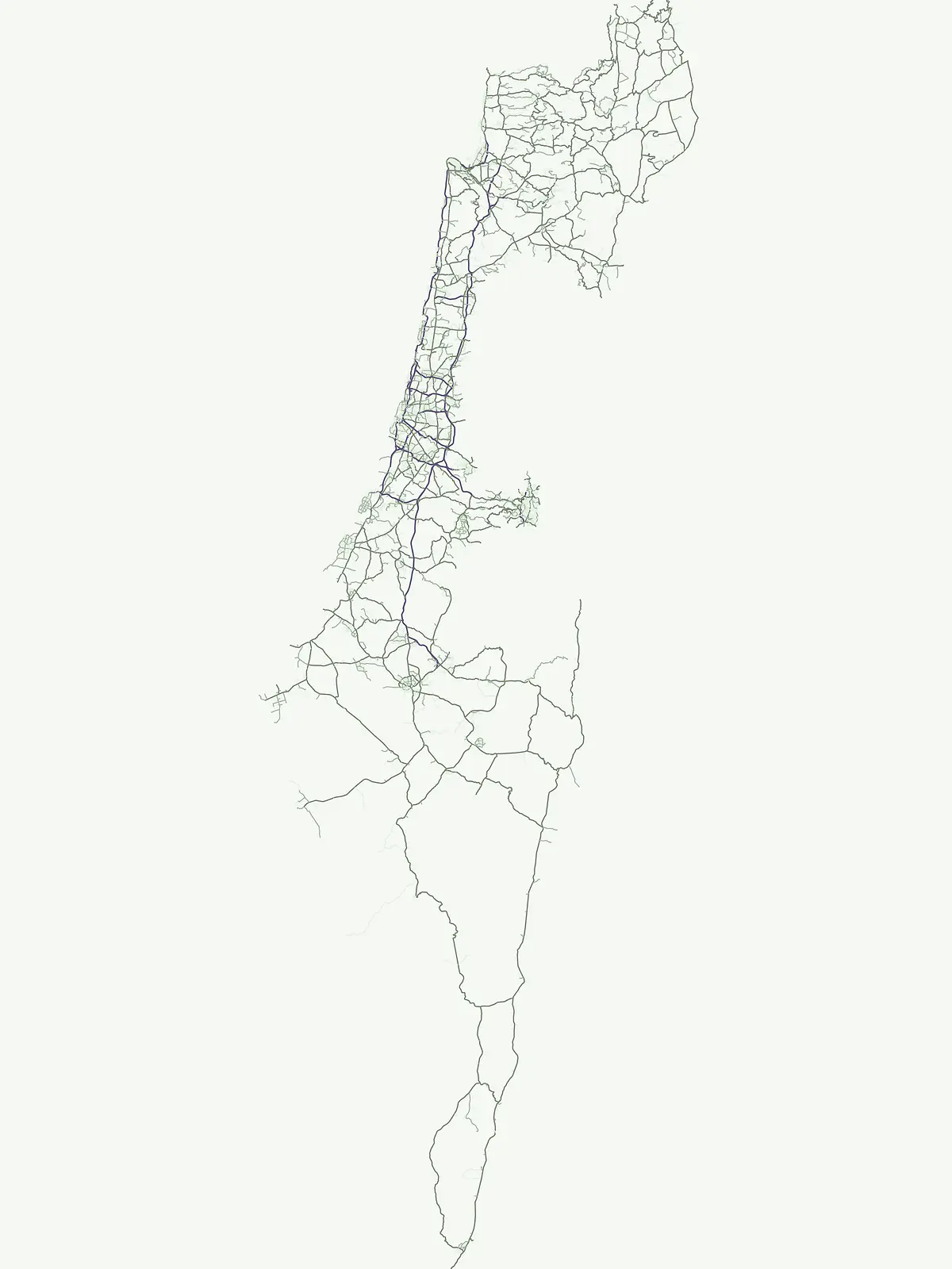
Visualize the geographic spread of Israel's national parks, from the Mediterranean coast to the Negev Desert.

Israel National Parks Map: Explore Protected Areas and Conservation Landscapes

View the mapped locations of national parks and protected areas across Israel, observing their placement relative to key geographic features like the Mediterranean coastline and the Negev Desert. Open the dedicated country map to explore the full extent of Israel's conservation landscapes, compare park positions, and trace regional protected area patterns in greater detail.
Natural feature types

Begin Exploring the Natural Features and Protected Landscapes of Israel

Trace the physical geography of Israel through a curated database of natural features found in protected areas. MoriAtlas provides a clear path to examine diverse landscapes and terrain types, helping to connect site-specific features to broader national geographic context.

Understanding the geographic distribution and diverse landscapes within Israel's protected areas

Common Questions on Israel's National Parks, Protected Areas, and Geographic Context

Explore key information on Israel's national parks, protected areas, and diverse geographic landscapes, from Mediterranean coastlines to the Negev desert. These common questions clarify Israel's unique park geography and the distribution of its protected landscapes, aiding comprehensive geographic discovery.
Other countries

Compare Park Geography and Protected Landscapes Across West Asia and the Mediterranean Region

Discover National Parks in Countries Near Israel: Expanding Your Middle East Protected Area Search

Browse national parks and protected areas in countries geographically linked to Israel, including neighboring nations and broader West Asian or Mediterranean regions. Explore diverse park geographies, trace the regional spread of conservation landscapes, and compare protected area profiles across country-level atlas views.

Cyprus National Parks and Protected Areas: Mapped Landscapes Explorer

Navigate Cyprus's protected areas through a detailed geographic lens. This MoriAtlas entry provides structured data on national parks and conservation landscapes, highlighting their mapped boundaries and regional context. Understand the island's natural terrain and explore its protected land distribution, serving as a crucial atlas entry point for geographic discovery within Cyprus.

45 parks

Explore Protected Landscapes: National Parks and Protected Areas of Turkey

Delve into the geography of Turkey with this atlas-style exploration of its national parks and protected areas. Understand the distribution of these significant natural landscapes, view their mapped boundaries, and appreciate the diverse terrain they encompass. This resource offers a structured way to navigate and discover the breadth of protected lands across Turkey, providing essential context for regional geography and conservation efforts.

43 parks

Greece: National Parks, Protected Areas, and Mapped Landscapes

This section offers a comprehensive atlas view of Greece's national parks and protected areas. Explore the geographic distribution, mapped boundaries, and landscape context of conservation sites across the country. MoriAtlas facilitates a structured understanding of Greece's natural protected regions, making it an essential tool for geographic discovery and atlas-based browsing.

31 parks

Azerbaijan's National Parks and Protected Areas: A Mapped Geographic Overview

Navigate the diverse protected areas and national parks within Azerbaijan. This atlas view focuses on the geographic distribution and mapped boundaries of its natural landscapes, offering a structured way to understand the country's conservation areas and their regional context for detailed exploration.

16 parks

Saudi Arabia National Parks and Protected Areas: Geographic Atlas Overview

This atlas entry for Saudi Arabia offers a comprehensive view of its national parks and protected areas. Understand the geographic context and distribution of these vital natural landscapes, providing a foundational layer for exploring the Kingdom's conservation areas and regional geography.

13 parks

Egypt National Parks and Protected Areas: Browse Mapped Landscapes and Geographic Distribution

Egypt's protected areas offer a window into its unique desert landscapes and historical natural sites. Navigate through a geographic atlas to understand the distribution of its national parks and conservation zones, examining their location and context within the country's vast terrain. This resource facilitates a structured exploration of Egypt's protected lands, revealing their geographical significance and regional patterns.

9 parks

North Macedonia National Parks and Protected Areas: Geographic Atlas Overview

Navigate the protected natural areas of North Macedonia through a structured geographic lens. This atlas view highlights the distribution and mapped boundaries of the country's national parks and significant protected lands. Understand the landscape context and regional significance of these conserved territories, essential for any map-based exploration of North Macedonia's natural heritage.

4 parks

Bulgaria National Parks and Protected Areas: Mapped Geographic Context

Access a structured overview of Bulgaria's national parks and protected areas. This atlas-focused resource highlights geographic distributions and mapped boundaries, enabling comprehensive discovery of the country's diverse natural terrain and conservation landscapes.

3 parks

Protected area types

Continue Exploring Israel's Protected Area Classification Framework

Deepen your geographic understanding of Israel by delving into its represented park designation categories. This focused exploration helps reveal how conservation efforts are structured and distributed across the country's diverse landscapes. Discover the specific characteristics and mapped boundaries of each designation type to build a more comprehensive atlas of Israel's protected natural areas.

Israel Park Designations
MoriAtlas Explorer

Continue Your Global Geographic Exploration with MoriAtlas Park Discovery

Dive deeper into the world's protected landscapes and national parks through MoriAtlas's structured atlas interface. Discover how continents and countries are organized, and how individual park geography fits into the broader map. Our platform is built for understanding the distribution and context of protected areas worldwide, facilitating your journey through global natural geography.

Global natural geography