Mori Atlas logo
Nearby park discovery

Regional landscape context and mapped proximity for Balkan protected areas

Protected Areas and National Parks in the Geography Surrounding Đerdap National Park

Examine the geographic distribution of protected lands and national parks situated within the vicinity of Đerdap National Park. This overview provides a mapped perspective of the surrounding terrain, tracing how diverse ecosystems, river gorges, and mountainous landscapes connect throughout this region of Serbia.

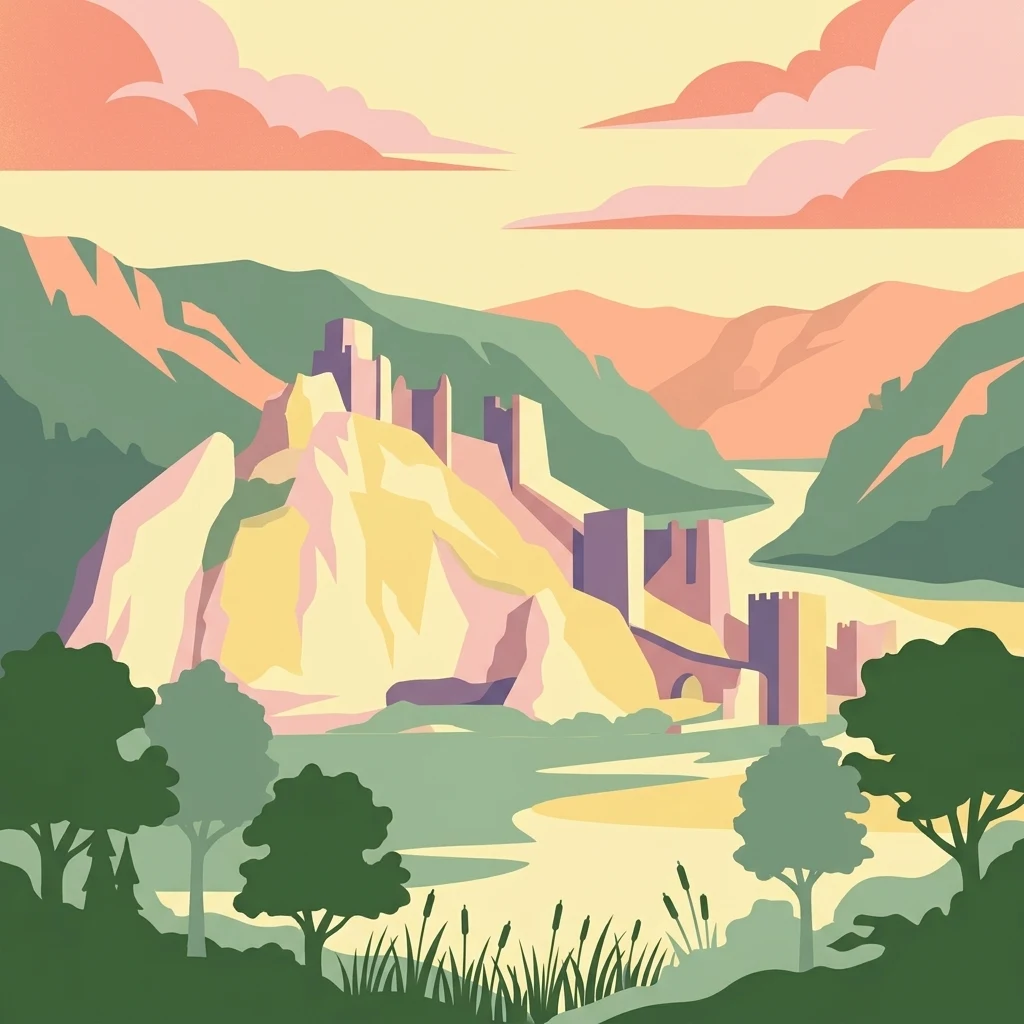
Stylized illustration of a castle on a hill by a river with mountains and trees

Europe's longest river gorge protecting the Danube's dramatic Iron Gate passage

Đerdap National Park

Đerdap National Park is Serbia's largest national park, established in 1974 to protect one of Europe's most spectacular river landscapes. The park stretches approximately 100 kilometers along the right bank of the Danube River in northeastern Serbia, from the Golubac Fortress to the dam near Novi Sip, bordering Romania across the river. The park's defining feature is the Đerdap Gorge, famously known as the Iron Gate—a colossal breakthrough valley carved through the southern Carpathian Mountains, representing the longest and most dramatic gorge on the Danube. This complex canyon system comprises four distinct gorges separated by ravines, with towering cliffs reaching 300 meters and river depths plunging to 82 meters in places. Beyond its dramatic terrain, the park encompasses a rich tapestry of forests, karstic springs, caves, and the vast artificial Lake Đerdap, Serbia's largest lake, created by the hydroelectric dam complex. The area holds exceptional significance as a European Geopark, Ramsar wetland site, and a repository of extraordinary biodiversity including Tertiary relict species.

Location
Serbia
Park type
National park
Established
1974
Area
637.9 km²
Đerdap National Park Protected Landscape
Regional park map

See the ranked park cluster in its geographic setting

Nearby parks around Đerdap National Park

This regional map shows the same 20 nearby parks ranked below around Đerdap National Park. Select a ranked marker to highlight that park’s boundary where boundary data is available.
Reference park: Đerdap National ParkRanked nearby parkSelected boundary: Đerdap National Park20 nearby parks shown
20 nearby parks

Ranked distance metrics and regional environmental comparisons across surrounding protected landscapes

Parks and Protected Areas Geographically Near Đerdap National Park

Spatial proximity rankings establish a structured collection of protected areas situated close to Đerdap National Park by measuring direct geographic separation. National boundaries and recorded environmental characteristics provide consistent baseline signals for comparing surrounding regional ecosystems.
Watercolor illustration of a river flowing through a valley with mountains in the background
Protected landscapeRomania
Park boundaries overlap#1 closest

North

Iron Gates Natural Park: Explore Romania's Protected Landscape and Geographic Context

Detailed atlas view of a protected landscape in Romania.

Uncover the geographic dimensions of Iron Gates Natural Park, a protected landscape situated in Romania. This detailed entry offers an atlas-centric exploration of its mapped boundaries and regional setting, facilitating a deeper understanding of its protected status and landscape features within the national geography. Discover the park's intrinsic value through structured geographic data and visual map context.

Area
1,156.66 km²
Established
2000
IUCN
V
Relief
Mixed relief
Watercolor illustration of a river flowing through a valley with mountains and forests in the background
National parkRomania
14 km away#2 closest

Northeast

Domogled-Valea Cernei National Park: National Park with Mapped Protected Landscape

Explore its protected boundaries and regional geography.

Domogled-Valea Cernei National Park is recognized as a National Park, offering a distinct protected landscape for atlas-based discovery. This page provides focused insights into its mapped geographic extent and the character of its natural terrain. Understand the park's role within Romania's protected areas network and its unique geographic identity. Utilize this structured view to navigate the park's features and its surrounding landscape context for informed exploration.

Area
612.11 km²
Established
2000
IUCN
II
Relief
Mountain
Watercolor illustration showing rolling hills, scattered trees, and a soft pink sky
Protected landscapeMehedinți County
About 25 km away#3 closest

Northeast

Mehedinți Plateau Geopark Protected Landscape: Karst Geography and Regional Context

Explore Romania's unique limestone formations and karst landscapes.

The Mehedinți Plateau Geopark in Mehedinți County, Romania, is a significant protected landscape celebrated for its extensive karst features. This page offers detailed insights into the park's mapped boundaries, including its famous natural bridges like Podul lui Dumnezeu, vast limestone pavements, and cave systems. Understand its position within the broader regional geography of southwestern Romania, providing a solid foundation for atlas-driven exploration of this geologically rich area.

Area
1,065 km²
Established
2005
IUCN
V
Relief
Upland
National parkRomania
About 29 km away#4 closest

North

Nera Gorge-Beușnița National Park: Karst Landscape and Protected Area in Romania

Explore the mapped geography of this protected Romanian landscape.

Nera Gorge-Beușnița National Park offers a detailed view of a protected karst canyon, featuring the Nera River's dramatic gorge and the picturesque Beușnița waterfalls. This protected area in Romania provides valuable context for understanding karst terrain, subterranean systems, and the geographic distribution of protected lands within the Balkan region. Users can explore its distinct landscape features and their place within Romania's atlas of natural protected areas.

IUCN
II
Relief
Mountain
Water
Major water bodies
Watercolor illustration of a landscape with mountains, forests, and a body of water
National parkRomania
40 km away#5 closest

North

Semenic-Cheile Carașului National Park: Romania's Protected Landscape Discovery

National Park Geography and Mapped Boundaries

Delve into Semenic-Cheile Carașului National Park, a protected landscape in Romania, with a focus on its atlas and geographic context. This page details the park's identity as a national park, its specific mapped boundaries, and its contribution to regional geographic understanding. Utilize MoriAtlas to explore the structured data that defines this protected area and its surrounding natural terrain, enhancing your comprehension of Romania's conservation landscapes.

IUCN
II
Scope
Terrestrial
Watercolor illustration of a mountain range with forests, a lake, and distant hills under a light sky
National parkHunedoara County
55 km away#6 closest

Northeast

Retezat National Park National Park: Protected Landscape and Regional Geography

Mapped boundaries and landscape context in Hunedoara County.

Retezat National Park is a key protected area featured within MoriAtlas, offering structured geographic data and map-based insights. This national park's protected landscape is situated in Hunedoara County, Romania, contributing significantly to the regional topography and natural context of the Southern Carpathians. Explore its mapped boundaries and understand its role as a distinct natural entity.

Area
380.47 km²
Established
1935
IUCN
II
Relief
Mountain
Watercolor illustration depicting a landscape with mountains, a winding river, and grassy fields
Protected landscapeSerbia
About 56 km away#7 closest

Northwest

Vršac Mountains Protected Landscape: A Unique Pannonian Island Mountain Range in Serbia

Explore distinct geological formations and rich avian habitats.

The Vršac Mountains Protected Landscape offers a unique geographic perspective as one of Serbia's Pannonian island mountains, emerging dramatically from the surrounding plains. This protected area is recognized for its striking gneiss and schist formations, its status as Vojvodina's highest elevation, and its exceptional importance for birdwatching, hosting over 120 species. Delve into the mapped terrain and geological character that distinguish this vital natural region.

Area
170 km²
Established
1982
IUCN
V
Relief
Mountain
Watercolor illustration showing a river flowing through a valley with green hills, trees, and snow-capped mountains in the background
National parkGorj County
87 km away#8 closest

Northeast

Defileul Jiului National Park: Romania's Protected National Park Landscape in Gorj County

Explore maps, geography, and protected area context.

Defileul Jiului National Park is a vital protected natural area situated in Gorj County, Romania. This MoriAtlas page serves as a detailed entry point for understanding the park's specific geography, its mapped perimeters, and its significance within the regional landscape atlas. Discover the park's topographic features and its relationship to the surrounding terrain of the Southern Carpathians, providing essential context for geographic exploration.

Area
111.27 km²
Established
2005
IUCN
II
Relief
Mountain
Watercolor painting showing green forests, a river, and pink-hued mountains in the background
Protected landscapeSerbia
About 90 km away#9 closest

West

Kosmaj Protected Landscape: Explore Serbia's Island Mountain Geography and Forests

Mapped terrain, historic monasteries, and biodiversity near Belgrade.

Kosmaj, a unique protected landscape and island mountain, presents a compelling study in regional geography and mapped terrain for atlas enthusiasts. Rising prominently near Belgrade, its landscape is characterized by dense deciduous forests of beech and oak blanketing its steeper slopes, along with distinct peaks like Mali Vis and Goli Vis. This area serves as a vital watershed source and boasts significant biodiversity, offering a rich context for understanding Serbia's natural and historic environments through structured geographic data and map exploration.

Area
0.035 km²
Established
2005
IUCN
V
Relief
Lowland
Watercolor painting of a landscape featuring rolling hills, a lake, trees, and a sky with clouds
Natural monumentSerbia
About 91 km away#10 closest

West

Avala Natural Monument: Iconic Protected Landscape and Regional Geography Near Belgrade

Explore Avala's mapped terrain and natural monument significance.

Avala Natural Monument offers a unique protected landscape and significant geographic context for the Belgrade metropolitan area. As one of Serbia's oldest protected natural sites, its distinct mountain terrain, geological composition, and panoramic views provide a rich subject for atlas-based discovery. Explore the mapped boundaries and natural features that define this prominent Serbian natural monument.

Area
5.01 km²
Established
1859
IUCN
III
Relief
Mountain
Watercolor painting showing a river, grassy areas, and forested hills in the background
Nature reserveSerbia
About 100 km away#11 closest

West

Veliko Ratno Ostrvo Nature Reserve: Geographic Overview and Protected Area Atlas

Explore the mapped terrain and protected wetland landscape.

Delve into the geographic specificity of Veliko Ratno Ostrvo, a nature reserve defined by its river island location on the Danube near Belgrade. This page offers an atlas-style view of the protected area, detailing its mapped boundaries and landscape context within Serbia. Understand Veliko Ratno Ostrvo as a key protected natural asset for regional geographic discovery.

IUCN
V
Watercolor painting of green rolling hills, a river, and distant mountains under a light sky.
Protected areaRomania
About 101 km away#12 closest

Northeast

Hațeg Country Dinosaur Geopark: Mapped Protected Area within Romania's Geography

Explore the protected landscape and regional atlas context.

Discover the Hațeg Country Dinosaur Geopark, a distinct protected area situated within the rich geography of Romania. This entry provides detailed information on its mapped boundaries and landscape characteristics, serving as a crucial anchor for understanding its place in the Southeast European region. Explore the structured geographic data and atlas context that define this significant protected landscape.

IUCN
V
Scope
Terrestrial
Protected landscapeHunedoara County
About 113 km away#13 closest

Northeast

Grădiștea Muncelului-Cioclovina Natural Park: Protected Landscape in Hunedoara County Atlas

Explore protected area geography and mapped boundaries.

Gain a structured understanding of Grădiștea Muncelului-Cioclovina Natural Park, a significant protected landscape located in Romania's Hunedoara County. This resource details its geographic position and mapped protected area extent, providing essential context for atlas exploration and regional landscape analysis. It serves as a focused entry point for understanding the park's unique geographic identity within its natural setting.

Area
381.84 km²
Established
2000
IUCN
V
Relief
Mountain
Watercolor painting depicting a river flowing through rolling hills with green and yellow tones
Protected landscapeSerbia
About 121 km away#14 closest

South

Sićevo Gorge Protected Landscape: Explore Serbia's Dramatic Karst Geography

Mapping the unique limestone cliffs and river valley terrain.

Delve into the atlas details of Sićevo Gorge, a protected landscape in Serbia defined by its spectacular limestone cliffs and the Nišava River canyon. This page provides a structured overview of its dramatic topography, intricate karst formations, and the regional geographic context. Understand the mapped boundaries and the unique geological character that makes this gorge a standout feature in Serbia's natural landscape.

IUCN
V
Scope
Terrestrial
Water
Minor water
Watercolor illustration of rolling hills and a winding path with green and pink terrain
National parkSerbia
About 125 km away#15 closest

South

Stara Planina National Park: Serbia's expansive national park in the Balkan Mountains

Mapped protected landscape and regional geography discovery

Stara Planina National Park is a newly established national park in eastern Serbia, notable for its extensive mountain terrain and designation within the Balkan Mountains. This protected area features the distinctive Kopren plateau, Tupavica waterfall, and rugged landmarks, all contributing to its unique geographic identity. MoriAtlas provides a structured atlas view of Stara Planina National Park, detailing its protected boundaries and landscape context for comprehensive discovery.

Area
1,200 km²
Established
2022
IUCN
II
Relief
Mountain
Watercolor illustration of a mountainous landscape with green forests, valleys, and distant mountains under a soft pink and green sky
National parkVâlcea County
131 km away#16 closest

Northeast

Buila-Vânturarița National Park: Romania's National Park in Vâlcea County Geography

Mapped protected landscape within Vâlcea County.

Delve into the specifics of Buila-Vânturarița National Park, a designated national park in Vâlcea County, Romania. This detailed entry focuses on its protected landscape identity and geographic placement, offering precise mapped boundary information relevant for atlas exploration. Understand how this national park contributes to the regional geography and protected area network, providing a foundational element for structured discovery of Romania's natural environments.

Area
41.86 km²
Established
2005
IUCN
II
Relief
Mountain
Watercolor illustration of a landscape with mountains, wildflowers, and a river
National parkSerbia
139 km away#17 closest

Northwest

Fruška Gora National Park: Mapped Protected Landscape and Geological Heritage

Discover unique island mountain geography and Serbian Orthodox heritage.

Investigate Fruška Gora National Park, an extraordinary protected landscape rising from the Pannonian Plain. This national park is celebrated for its ancient forests, significant paleontological sites with fossils spanning millions of years, and an exceptional density of 17 historic Serbian Orthodox monasteries. MoriAtlas provides essential geographic context and mapped boundaries for understanding this unique island mountain within its regional context, ideal for structured atlas exploration.

Area
266.72 km²
Established
1960
IUCN
II
Relief
Mountain
Watercolor illustration of a landscape with mountains, trees, and a river
Protected landscapeSibiu County
About 140 km away#18 closest

Northeast

Cindrel Natural Park: Protected Landscape within Sibiu County's Regional Geography

Mapped natural landscapes and protected area context.

Delve into the protected landscape of Cindrel Natural Park, situated in Sibiu County, Romania. This page offers a detailed geographic perspective, highlighting the park's mapped boundaries and its role within the broader natural terrain of the Southern Carpathians. Understand the structured atlas data that defines Cindrel Natural Park and its regional significance for protected land discovery.

Area
98.73 km²
Established
2000
IUCN
V
Relief
Mountain
Watercolor illustration of a river flowing through a valley with mountains, greenery, and pink flowers
Protected landscapeSerbia
About 145 km away#19 closest

West

Ovčar-Kablar Gorge Protected Landscape: Serbia's River Gorge and Monastery Atlas

Explore karst terrain, monastery sites, and mapped river meanders.

Ovčar-Kablar Gorge is a protected landscape in Serbia renowned for its dramatic karst geology and the West Morava river's pronounced meanders. This area offers a unique atlas perspective, highlighting over a dozen historic Serbian Orthodox monasteries nestled within the dramatic canyon setting. The protected landscape reveals a confluence of significant natural features, including karst cliffs and thermal springs, alongside centuries of spiritual heritage, making it a distinct point for geographic discovery and understanding Serbia's mapped natural and cultural resources.

Area
25 km²
Established
2001
IUCN
V
Relief
Mixed relief
Watercolor painting showing green hills, trees, and a river
National parkVâlcea County
147 km away#20 closest

Northeast

Cozia National Park: Protected Landscape and Regional Geography in Vâlcea County

Discover the mapped protected area in Romania's landscape.

Cozia National Park is a key national park situated within Vâlcea County, Romania. This page facilitates the exploration of its protected landscape, offering detailed insights into its geographic context and mapped features. Understand how Cozia National Park contributes to the regional geography and atlas of Romania's protected areas, providing a foundation for structured landscape discovery.

Area
171 km²
Established
2000
IUCN
II
Relief
Mountain
Distance methodology

Geographic measurements, not driving distances

How nearby park distances are calculated

Distances use park boundaries whenever the available geometry allows it. When one or both boundaries are missing, the mapped park locations provide a clearly labelled estimate. Every value represents straight-line geographic separation and does not use roads or routing.

Boundary distance

Calculated between the nearest points of both park boundaries.

Location-to-boundary estimate

Estimated from one mapped park location to the nearest boundary of the other park.

Mapped-location estimate

Estimated between the mapped locations of both parks.

MoriAtlas Explorer

Continue exploring the geography of Đerdap National Park's Protected Landscape

Deepen your understanding of Đerdap National Park's unique position within the regional geography by exploring its detailed maps and protected landscape features. MoriAtlas provides structured insights into its dramatic karst terrain, the significance of the Iron Gate gorge, and its role as a vital natural area for continued atlas discovery.