Mori Atlas logo
Nearby park discovery

Mapping geographic proximity and landscape continuity in the Eastern Ukraine corridor

Regional Protected Landscapes and National Parks Near Dvorichna National Nature Park

Identify the distribution of protected areas and national parks clustered near Dvorichna National Nature Park. This geographic overview highlights neighboring wilderness regions and natural landscape connections across the surrounding terrain, providing a spatial perspective on conservation lands within the broader context of Eastern Ukraine.

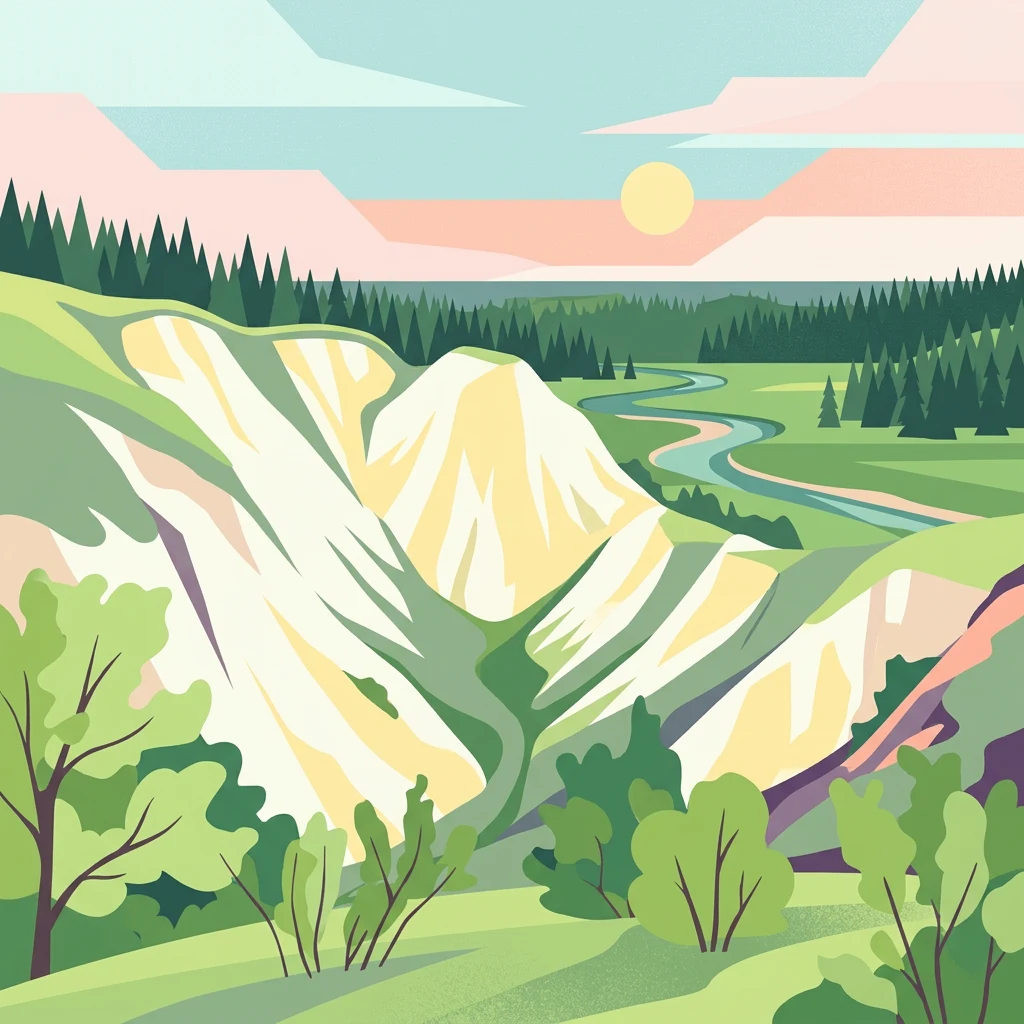
Illustrated landscape showing a river valley with light-colored hills, green forests, and a sun setting in the sky

Ukraine's chalk steppe sanctuary along the Oskil River

Dvorichna National Nature Park

Dvorichna National Nature Park is a protected area in eastern Ukraine, established in 2009 through a presidential decree. The park occupies 3,131 hectares along the right bank of the Oskil River in Kupiansk Raion, Kharkiv Oblast, situated near the Russian border. The landscape is defined by dramatic chalk formations that create a unique ecosystem supporting extraordinary biodiversity. Approximately 30% of the plant species found within the park are endemic to this region, making it one of Ukraine's most botanically significant protected areas. The chalk steppe habitat supports rare and endangered species of flora and fauna, many of which are protected under Ukrainian and international conservation agreements. The park serves as a living laboratory for scientific research and offers visitors the opportunity to experience pristine natural landscapes rarely found elsewhere in Europe.

Location
Ukraine
Park type
National park
Established
2009
Area
31.3 km²
Dvorichna National Nature Park Atlas
Regional park map

See the ranked park cluster in its geographic setting

Nearby parks around Dvorichna National Nature Park

This regional map shows the same 20 nearby parks ranked below around Dvorichna National Nature Park. Select a ranked marker to highlight that park’s boundary where boundary data is available.
Reference park: Dvorichna National Nature ParkRanked nearby park20 nearby parks shown
20 nearby parks

Ranked geographic collection and surrounding regional protected landscapes

Parks and Protected Areas Geographically Near Dvorichna National Nature Park

Examine the ranked collection of nearby protected areas evaluated by geographic separation and direction from Dvorichna National Nature Park. Compare surrounding regional landscapes and recorded environmental characteristics to understand broader protected-area patterns across the wider territory.
Watercolor illustration showing a river winding through a forested valley with rolling hills and distant mountains under a light sky
National parkDonetsk Oblast
About 82 km away#1 closest

South

Holy Mountains National Nature Park: Donetsk Oblast Protected Landscape

Mapped boundaries and regional geographic context.

This entry details Holy Mountains National Nature Park, a protected national park located in Donetsk Oblast, Ukraine. It serves as a key point for exploring the mapped protected areas and natural landscapes within the Donbas region. Understand the park's geographic significance and its place within the atlas of eastern Ukraine's diverse terrain and conservation efforts.

Area
406 km²
Established
1997
IUCN
II
Relief
Mixed relief
Watercolor illustration showing a valley with a winding river, green trees, and distant purple mountains under a light sky
National parkKharkiv Oblast
About 105 km away#2 closest

West

Homilsha Woods National Nature Park: National Park & Protected Landscape Atlas

Ancient oak woodlands and river valley geography in Kharkiv Oblast.

Delve into the protected natural heritage of Homilsha Woods National Nature Park, a significant national park situated in Ukraine's Kharkiv Oblast. This park preserves exceptional examples of ancient oak forests, some hundreds of years old, set within a complex geographic transition zone between steppe and forest ecosystems. Its diverse terrain, including hilly uplands and riverine plains, provides a compelling subject for mapped landscape discovery and understanding regional protected area distribution.

Area
143 km²
Established
2004
IUCN
II
Relief
Upland
Watercolor illustration of a landscape with green fields, a body of water, and distant mountains
National parkKharkiv Oblast
About 182 km away#3 closest

West

Sloboda National Nature Park: National Park Protected Landscape in Kharkiv Oblast

Mapped Boundaries and Regional Geography Exploration

Investigate Sloboda National Nature Park, a recognized national park situated within Ukraine's Kharkiv Oblast. This page offers detailed insights into its protected landscape, focusing on its geographic setting and mapped terrain. Understand how this park contributes to the regional geography of Sloboda Ukraine and explore its mapped boundaries for a structured atlas discovery experience.

Area
52.44 km²
Established
2009
IUCN
II
Relief
Mixed relief
Watercolor depiction of a river landscape with grassy plains, distant trees, and hills
National parkSumy Oblast
About 209 km away#4 closest

West

Hetman National Nature Park: National Park Geography and Protected Landscape Atlas

Mapped protected area within Sumy Oblast, Ukraine.

Explore Hetman National Nature Park, a designated national park situated in Sumy Oblast, Ukraine. This page offers a detailed look at its geographic setting, mapped boundaries, and role as a protected landscape. Understand its place within the regional geography of northeastern Ukraine and utilize MoriAtlas for structured map-based discovery of this significant natural area.

Area
234 km²
Established
2009
IUCN
II
Relief
Lowland
Watercolor painting of a coastal scene with green hills, trees, and a body of water
National parkDonetsk Oblast
About 295 km away#5 closest

South

Meotyda National Nature Park: Coastal Wetlands and Bird Migration Hub in Donetsk Oblast

Explore protected park boundaries and unique Azov Sea ecosystems.

Meotyda National Nature Park protects a critical stretch of the Sea of Azov coastline, featuring diverse habitats such as coastal wetlands, estuaries, and steppe. Located in Donetsk Oblast, this national park is internationally recognized for its importance to migratory birds, supporting millions of waterfowl and over 100 nesting bird species annually. MoriAtlas offers an in-depth view of its geographic setting, mapped protected area, and its role within regional ecological corridors, providing essential context for understanding this significant Ukrainian natural landscape.

Area
207.21 km²
Established
2009
IUCN
II
Relief
Lowland
Watercolor depiction of a river flowing through wetlands with green vegetation, trees, and distant hills under a soft sky
National parkPoltava Oblast
About 328 km away#6 closest

West

Lower Sula National Nature Park: Protected Wetlands and River Floodplain Atlas Explorer

Mapped boundaries and geography of this Ukrainian national park.

Discover the detailed geography and protected landscape features of Lower Sula National Nature Park, located in Poltava Oblast, Ukraine. This page provides an atlas-level view of its critical wetland habitats, including marshes and shallow lakes, which are vital for waterfowl and fish spawning. Explore the park's unique position within the Sula River floodplain and its ecological significance as a national nature park, offering rich context for geographic study.

Area
186 km²
Established
2010
IUCN
II
Relief
Lowland
Watercolor illustration of a landscape with rolling hills, a body of water, and greenery
National parkZaporizhzhia Oblast
About 341 km away#7 closest

Southwest

Grand Meadow National Nature Park: National Park Protected Landscape and Regional Geography

Explore the mapped boundaries and natural terrain.

Grand Meadow National Nature Park represents a distinct protected landscape within Zaporizhzhia Oblast, Ukraine. As a national park, its designation signifies an area managed for conservation and geographic study. This entry on MoriAtlas details the park's physical presence, offering users the opportunity to explore its mapped terrain, understand its role in regional geography, and place it within the broader atlas of Ukrainian protected areas. It is ideal for users seeking concrete landscape context and precise geographic data.

Area
168 km²
Established
2006
IUCN
II
Relief
Lowland
Watercolor illustration showing a river flowing through a valley with green hills and trees
National parkPoltava Oblast
About 377 km away#8 closest

West

Pyriatyn National Nature Park: Detailed Atlas View of Ukrainian River Valley Protected Landscapes

Explore Poltava Oblast's unique wetland and floodplain ecosystems.

Pyriatyn National Nature Park provides an exceptional case study of a complete river valley ecosystem within Ukraine's Poltava Oblast. This protected area showcases a distinct topographic sequence, transitioning from upland terraces to extensive floodplain wetlands and the meandering Udai River. Discover the park's significant role in conserving boreal plant species at their southern range limits and its importance as a mapped natural landscape for geographic atlas exploration.

Area
120 km²
Established
2009
IUCN
II
Relief
Lowland
Watercolor painting of a landscape with green hills, water bodies, and vegetation
National parkZaporizhzhia Oblast
About 378 km away#9 closest

Southwest

Pryazovia National Nature Park: National Park Protected Landscape Atlas

Explore the mapped boundaries and regional geography of Pryazovia National Nature Park.

Pryazovia National Nature Park represents a key protected area within Zaporizhzhia Oblast, Ukraine. This MoriAtlas entry provides detailed atlas-style information, emphasizing the park's mapped boundaries and its integration into the regional geography. Understand the park's character as a protected natural landscape situated in the southeastern Ukrainian coastal zone near the Sea of Azov, offering valuable context for geographic exploration.

Area
781 km²
Established
2010
IUCN
II
Relief
Lowland
National parkSumy Oblast
About 397 km away#10 closest

Northwest

Desna, Stara Huta National Nature Park: Key Protected Area and Regional Geographic Context in Ukraine

Explore mapped landscapes of river floodplains and boreal forests.

This page details Desna, Stara Huta National Nature Park, a significant protected area within Ukraine's Sumy Oblast. It showcases a landscape defined by the Desna River floodplain, unique wetlands, and the southernmost extension of the Bryansk Forest. Users can explore its geographic identity, protected status, and its role in the atlas of Eastern European natural regions, focusing on landscape diversity and mapped boundaries.

Area
162 km²
Established
1999
IUCN
II
Relief
Lowland
Watercolor painting of rolling hills, forests, and wildflowers in a landscape
National parkUkraine
About 402 km away#11 closest

West

Ichnia National Nature Park: A Protected Landscape with Geographic Identity in Ukraine

Explore the mapped boundaries and regional natural context of this national park.

Ichnia National Nature Park represents a significant protected landscape within Ukraine, providing users with a focused entry point for geographic discovery. This page details its designation as a national park, highlighting its mapped features and regional setting. It serves as a foundational resource for understanding the park's specific landscape character and its contribution to the broader atlas of Ukraine's protected natural areas, offering detailed geographic context for further exploration.

Area
97 km²
Established
2004
IUCN
II
Relief
Lowland
National parkOryol Oblast
About 417 km away#12 closest

Northwest

Orlovskoye Polesye National Park: Protected Forest and Wetland Atlas

Geographic overview of the Central Russian Upland sanctuary

Orlovskoye Polesye National Park spans the distinctive terrain of the Central Russian Upland, where forested groves meet expansive wetlands. As a major conservation zone for the European bison, the park showcases a rare forest-marsh ecosystem within Oryol Oblast. Use this geographic record to trace the protected boundaries and understand the regional landscape context of this significant wilderness area.

Area
777.45 km²
Established
1994
IUCN
II
Relief
Lowland
National parkOryol Oblast
About 417 km away#13 closest

Northwest

Orlovskoye Polesye National Park: A Comprehensive Atlas of Protected Forest and Steppe Terrain

Geography and landscape context in the Russian Oryol Oblast

Orlovskoye Polesye National Park represents a significant protected area at the meeting point of broadleaf forests and open steppe. Spanning over 77,000 hectares, the park landscape features a dissected plain shaped by the meandering Vytebet River. This atlas entry covers the park's natural geography, river valley networks, and its role as a refuge for rare species within the central Russian ecosystem.

Area
777.45 km²
Established
1994
IUCN
II
Relief
Upland
Watercolor illustration showing a winding river through a grassy field with wildflowers and distant hills under a soft sky
National parkChernihiv Oblast
About 436 km away#14 closest

Northwest

Mezyn National Nature Park: Protected Area with Paleolithic Heritage in Chernihiv Oblast

Explore ancient forests, river wetlands, and prehistoric landscapes.

Mezyn National Nature Park in Chernihiv Oblast, Ukraine, represents a significant protected area where natural landscapes meet profound archaeological discoveries. This national park encompasses diverse terrain, from the expansive Desna River floodplain dotted with oxbow lakes to ancient oak forests and rolling upland areas shaped by glacial activity. It is particularly noted for the Mezyn Paleolithic site, offering insights into Ice Age human life with remarkable artifacts and bone dwellings, making it a unique destination for atlas-driven discovery of protected lands and prehistoric geography.

Area
310 km²
Established
2004
IUCN
II
Relief
Lowland
Watercolor landscape painting with green fields, hills, and water under a soft sky
National parkKyiv Oblast
About 442 km away#15 closest

West

Bile Ozero National Nature Park: Detailed National Park Atlas and Geography

Explore protected landscape boundaries in Kyiv Oblast.

Delve into Bile Ozero National Nature Park, a prominent national park situated in Kyiv Oblast, Ukraine. This entry provides a focused atlas-style exploration of the park's protected area status and its precise geographic positioning. Understand the mapped contours of this natural landscape and its regional context, essential for comprehensive geographic discovery on MoriAtlas.

Area
70.14 km²
Established
2009
IUCN
II
Scope
Terrestrial
Watercolor illustration showing a wetland area with green vegetation, a winding water body, and purple-hued mountains in the background
National parkUkraine
About 459 km away#16 closest

Southwest

Azov, Syvash National Nature Park: National Park Protected Landscape and Geography

Explore mapped boundaries and regional landscape context.

Azov, Syvash National Nature Park stands as a notable protected area, offering a distinct geographic identity within Ukraine's atlas of natural landscapes. This national park's mapped boundaries provide a foundation for understanding its landscape context and regional significance. MoriAtlas enables detailed exploration of its protected terrain and its place within the country's conservation geography, serving as a gateway to structured geographic information and detailed park data for researchers and explorers.

Area
525.8 km²
Established
1993
IUCN
II
Relief
Lowland
Watercolor painting showing a river flowing through a valley with green fields, scattered trees, and mountain ranges in the background
National parkRussia
About 498 km away#17 closest

North

Ugra National Park: Explore Russia's Protected Landscape and National Park Atlas

Mapped boundaries and regional geographic context.

Ugra National Park represents a crucial protected area within Russia, offering detailed geographic context for atlas-based exploration. This entry details the park's specific identity as a national park, highlighting its mapped boundaries and landscape character. Engage with the structured data to understand Ugra National Park's position within Russia's geography and its significance as a protected natural landscape, facilitating comprehensive map exploration.

Area
986,245 km²
Established
1997
IUCN
II
Relief
Lowland
Watercolor illustration of a river landscape with green hills, reeds, and water lilies
National parkUkraine
About 499 km away#18 closest

West

Zalissia National Nature Park: Protected Forest Atlas and Regional Geography

Mapping Ukraine's temperate hardwood and pine forest ecosystems.

Delve into Zalissia National Nature Park, a significant protected landscape in Ukraine renowned for its vast temperate hardwood forests and ancient pine stands. This atlas entry details the park's mapped boundaries, its position within the Desna River floodplain, and the unique geographic context of its forest ecosystems. Understanding Zalissia National Nature Park offers insight into the conservation of northern Ukraine's natural heritage and its place in the broader regional geography.

Area
148 km²
Established
2009
IUCN
II
Relief
Lowland
Watercolor illustration of a landscape with grassy fields, trees, a river, and distant hills.
National parkKherson Oblast
About 512 km away#19 closest

Southwest

Oleshky Sands National Nature Park: Mapping Ukraine's Distinctive Semi-Arid Dune Landscape

Explore protected sandy steppe, dunes, and conservation areas in Kherson Oblast.

Oleshky Sands National Nature Park is a critical protected landscape in Kherson Oblast, Ukraine, renowned for its unusual semi-arid terrain dominated by expansive sand dunes and sandy steppe. This page provides detailed geographic context for the park, highlighting its unique mapped boundaries, the contrast between its Radensk and Burkut zones, and its ecological importance as part of the Pontic-Caspian steppe. Understand the specific landscape features and regional geography that make this national park a significant natural asset within Ukraine's protected area network.

Area
80.2 km²
Established
2010
IUCN
II
Relief
Mixed relief
Watercolor artwork showing tall trees, green foliage, and distant mountains under a soft sky
National parkUkraine
About 516 km away#20 closest

West

Holosiiv National Nature Park: Ukraine's Protected Area and Mapped Landscape

Explore geographic boundaries and regional context.

Holosiiv National Nature Park represents a significant protected natural landscape within Ukraine. This detail page offers in-depth atlas exploration of the park's mapped boundaries and its integration into the country's regional geography. Understand the value of this protected area through structured geographic data and visual context, enabling a deeper appreciation of its unique landscape identity within the national park system.

Area
45.255 km²
Established
2007
IUCN
II
Relief
Lowland
Distance methodology

Geographic measurements, not driving distances

How nearby park distances are calculated

Distances use park boundaries whenever the available geometry allows it. When one or both boundaries are missing, the mapped park locations provide a clearly labelled estimate. Every value represents straight-line geographic separation and does not use roads or routing.

Boundary distance

Calculated between the nearest points of both park boundaries.

Location-to-boundary estimate

Estimated from one mapped park location to the nearest boundary of the other park.

Mapped-location estimate

Estimated between the mapped locations of both parks.

MoriAtlas Explorer

Continue Your Atlas Exploration of Dvorichna National Nature Park's Geography

Delve deeper into the geographic specifics and protected landscape context of Dvorichna National Nature Park. Utilize MoriAtlas to trace its mapped boundaries and understand its relationship to the surrounding terrain. This structured approach aids in building a comprehensive understanding of Ukraine's natural regions and conservation areas.

Global natural geography