Mori Atlas logo
Nearby park discovery

Map protected geography around a forested island mountain southeast of Belgrade

Position Kosmaj within Serbia's wider forest and island-mountain protected geography

Kosmaj rises as a low island mountain above the Šumadija plain, shaped by a crescent ridge and three peaks clothed in beech-oak forest, grassland, and orchard foothills over flysch, serpentine, and magmatic rock, with several rivers beginning on its slopes. Explore nearby Serbian protected geography without blending separate watersheds, geology, or cultural sites.

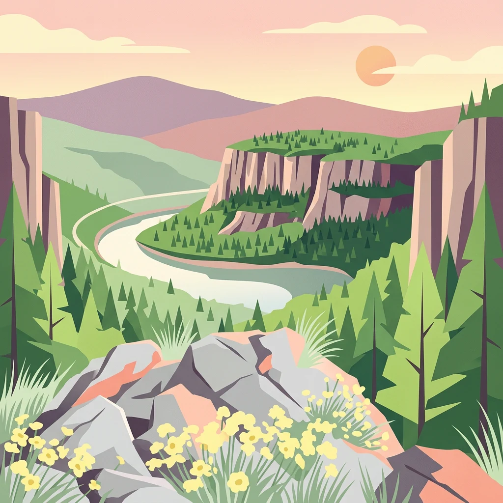
Stylized illustration showing a mountainous landscape with a winding river, cliffs, forests, and yellow wildflowers

Belgrade's highest peak, an island mountain of forests, monasteries, and ancient mining heritage

Kosmaj

Kosmaj is a mountain located approximately 40 kilometers southeast of Belgrade, Serbia, standing at 626 meters elevation as the highest point within the Belgrade City area. Classified as an island mountain, Kosmaj rises from the surrounding lowlands of the Šumadija region, its peaks forming a distinctive landscape that was once an island in the ancient Pannonian Sea until 600,000 years ago. The mountain belongs administratively to the municipalities of Mladenovac, Sopot, Grocka, Barajevo, and Voždovac, making it a significant green space within easy reach of Serbia's capital city. The mountain is characterized by three named peaks—Mali Vis, Goli Vis, and Rutavi Vis—each bearing descriptive names reflecting their appearance. The geology consists of flysch, serpentine, and magmatic rocks, with over 70% of the area covered in deciduous forests of beech and oak. Kosmaj serves as the watershed source for several rivers including Turija, Lug, Ralja, and Topčiderka, contributing to the broader Kolubara and Velika Morava river systems. The mountain holds deep cultural significance with its network of historic monasteries and its legacy as an important Roman and medieval mining center for iron, silver, and lead.

Location
Serbia
Park type
Protected landscape
Established
2005
Area
0 km²
Highest point
626 m
Kosmaj Protected Landscape Serbia
Regional park map

See the ranked park cluster in its geographic setting

Nearby parks around Kosmaj

This regional map shows the same 20 nearby parks ranked below around Kosmaj. Select a ranked marker to highlight that park’s boundary where boundary data is available.
Reference park: KosmajRanked nearby park20 nearby parks shown
20 nearby parks

Explore surrounding protected landscapes and regional park geography ranked by proximity.

Parks and Protected Areas Geographically Near Kosmaj

Examine the ranked collection of protected areas situated within geographic proximity to Kosmaj to analyze surrounding regional terrain and boundary relationships. Compare measured separation distances alongside recorded environmental attributes to evaluate how adjacent conservation landscapes connect across the territory.
Watercolor painting of a landscape featuring rolling hills, a lake, trees, and a sky with clouds
Natural monumentSerbia
About 25 km away#1 closest

North

Avala Natural Monument: Iconic Protected Landscape and Regional Geography Near Belgrade

Explore Avala's mapped terrain and natural monument significance.

Avala Natural Monument offers a unique protected landscape and significant geographic context for the Belgrade metropolitan area. As one of Serbia's oldest protected natural sites, its distinct mountain terrain, geological composition, and panoramic views provide a rich subject for atlas-based discovery. Explore the mapped boundaries and natural features that define this prominent Serbian natural monument.

Area
5.01 km²
Established
1859
IUCN
III
Relief
Mountain
Watercolor painting showing a river, grassy areas, and forested hills in the background
Nature reserveSerbia
About 42 km away#2 closest

North

Veliko Ratno Ostrvo Nature Reserve: Geographic Overview and Protected Area Atlas

Explore the mapped terrain and protected wetland landscape.

Delve into the geographic specificity of Veliko Ratno Ostrvo, a nature reserve defined by its river island location on the Danube near Belgrade. This page offers an atlas-style view of the protected area, detailing its mapped boundaries and landscape context within Serbia. Understand Veliko Ratno Ostrvo as a key protected natural asset for regional geographic discovery.

IUCN
V
Watercolor illustration of a river flowing through a valley with mountains, greenery, and pink flowers
Protected landscapeSerbia
About 70 km away#3 closest

Southwest

Ovčar-Kablar Gorge Protected Landscape: Serbia's River Gorge and Monastery Atlas

Explore karst terrain, monastery sites, and mapped river meanders.

Ovčar-Kablar Gorge is a protected landscape in Serbia renowned for its dramatic karst geology and the West Morava river's pronounced meanders. This area offers a unique atlas perspective, highlighting over a dozen historic Serbian Orthodox monasteries nestled within the dramatic canyon setting. The protected landscape reveals a confluence of significant natural features, including karst cliffs and thermal springs, alongside centuries of spiritual heritage, making it a distinct point for geographic discovery and understanding Serbia's mapped natural and cultural resources.

Area
25 km²
Established
2001
IUCN
V
Relief
Mixed relief
Watercolor illustration of a river flowing through a valley with mountains in the background
Protected landscapeRomania
About 74 km away#4 closest

East

Iron Gates Natural Park: Explore Romania's Protected Landscape and Geographic Context

Detailed atlas view of a protected landscape in Romania.

Uncover the geographic dimensions of Iron Gates Natural Park, a protected landscape situated in Romania. This detailed entry offers an atlas-centric exploration of its mapped boundaries and regional setting, facilitating a deeper understanding of its protected status and landscape features within the national geography. Discover the park's intrinsic value through structured geographic data and visual map context.

Area
1,156.66 km²
Established
2000
IUCN
V
Relief
Mixed relief
Watercolor illustration of a landscape with mountains, wildflowers, and a river
National parkSerbia
About 84 km away#5 closest

Northwest

Fruška Gora National Park: Mapped Protected Landscape and Geological Heritage

Discover unique island mountain geography and Serbian Orthodox heritage.

Investigate Fruška Gora National Park, an extraordinary protected landscape rising from the Pannonian Plain. This national park is celebrated for its ancient forests, significant paleontological sites with fossils spanning millions of years, and an exceptional density of 17 historic Serbian Orthodox monasteries. MoriAtlas provides essential geographic context and mapped boundaries for understanding this unique island mountain within its regional context, ideal for structured atlas exploration.

Area
266.72 km²
Established
1960
IUCN
II
Relief
Mountain
Watercolor illustration of a river flowing through a valley with rolling hills and trees
National parkSerbia
About 90 km away#6 closest

East

Đerdap National Park: Europe's Grandest River Gorge and Protected Landscape

Explore Serbia's largest national park along the Danube River.

Đerdap National Park is defined by the Iron Gate, Europe's longest and most dramatic river gorge, a geological marvel carved through the Carpathian Mountains. This protected area showcases a complex karst landscape with towering cliffs, deep river sections, and rich biodiversity, including vital Tertiary relict species. The park's vastness and unique terrain offer a profound geographic context for understanding regional natural landscapes and conservation efforts. Explore its mapped boundaries and ecological significance.

Area
637.87 km²
Established
1974
IUCN
II
Relief
Mountain
Watercolor painting depicting a river flowing through a valley with mountains in the background and trees on both sides
National parkSerbia
About 99 km away#7 closest

Southwest

Tara National Park: Endemic Flora and Dramatic Dinaric Alps Geography

Discover Serbia's iconic protected mountain landscape and its unique botanical heritage.

Tara National Park is a significant protected area in Serbia, celebrated for its exceptional botanical value and dramatic mountainous terrain. It is the last refuge for Pančić's spruce, a living fossil conifer, and hosts a remarkable diversity of Balkan flora. The park's landscape is defined by steep limestone cliffs, deep river valleys like the Drina canyon, and expansive forest ecosystems, offering a unique geographic study of protected lands. Explore its mapped features and discover a vital conservation area within the Dinaric Alps.

Area
249.92 km²
Established
1981
IUCN
II
Relief
Mountain
Watercolor illustration depicting a landscape with mountains, a winding river, and grassy fields
Protected landscapeSerbia
About 100 km away#8 closest

Northeast

Vršac Mountains Protected Landscape: A Unique Pannonian Island Mountain Range in Serbia

Explore distinct geological formations and rich avian habitats.

The Vršac Mountains Protected Landscape offers a unique geographic perspective as one of Serbia's Pannonian island mountains, emerging dramatically from the surrounding plains. This protected area is recognized for its striking gneiss and schist formations, its status as Vojvodina's highest elevation, and its exceptional importance for birdwatching, hosting over 120 species. Delve into the mapped terrain and geological character that distinguish this vital natural region.

Area
170 km²
Established
1982
IUCN
V
Relief
Mountain
Watercolor painting showing a river canyon with mountains in the background and green vegetation in the foreground
National parkBosnia and Herzegovina
About 107 km away#9 closest

Southwest

Drina National Park: Bosnia and Herzegovina's Protected Canyon and Endemic Ecosystem

Explore mapped geography and natural landscapes in this Balkan national park.

Drina National Park is a protected area in eastern Bosnia and Herzegovina, celebrated for its striking Drina River canyon landscape. As a national park, it preserves vital habitats for endemic species such as the Serbian spruce and provides a crucial geographic anchor for regional conservation. Its deep gorges and steep slopes offer a rich context for understanding the natural terrain and mapped boundaries within the broader Balkan geography.

Area
63.15 km²
Established
2017
IUCN
II
Relief
Mountain
Watercolor illustration of a landscape with mountains, a river, grassland, and vegetation
Protected areaSerbia
About 109 km away#10 closest

North

Jegrička Nature Park: Mapped Protected Area with Riverine Wetland Ecosystems

Explore the geography and protected landscape of Jegrička Nature Park.

Jegrička Nature Park is a designated protected area recognized for its significant riverine wetland character within the Pannonian Plain of northern Serbia. The park's landscape is defined by the meandering Jegrička river, extensive marshlands, and riparian vegetation, serving as crucial freshwater habitat for diverse waterfowl and migratory bird populations. This page offers detailed geographic context and atlas-level exploration of its protected boundaries and ecological importance within Eastern Europe's broader natural heritage.

IUCN
V
Relief
Lowland
Scope
Mixed
Water
Major water bodies
Watercolor illustration of a landscape with mountains, forests, and a body of water
National parkRomania
About 110 km away#11 closest

Northeast

Semenic-Cheile Carașului National Park: Romania's Protected Landscape Discovery

National Park Geography and Mapped Boundaries

Delve into Semenic-Cheile Carașului National Park, a protected landscape in Romania, with a focus on its atlas and geographic context. This page details the park's identity as a national park, its specific mapped boundaries, and its contribution to regional geographic understanding. Utilize MoriAtlas to explore the structured data that defines this protected area and its surrounding natural terrain, enhancing your comprehension of Romania's conservation landscapes.

IUCN
II
Scope
Terrestrial
Watercolor illustration showing rolling hills, a river, trees, and distant mountains
Protected landscapeSerbia
About 115 km away#12 closest

Southwest

Zlatibor Protected Landscape: Explore its Mapped Geography and Unique Alpine Meadows

Discover Dinaric Alps protected terrain and landscape context.

Zlatibor Protected Landscape offers a distinct exploration of mountainous terrain and protected natural areas in Serbia. Situated in the Dinaric Alps, its landscape is defined by rolling upland plateaus, dense coniferous forests, and open alpine meadows, creating a visually rich environment. The park's geography includes notable karst features and extensive cave systems, complemented by the natural boundaries of significant rivers. Delve into the mapped protected area to understand its landscape character, from the highest peak at Tornik to the unique geological formations and the rare endemic pine subspecies, providing a concrete geographic perspective for atlas-based discovery.

Area
0.419 km²
Established
2017
IUCN
VI
Relief
Mixed relief
National parkRomania
About 117 km away#13 closest

Northeast

Nera Gorge-Beușnița National Park: Karst Landscape and Protected Area in Romania

Explore the mapped geography of this protected Romanian landscape.

Nera Gorge-Beușnița National Park offers a detailed view of a protected karst canyon, featuring the Nera River's dramatic gorge and the picturesque Beușnița waterfalls. This protected area in Romania provides valuable context for understanding karst terrain, subterranean systems, and the geographic distribution of protected lands within the Balkan region. Users can explore its distinct landscape features and their place within Romania's atlas of natural protected areas.

IUCN
II
Relief
Mountain
Water
Major water bodies
Watercolor illustration of mountainous landscape with forests and distant hills
National parkSerbia
About 122 km away#14 closest

South

Kopaonik National Park: Serbia's Premier Protected Mountain Landscape

Explore Balkan biodiversity and unique geographic terrain.

MoriAtlas presents Kopaonik National Park, a key protected area celebrated for its extraordinary endemic plant species and its distinctive mountainous geography. This national park safeguards a significant biodiversity hotspot within the Balkans, characterized by a prominent mountain plateau and peaks exceeding 2,000 meters. Discover the park's varied terrain, from forested slopes to subalpine meadows, and understand its role in regional natural landscapes. Utilize our map-based exploration tools to grasp Kopaonik National Park's protected boundaries and its unique place in geographic context.

Area
118.1 km²
Established
1981
IUCN
II
Relief
Mountain
Watercolor illustration of a river flowing through a valley with mountains and forests in the background
National parkRomania
About 152 km away#15 closest

Northeast

Domogled-Valea Cernei National Park: National Park with Mapped Protected Landscape

Explore its protected boundaries and regional geography.

Domogled-Valea Cernei National Park is recognized as a National Park, offering a distinct protected landscape for atlas-based discovery. This page provides focused insights into its mapped geographic extent and the character of its natural terrain. Understand the park's role within Romania's protected areas network and its unique geographic identity. Utilize this structured view to navigate the park's features and its surrounding landscape context for informed exploration.

Area
612.11 km²
Established
2000
IUCN
II
Relief
Mountain
Watercolor illustration showing rolling hills, scattered trees, and a soft pink sky
Protected landscapeMehedinți County
About 174 km away#16 closest

East

Mehedinți Plateau Geopark Protected Landscape: Karst Geography and Regional Context

Explore Romania's unique limestone formations and karst landscapes.

The Mehedinți Plateau Geopark in Mehedinți County, Romania, is a significant protected landscape celebrated for its extensive karst features. This page offers detailed insights into the park's mapped boundaries, including its famous natural bridges like Podul lui Dumnezeu, vast limestone pavements, and cave systems. Understand its position within the broader regional geography of southwestern Romania, providing a solid foundation for atlas-driven exploration of this geologically rich area.

Area
1,065 km²
Established
2005
IUCN
V
Relief
Upland
Watercolor illustration of a river flowing through wetland vegetation with distant hills under a light sky
Protected landscapeOsijek-Baranja County
About 177 km away#17 closest

Northwest

Kopački Rit Protected Landscape: A Key European Wetland Ecosystem in Osijek-Baranja County

Mapped natural terrain and protected landscape geography.

Delve into the protected landscape of Kopački Rit, a pivotal European wetland situated within Osijek-Baranja County, Croatia. This page offers a detailed look at its dynamic floodplain ecosystem, mapped water channels, marshes, and riparian forests, highlighting its importance for biodiversity and regional geography. Understand the park's extensive protected boundaries and its place in the broader continental atlas.

Area
177 km²
Established
1976
IUCN
V
Relief
Lowland
Watercolor painting depicting a river flowing through rolling hills with green and yellow tones
Protected landscapeSerbia
About 178 km away#18 closest

Southeast

Sićevo Gorge Protected Landscape: Explore Serbia's Dramatic Karst Geography

Mapping the unique limestone cliffs and river valley terrain.

Delve into the atlas details of Sićevo Gorge, a protected landscape in Serbia defined by its spectacular limestone cliffs and the Nišava River canyon. This page provides a structured overview of its dramatic topography, intricate karst formations, and the regional geographic context. Understand the mapped boundaries and the unique geological character that makes this gorge a standout feature in Serbia's natural landscape.

IUCN
V
Scope
Terrestrial
Water
Minor water
Watercolor illustration of a mountain range with forests, a lake, and distant hills under a light sky
National parkHunedoara County
About 180 km away#19 closest

Northeast

Retezat National Park National Park: Protected Landscape and Regional Geography

Mapped boundaries and landscape context in Hunedoara County.

Retezat National Park is a key protected area featured within MoriAtlas, offering structured geographic data and map-based insights. This national park's protected landscape is situated in Hunedoara County, Romania, contributing significantly to the regional topography and natural context of the Southern Carpathians. Explore its mapped boundaries and understand its role as a distinct natural entity.

Area
380.47 km²
Established
1935
IUCN
II
Relief
Mountain
Watercolor painting of green mountains, forests, and fields under a light sky
National parkKosovo
About 180 km away#20 closest

South

Bjeshkët e Nemuna National Park: Kosovo's Largest Alpine Protected Landscape

Explore dramatic mountains, glacial lakes, and diverse ecosystems.

Delve into the protected geography of Bjeshkët e Nemuna National Park, Kosovo's expansive national park located in the Accursed Mountains. This atlas entry details its significant alpine terrain, from dense forests to high-altitude meadows, and highlights the presence of glacial lakes like Liqenat. Understand its role as a vital conservation corridor and a key component of the Balkan's natural heritage.

Area
630.28 km²
Established
2012
IUCN
II
Relief
Mountain
Distance methodology

Geographic measurements, not driving distances

How nearby park distances are calculated

Distances use park boundaries whenever the available geometry allows it. When one or both boundaries are missing, the mapped park locations provide a clearly labelled estimate. Every value represents straight-line geographic separation and does not use roads or routing.

Boundary distance

Calculated between the nearest points of both park boundaries.

Location-to-boundary estimate

Estimated from one mapped park location to the nearest boundary of the other park.

Mapped-location estimate

Estimated between the mapped locations of both parks.

MoriAtlas Explorer

Continue Exploring Kosmaj's Protected Landscape and Regional Geography

Delve deeper into the mapped terrain and unique island mountain geography of Kosmaj. Understanding this protected landscape provides valuable context for exploring Serbia's natural areas and regional atlas. Discover the park's distinct features and how its boundaries fit within the broader geographic framework of Šumadija and beyond.

Global natural geography