Mori Atlas logo
Nearby park discovery

Regional geographic analysis and spatial distribution of surrounding protected territories

National Parks and Protected Landscapes Near Northern Velebit National Park in Croatia

Examine the geographic distribution of protected natural areas situated in the broader region around Northern Velebit National Park. This spatial overview provides insight into how various parks and reserves are positioned within the local landscape of the Dinaric Alps, facilitating a clearer understanding of the regional terrain and the interconnected nature of protected lands across this area.

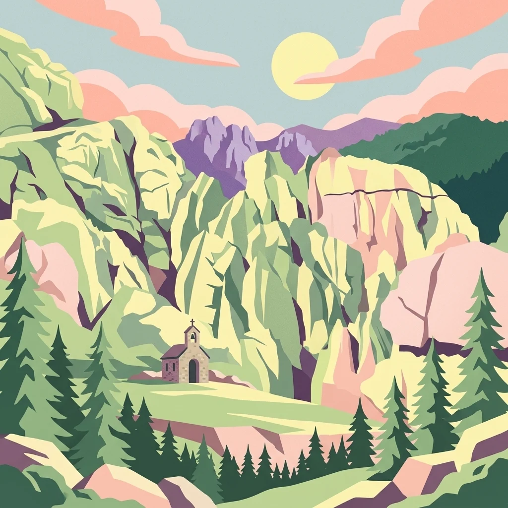
Stylized illustration of rocky mountains, pine trees, and a small chapel with a setting sun

About Northern Velebit National Park

Northern Velebit National Park

Northern Velebit National Park stands as a prominent protected area, contributing significantly to the geographic understanding of Croatia's Velebit mountain range. This page provides focused details on its protected landscape features, mapped boundaries, and position within the Dinaric Alps. It serves as an essential entry point for users seeking structured atlas-based information on national parks and their role in regional conservation efforts, highlighting its unique geographic characteristics.

Location
Croatia
Park type
National park
Northern Velebit National Park Protected Area
Regional park map

See the ranked park cluster in its geographic setting

Nearby parks around Northern Velebit National Park

This regional map shows the same 20 nearby parks ranked below around Northern Velebit National Park. Select a ranked marker to highlight that park’s boundary where boundary data is available.
Reference park: Northern Velebit National ParkRanked nearby park20 nearby parks shown
20 nearby parks

Distance ranked collection and regional geography for comparative spatial analysis

Parks and Protected Areas Geographically Near Northern Velebit National Park

Spatial proximity rankings evaluate geographic separation and directional distribution for parks near Northern Velebit National Park. Comparative analysis of surrounding landscapes and recorded environmental characteristics reveals broader protected area patterns.
Watercolor illustration of a mountain landscape with trees and water
National parkCroatia
About 45 km away#1 closest

Southeast

Paklenica National Park: Croatia's Iconic Karst Canyon and UNESCO Beech Forests

Explore dramatic protected landscape and regional geography.

Paklenica National Park presents a spectacular protected area defined by its deep karst canyons, with Velika Paklenica and Mala Paklenica carving dramatic vertical walls into the Velebit mountain range. This national park is celebrated for its status as a leading European climbing destination and its ancient beech forests, part of a UNESCO World Heritage site. Exploring Paklenica offers insight into unique geological formations, extensive cave systems, and the rich biodiversity of this significant Croatian landscape.

Area
95 km²
IUCN
II
Relief
Mountain
Climate
Mediterranean
National parkCroatia
About 53 km away#2 closest

Northeast

Plitvice Lakes National Park: Croatia's Iconic National Park and UNESCO Heritage Site

Mapped protected area with cascading lakes and karst geography.

Delve into the protected landscape of Plitvice Lakes National Park, a jewel of Croatia's natural heritage. This atlas entry highlights the park's famous system of 16 terraced lakes and cascading waterfalls, set within a unique karst terrain. Understand the geographic context and mapped boundaries of this significant protected area, renowned for its geological processes and ancient forest ecosystems. Explore the full spectrum of its protected natural identity.

IUCN
II
Watercolor illustration showing mountains, a river, a waterfall, trees, and flowers.
National parkBosnia and Herzegovina
About 73 km away#3 closest

East

Una National Park: Bosnia and Herzegovina's Largest National Park and Protected Landscape

Explore its dramatic river canyons and karst geography.

Una National Park represents a significant protected landscape in Bosnia and Herzegovina, covering approximately 198 square kilometers of the Upper Una River basin. This page details the park's protected area identity, focusing on its spectacular riverine geography, including iconic features like the Štrbački Buk waterfall and the deep Unac River canyon. Users can explore the park's mapped boundaries, understand its place within the regional Dinaric mountain context, and discover the characteristics of its unique karst terrain and pristine river ecosystems. MoriAtlas provides essential geographic context for this vital natural area.

Area
350 km²
Established
2008
IUCN
II
Relief
Mixed relief
Watercolor illustration of a mountainous landscape with green forests, a lake, and distant pink-hued mountains under a light sky
National parkPrimorje-Gorski Kotar County
About 83 km away#4 closest

North

Risnjak National Park: Protected Mountain Landscape in Primorje-Gorski Kotar

Explore karst terrain and regional geographic context.

Risnjak National Park represents a substantial protected area within the rugged mountain geography of Croatia's Gorski Kotar region. This national park is distinguished by its dramatic karst formations, diverse alpine flora reaching from forested slopes to rocky summits, and the significant natural landmark of the Kupa River's source. Discover its mapped boundaries and the ecological importance of this unique landscape situated in Primorje-Gorski Kotar County.

Area
63.5 km²
Established
1949
IUCN
II
Visitors
16.8K annual
Watercolor illustration of rolling hills, trees, and a body of water
Nature reserveDugi Otok
About 84 km away#5 closest

South

Telašćica Nature Park: Adriatic Sea Cliffs, Lake Mir, and Protected Landscape

Dugi Otok's Premier Nature Reserve on the Dalmatian Coast

Telašćica Nature Park safeguards a highly distinctive coastal environment on Croatia's Dugi Otok island. This protected area is defined by its imposing 161-meter-high vertical limestone cliffs, locally named 'stene,' which create a breathtaking interface with the Adriatic Sea. Within the park, the unique saltwater Lake Mir offers a fascinating geological feature, while the sheltered bay and its surrounding landscape showcase a rich Mediterranean flora and a complex archipelago. The park serves as a prime example of Adriatic karst landscape preservation and mapped coastal geography.

Area
70.5 km²
Established
1988
IUCN
II
Relief
Mixed relief
National parkŠibenik-Knin County
About 92 km away#6 closest

South

Kornati Islands National Park: Dense Mediterranean Archipelago and Protected Karst Landscape

Explore the mapped geography and unique protected island terrain.

Kornati Islands National Park, located in Šibenik-Knin County, Croatia, is distinguished as the Mediterranean's most densely packed archipelago. This national park protects a vast expanse of karst limestone islands, dramatic sea cliffs, and unique flat rock plateaus, alongside its significant marine environment. MoriAtlas provides detailed geographic context and mapped boundaries, enabling structured exploration of this exceptional protected landscape and its ecological significance within the Adriatic Sea.

Area
320 km²
Established
1980
IUCN
II
Relief
Lowland
Watercolor painting of coastal landscape with green islands, trees, and calm water under a soft sky
National parkCroatia
About 98 km away#7 closest

West

Brijuni Islands National Park: Adriatic Protected Landscape and Historical Atlas

Mapped boundaries, regional geography, and ecological context.

Brijuni Islands National Park is a significant protected area comprising a Croatian archipelago in the northern Adriatic Sea. This national park showcases a unique Mediterranean landscape blending natural habitats with extensive archaeological sites, offering a rich context for atlas-based exploration. Understanding Brijuni Islands National Park contributes to a broader appreciation of regional geography and the mapped distribution of protected lands.

Area
7.5 km²
Established
1983
IUCN
II
Relief
Lowland
National parkŠibenik-Knin County
About 110 km away#8 closest

Southeast

Krka National Park: Croatia's National Park with European Cascade Waterfalls

Explore the mapped protected landscape and karst geography.

Krka National Park, designated as a national park in Croatia, offers a rich exploration of its protected landscape. Located in Šibenik-Knin County, the park is defined by the Krka River and its extraordinary seven travertine waterfalls, most notably Skradinski buk, the largest cascade system of its kind in Europe. This atlas-focused view highlights the park's unique karst terrain, Mediterranean ecosystems, and its position within the regional geography, providing essential context for understanding its protected natural heritage.

Area
109 km²
Established
1985
IUCN
II
Relief
Lowland
Regional parkSlovenia
About 132 km away#9 closest

Northwest

Škocjan Caves Regional Park: Mapped Karst Landscape and UNESCO World Heritage Site in Slovenia

Discover its profound underground river canyon and doline geography.

Škocjan Caves Regional Park in Slovenia is a protected karst landscape of global importance, renowned for its vast subterranean system and the Reka River's underground journey. This site, a UNESCO World Heritage designation, features dramatic collapse dolines like Mala and Velika dolina, alongside immense cave chambers that illustrate classic karst hydrology. It serves as a key reference point for understanding regional geology and protected area networks within southeastern Europe's unique terrains.

Area
4.15 km²
Established
1996
IUCN
V
Relief
Lowland
Protected areaFriuli-Venezia Giulia
About 136 km away#10 closest

Northwest

Val Rosandra Protected Area: Mapped Karst Landscapes and Geography in Northeastern Italy

A canyon-like river valley and natural reference for karst phenomena

Val Rosandra stands as a defining protected area within the Friuli Venezia Giulia region, characterized by its sharp limestone cliffs, narrow gorges, and the distinct Supet waterfall. Its unique geological layering creates a compact environment where contrasting climates produce an extraordinary botanical intersection, set against a rich backdrop of historical remnants ranging from Roman aqueducts to former railway paths.

Area
7.46 km²
Established
1996
Relief
Mixed relief
Climate
Mediterranean
A soft watercolor painting of a coastal scene featuring green vegetation, a light shoreline, and hazy distant mountains.
Protected landscapeAnkaran
About 143 km away#11 closest

Northwest

Landschaftspark Debeli rtič: Coastal Protected Landscape and Regional Geography Map

Protected marine and terrestrial landscape near Ankaran, Slovenia

Located on the Muggia Peninsula, Landschaftspark Debeli rtič protects a rare combination of flysch cliffs and shallow underwater reefs. This record provides a geographic breakdown of the park, including its distinct transition from agricultural vineyards to coastal woodland, offering a clear view of the protected area boundaries and surrounding Adriatic terrain.

Area
3.4 km²
Established
2018
Relief
Upland
Climate
Mediterranean
Watercolor illustration of a wetland with river, trees, and distant hills
Protected landscapeSisak-Moslavina County
About 147 km away#12 closest

Northeast

Lonjsko Polje Protected Landscape: Explore Croatia's Largest Inland Wetland and Pastoral Heritage

Discover mapped natural landscapes and unique floodplain geography.

Lonjsko Polje, a significant protected landscape in Croatia's Sisak-Moslavina County, represents the largest inland wetland within the Danube basin. This area is characterized by its vast alluvial floodplain, shaped by seasonal river dynamics, which fosters diverse habitats for wildlife and preserves a rare example of traditional pastoral culture. Explore the mapped geography and understand the ecological importance of this unique wetland ecosystem through structured atlas-style content.

Area
505.6 km²
Established
1998
IUCN
V
Relief
Lowland
A soft watercolor painting of a wetland landscape featuring green meadows, gentle rolling hills, and a river flowing through the scene.
Nature reserveSlovenia
About 149 km away#13 closest

North

Naturreservat Iški morost: Protected Nature Reserve and Wetland Landscape in Central Slovenia

Mapped protected wetlands of the Ljubljana Marsh region

Naturreservat Iški morost serves as a primary conservation site for the distinct wet meadow habitats of the Ljubljana Marsh. This reserve demonstrates the intersection of wetland geography and bird conservation, protecting a crucial, coherent landscape that is rare in contemporary Slovenian lowlands.

Area
0.65 km²
IUCN
Ia
Relief
Lowland
Climate
Temperate
Watercolor illustration showing layered mountains, green valleys, and a body of water with soft color gradients
National parkBosnia and Herzegovina
About 150 km away#14 closest

East

Kozara National Park: Bosnia and Herzegovina's Distinctive Forested Mountain Landscape

Mapped protected area in the Pannonian Plain's highland oasis.

Kozara National Park represents a significant protected natural area within Bosnia and Herzegovina, distinguished by its rounded, forested peaks that ascend from the surrounding Pannonian lowlands. This national park offers a unique landscape characterized by dense deciduous and mixed forests, interspersed with clearings and meadows, covering a considerable portion of its 39 square kilometer area. The park's geographic identity is further defined by its proximity to major rivers like the Una, Sava, Sana, and Vrbas, which delineate its natural boundaries and contribute to its distinct regional context. For atlas-based discovery, Kozara provides insight into how isolated highlands create unique protected landscapes within flatter terrain.

Area
39.08 km²
Established
1967
IUCN
II
Relief
Upland
Watercolor illustration of a landscape with rolling hills, scattered trees, and a winding river.
Protected landscapeCroatia
About 155 km away#15 closest

Northeast

Medvednica Nature Park: Mapped Protected Landscape and Central European Karst Geography

Explore protected area boundaries and natural terrain.

Medvednica Nature Park stands as a significant protected landscape, renowned for its complex karst topography and extensive cave networks, including the notable Veternica cave. Located immediately north of Zagreb, Croatia, this park offers a rich tapestry of central European mountain geography, dominated by dense beech and oak forests. Its unique features, such as the karst fields and rounded ridges, contribute to its distinct identity within Croatia's protected areas. MoriAtlas maps its geography, providing context for its ecological value and recreational significance.

Established
1981
IUCN
V
Relief
Mountain
Climate
Temperate
Protected landscapeSlovenia
About 163 km away#16 closest

Northwest

Ternowaner Wald Protected Landscape: Karst Plateau and Forest Geography in Slovenia

Dinaric highland exploration and protected terrain mapping.

Ternowaner Wald is a prominent limestone plateau located in southwestern Slovenia. Characterized by deep karst phenomena including sinkholes and the Great Ice Cave in Paradana, the area represents a critical ecological junction of mixed Dinaric beech and fir forests. This overview details the plateau boundaries, tectonic features, and protected status of this diverse highland geography.

Relief
Mountain
Climate
Temperate
Access
Moderate access
Scope
Terrestrial
Watercolor illustration of a river flowing through a forested valley with mountains in the background
National parkSlovenia
About 190 km away#17 closest

Northwest

Triglav National Park: A Mapped Alpine Protected Landscape in Slovenia

Julian Alps geography, glacial lakes, and karst terrain.

Triglav National Park is Slovenia's premier protected area, covering 880 square kilometers of the Julian Alps. This page details its dramatic alpine geography, including Mount Triglav, glacial valleys, and significant karst features. Understand the mapped boundaries and landscape context of this national park, a key entry in the MoriAtlas geographic discovery resource for understanding protected lands.

Area
880 km²
Established
1981
IUCN
II
Visitors
1.6M annual
A horizontal watercolor painting showing a soft mountain range with green forests, a winding river valley, and wildflowers in the foreground.
Protected areaAustria
About 208 km away#18 closest

North

Geopark Karawanken: Alpine Protected Landscape and Tectonic Geography in Austria

A cross-border protected area defined by tectonic uplift and deep alpine valleys.

Geopark Karawanken showcases a profound geological record formed by tectonic plate convergence. The protected area features sharp mountain massifs, subterranean karst systems, and deep-cut gorges that reveal the underlying structural complexity of the alpine range, offering a clear view of how tectonic forces shape regional geography.

Area
1,067 km²
Established
2013
Relief
Mountain
Climate
Alpine
Watercolor painting of a mountain landscape featuring a river, hills, and vegetation
Nature reservePožega-Slavonia County
About 216 km away#19 closest

Northeast

Papuk Nature Park: Explore Croatia's Foremost Geopark and Mountain Landscape

Mapped protected area with significant geological heritage in Slavonia.

Papuk Nature Park stands as a cornerstone of geological discovery in Croatia, celebrated as the nation's first UNESCO Global Geopark. Within Požega-Slavonia County, its mountainous terrain features dramatic ridgelines, ancient rock formations like Sokoline stijene, and extensive forests. This protected area offers a unique landscape context for atlas-driven exploration, detailing its mapped boundaries and its critical role in preserving Slavonia's highland geography and geological heritage.

Established
1999
IUCN
V
Relief
Highland
Climate
Temperate
Watercolor illustration of a landscape with green hills, a river, and distant mountains under a light sky
Protected landscapeDalmatia
About 223 km away#20 closest

Southeast

Biokovo Nature Park: Protected Landscape and Karst Terrain in Dalmatia

Explore Dalmatia's premier protected mountain range along the Adriatic.

Biokovo Nature Park is a striking protected landscape situated in the Dalmatia region of Croatia, characterized by its immense limestone massifs that create a formidable barrier between the coast and the continental interior. This protected area is defined by its classic karst topography, featuring a complex network of sinkholes and caves, and offers unparalleled views from peaks like Sveti Jure. MoriAtlas provides detailed geographic context for understanding Biokovo Nature Park's unique terrain, mapped boundaries, and its significant role in the regional landscape.

Area
196 km²
Established
1981
IUCN
V
Relief
Mountain
Distance methodology

Geographic measurements, not driving distances

How nearby park distances are calculated

Distances use park boundaries whenever the available geometry allows it. When one or both boundaries are missing, the mapped park locations provide a clearly labelled estimate. Every value represents straight-line geographic separation and does not use roads or routing.

Boundary distance

Calculated between the nearest points of both park boundaries.

Location-to-boundary estimate

Estimated from one mapped park location to the nearest boundary of the other park.

Mapped-location estimate

Estimated between the mapped locations of both parks.

MoriAtlas Explorer

Continue mapping Northern Velebit National Park's Geographic Context

Delve deeper into the atlas-based discovery of Northern Velebit National Park by examining its precise geographic setting and protected landscape attributes. Understanding its regional context within the Velebit mountains is key to appreciating its value. This exploration supports a structured approach to analyzing national parks and their place in broader conservation geography, offering a clear path from individual park details to regional topographic understanding.