Mori Atlas logo
Nearby park discovery

Map-based regional geography and proximity analysis of Caucasus mountain protected lands.

Protected Areas and National Parks Surrounding Kazbegi National Park in Northern Georgia

Examine the geographic distribution of protected areas and national parks situated within the vicinity of Kazbegi National Park. This regional perspective focuses on the surrounding Greater Caucasus mountain terrain, helping to identify how individual parks and wilderness areas relate to one another within the broader alpine landscape of northern Georgia.

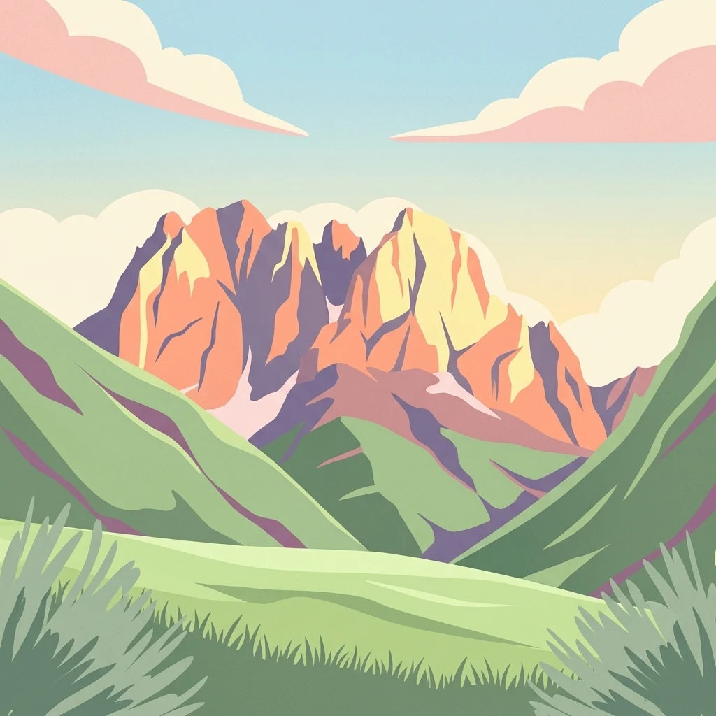
Stylized illustration of mountain peaks with green valleys and pink clouds

Georgia's alpine wilderness in the Greater Caucasus

Kazbegi National Park

Kazbegi National Park is a protected area in the Mtskheta-Mtianeti region of north-eastern Georgia, encompassing the dramatic landscapes of the Greater Caucasus mountain range. The park occupies Kazbegi Municipality in the historic Khevi region, with its headquarters in the town of Stepantsminda. Established in 1976 as a state reserve and redesignated as a national park following Georgia's independence, the protected area spans a significant portion of the southern slopes of the main Caucasus ridge. The park's terrain is characterized by towering peaks, alpine meadows, deep river valleys, and rugged cliffs that define the southern frontier of the Caucasus. As a high-altitude protected area with its lowest points at approximately 1,400 meters above sea level, Kazbegi preserves one of Georgia's most ecologically significant mountain ecosystems. The region supports a remarkable diversity of endemic plant species and serves as habitat for iconic Caucasus wildlife including the East Caucasian tur, chamois, brown bear, and golden eagle. Beyond its ecological importance, Kazbegi holds substantial cultural significance. The area contains ancient Christian monuments alongside evidence of older pagan traditions, reflecting centuries of human settlement in this mountainous frontier region.

Location
Georgia
Park type
National park
Established
1976
Area
1,446.2 km²
Kazbegi National Park Protected Landscape
Regional park map

See the ranked park cluster in its geographic setting

Nearby parks around Kazbegi National Park

This regional map shows the same 20 nearby parks ranked below around Kazbegi National Park. Select a ranked marker to highlight that park’s boundary where boundary data is available.
Reference park: Kazbegi National ParkRanked nearby parkSelected boundary: Kazbegi National Park20 nearby parks shown
20 nearby parks

Geographic proximity ranking and regional environmental comparison signals

Ranked Protected Areas and Surrounding Parks Near Kazbegi National Park

Examine the ranked collection of protected areas situated geographically near Kazbegi National Park using measured spatial separation and directional orientation. Compare surrounding park environments and regional landscape patterns to analyze high-altitude conservation frameworks across the Greater Caucasus.
Watercolor painting showing a landscape with green hills, trees, and distant mountains
National parkMtskheta-Mtianeti
About 34 km away#1 closest

East

Pshav-Khevsureti National Park: Protected Mountain Landscape and Regional Geography in Mtskheta-Mtianeti

Explore rugged terrain and alpine ecosystems in Georgia's Caucasus.

Pshav-Khevsureti National Park is a key protected area in Georgia's Mtskheta-Mtianeti region, recognized for its dramatic mountain terrain, deep river valleys, and alpine zones. Established as a national park, it safeguards the watersheds of major rivers, supporting significant wildlife and offering a compelling geographic context for atlas exploration. This protected landscape provides insight into the unique natural and cultural heritage of the Khevsureti region, making it a focal point for understanding Georgia's protected area network and mountainous geography.

Area
1,400.44 km²
Established
2014
IUCN
II
Relief
Mountain
A soft watercolor painting depicting a mountain range in the background with rolling green hills and grassy foreground, isolated on a white background.
National parkNorth Ossetia-Alania
About 53 km away#2 closest

Northwest

Alania National Park: Geographic and Protected Landscape Overview of the Central Caucasus

High mountain terrain, glacial basins, and historic Ossetian sites

Alania National Park encompasses a dramatic vertical expanse, ranging from temperate coniferous forests to the snow-covered peaks of the Caucasus Mountains. The area is defined by its complex hydrography, including over fifty glaciers, numerous glacial lakes, and powerful waterfalls carved into limestone gorges. Serving as both a nature reserve and a cultural heritage zone, this protected territory balances wild mountain ecosystems with the enduring history of the Digoria region.

Area
549.26 km²
Established
1998
IUCN
II
Relief
Mountain
National parkNorth Ossetia-Alania
About 53 km away#3 closest

Northwest

Alaniya National Park: Protected Glacial Mountain Landscape in North Ossetia-Alania, Russia

Explore dramatic terrain and ancient heritage.

Alaniya National Park, situated in the rugged Central Caucasus Mountains of North Ossetia-Alania, Russia, is a premier example of a protected landscape defined by its dramatic glacial formations and high alpine environments. The park's geography features extensive glaciated peaks, deep valleys, and unique biodiversity. It preserves critical habitats and showcases significant archaeological sites, providing a rich context for understanding the natural and cultural history of the region through a structured atlas perspective.

Area
549 km²
Established
1998
IUCN
II
Relief
Mountain
Watercolor painting of a mountainous landscape with green hills, valleys, and distant mountains under a pale sky
National parkGeorgia
About 62 km away#4 closest

East

Tusheti National Park National Park: Geographic Exploration of Caucasus Protected Landscapes

Mapped protected area boundaries and alpine terrain in Georgia.

Tusheti National Park offers a deep dive into the rugged geography of the Greater Caucasus. This national park, situated in a remote corner of Georgia, protects a dramatic landscape characterized by high mountain ridges, glacial valleys, and diverse ecosystems. The park's mapped boundaries encompass significant alpine terrain, providing essential habitat and serving as a critical area for understanding regional protected land distribution and landscape context. Explore the unique geographic identity of Tusheti National Park.

Area
1,276.43 km²
Established
2003
IUCN
II
Relief
Mountain
Watercolor illustration of a landscape with mountains, a river, trees, and grassy fields
National parkMtskheta Municipality
About 74 km away#5 closest

Southeast

Tbilisi National Park: Oldest Protected Landscape in Mtskheta Municipality

Explore Georgia's oldest national park and its mapped forest terrain.

Tbilisi National Park represents Georgia's oldest protected area, nestled in the Saguramo Range within Mtskheta Municipality. This page provides an atlas-focused view of its geographic features, including mountainous terrain and deciduous forest ecosystems. Users can explore the park's mapped boundaries and understand its significance as a crucial natural landscape close to Tbilisi, contributing to the region's protected areas network.

Area
380.02 km²
Established
1973
IUCN
II
Relief
Highland
Watercolor illustration of a mountainous landscape with green forests, rolling hills, and distant mountains under a light sky
National parkGeorgia
About 82 km away#6 closest

South

Algeti National Park: Explore Georgia's Protected Coniferous Forest Landscape

Mountain terrain, protected forests, and regional geography.

Algeti National Park, located in Georgia's Kvemo Kartli region, serves as a critical protected area preserving the easternmost populations of Caucasian Spruce and Nordmann Fir. This national park features a dramatic mountainous landscape within the Trialeti Range, characterized by deeply incised valleys, flowing rivers, and extensive old-growth forest ecosystems. Users can explore the park's geographic context, mapped boundaries, and the ecological significance of its unique coniferous and mixed forests, contributing to a broader understanding of protected lands in the Caucasus.

Area
68.22 km²
Established
2007
IUCN
II
Visitors
8K annual
Watercolor illustration of a landscape with mountains, a river, and grassy fields
National parkGeorgia
96 km away#7 closest

Southwest

Borjomi-Kharagauli National Park: Protected Landscape Atlas of Georgia's Lesser Caucasus

Explore its unique forests, wildlife, and mountain terrain.

Delve into Borjomi-Kharagauli National Park, a significant protected area in Georgia's Lesser Caucasus region. This national park is renowned for its extensive old-growth forests, including rare Colchian fragments, and a remarkable concentration of endemic species. The park's dramatic mountainous terrain, spanning over 1,000 square kilometers, offers a rich tapestry of landscapes from deep valleys to alpine meadows, providing critical habitat for large mammals and contributing significantly to the region's biodiversity. Explore its mapped boundaries and geographic context for a deeper understanding of this vital conservation landscape.

Area
1,093 km²
Established
1995
IUCN
II
Relief
Mountain
Watercolor painting of mountains, lake, and forest landscape with greenery and distant peaks
National parkKabardino-Balkaria
136 km away#8 closest

Northwest

Prielbrusye National Park: Mapped Protected Landscape within Kabardino-Balkaria's Geography

Explore regional park boundaries and natural terrain context.

Prielbrusye National Park is a significant protected area featured in the MoriAtlas geographic discovery platform. This page details its identity as a national park, emphasizing its mapped boundaries and its position within the broader landscape of Kabardino-Balkaria. Users can explore the park's unique geographic context, understand its protected status, and integrate its information into a larger atlas-based understanding of regional natural territories.

Area
10,102 km²
Established
1986
IUCN
II
Relief
Mountain
Watercolor illustration of rolling green fields, a lake, and distant hills under a sunset sky
National parkShirak Province
164 km away#9 closest

Southwest

Lake Arpi National Park: High-Altitude Wetland Protected Landscape in Shirak Province

Mapped boundaries of an important South Caucasus conservation area.

Lake Arpi National Park offers a unique window into high-altitude wetland ecosystems on the Shirak and Javakheti plateau, located at roughly 2000 meters above sea level. Established as a national park in 2009, it protects critical habitats, including the central Lake Arpi, and serves as a vital sanctuary for numerous bird species. This protected area is distinguished by its alpine meadows, significant bird populations, and its distinct geographic setting within Armenia's northwestern region, providing rich context for atlas-based exploration of protected lands.

Area
250 km²
Established
2009
IUCN
II
Relief
Mountain
Watercolor painting of green and pink mountain ranges under a light sky background
National parkSamtskhe–Javakheti
About 166 km away#10 closest

Southwest

Javakheti National Park: Protected Highland Landscape and Wetland Atlas

Explore the unique geography and mapped park boundaries of this Georgian protected area.

Delve into Javakheti National Park, a significant protected landscape located in Georgia's Samtskhe, Javakheti region. This page serves as an entry point for understanding the park's distinctive highland terrain, its remarkable chain of lakes and marshes, and its protected area status. Explore the geographic context of this national park, its role in wetland conservation, and its value for structured atlas-based discovery of natural landscapes.

Area
238.53 km²
Established
2011
IUCN
II
Relief
Mixed relief
Nature reserveZagatala District
About 175 km away#11 closest

Southeast

Zagatala State Reserve: Protected Mountain Geography and Forested River Valleys in Northern Azerbaijan

Ancient broadleaf woodlands within the Greater Caucasus mountain range.

Zagatala State Reserve protects a critical mountainous region in northern Azerbaijan, known for its extensive oak and beech forests, rugged karst formations, and dramatic river-carved topography. The area supports rare Caucasian fauna and offers an intact look at the natural landscape transitions from forested foothills to high mountain meadows.

Established
1929
National parkTavush Province
181 km away#12 closest

South

Dilijan National Park: Mapped Protected Landscape and Forested Terrain in Tavush Province

Explore ancient deciduous forests and medieval sites within this protected area.

Dilijan National Park offers a unique atlas perspective on Armenia's natural and cultural heritage. This protected landscape in Tavush Province is dominated by vast, ancient deciduous forests, including rare yew groves, making it a vital conservation area. Its mountainous terrain, carved by rivers and dotted with medieval monasteries like Haghartsin and Goshavank, provides a rich context for geographic discovery. Users can explore the park's mapped boundaries and understand its significance as a preserved woodland ecosystem within the Caucasus region through its detailed geographic information.

Area
240 km²
Established
2002
IUCN
II
Relief
Mixed relief
Watercolor painting of a mountainous landscape with rocky outcrops, forests, and distant hills
National parkRussia
About 185 km away#13 closest

Northwest

Kislovodsk National Park: Geographic and Protected Area Atlas of the Caucasus Foothills

Mapped mountain terrain and urban forest boundaries in Russia.

Trace the extensive boundaries of Kislovodsk National Park, located within the North Caucasus foothills of Russia. This overview details the park's unique structure, shifting from city-adjacent gardens to the rugged elevation of the Dzhinal Ridge, providing a clear geographic context for one of Europe's most distinctive urban protected landscapes.

Area
10 km²
Established
2016
IUCN
II
Relief
Upland
A soft watercolor painting depicting a gentle mountain landscape with green forests, grassy plains, and a winding path or stream against a light background.
National parkStavropol Krai
About 186 km away#14 closest

Northwest

Kislovodsk National Park and the Mountain Landscapes of Stavropol Krai, Russia

Protected mountain terrain and urban resort geography

Tracing the vertical gradient of Kislovodsk National Park, this entry covers the park's transition from cultivated rose valleys to forested mountain ridges. Featuring sandstone formations and extensive walking trail networks, the geography showcases the intersection of Caucasus foothill ecosystems and managed resort heritage within the Stavropol Krai region.

Area
9.658 km²
Established
2016
IUCN
II
Visitors
5.1M annual
Watercolor painting showing green hills, a river, and distant purple and orange mountains
National parkDedoplistsqaro Municipality
188 km away#15 closest

Southeast

Vashlovani National Park: Georgia's Unique Lowland Desert and Badland Protected Landscape

Discover distinct semi-arid terrain and rare forest ecosystems.

Vashlovani National Park in Dedoplistsqaro Municipality represents a significant protected area preserving Georgia's rare lowland desert and semi-arid steppe ecosystems. This national park is characterized by its striking badland topography, known as the "Sharp Walls," wild pistachio forests, and riparian habitats along the Alazani River. Its unique geographic setting, far removed from Georgia's typical mountainous landscapes, makes Vashlovani a crucial site for understanding regional biodiversity and conservation within the Caucasus.

Area
442.51 km²
Established
1935
IUCN
II
Relief
Lowland
Watercolor landscape with mountains, river, forests, and wetlands
National parkGeorgia
192 km away#16 closest

West

Kolkheti National Park: Mapped Wetland Landscape & Protected Area in Georgia

Explore the peat bogs, coastal ecosystems, and bird migration routes.

Discover Kolkheti National Park, a key protected national park located in Georgia's western coastal region. This atlas entry focuses on the park's extensive wetland environments, including its significant peat bogs and Lake Paliastomi, highlighting its role as a critical migratory bird corridor and a unique natural landscape within the Black Sea region. Understand its geographic context and protected area boundaries.

Area
807.99 km²
Established
1998
IUCN
II
Visitors
13.7K annual
Watercolor painting showing mountains, trees, and a lake in soft green and blue tones
National parkArtvin Province
205 km away#17 closest

Southwest

Karagöl-Sahara National Park: Mapped Highland Lake and Plateau Protected Area

Discover Artvin Province's unique landslide lake and alpine terrain.

Karagöl-Sahara National Park presents a compelling protected landscape in Artvin Province, Turkey, renowned for its dramatic landslide lake, Karagöl, and the expansive Sahara plateau. This national park provides a unique map of highland geography, featuring dense conifer forests that give way to alpine meadows at elevations around 1,800 meters. Examine the geological character, including active landslide zones and sedimentary formations, that shape this distinctive terrain and contribute to its protected ecological value within the Black Sea Region.

Area
32.51 km²
Established
1994
IUCN
II
Relief
Mountain
National parkGegharkunik Province
205 km away#18 closest

South

Sevan National Park: High-Altitude Lake and Protected Landscape in Gegharkunik

Explore map context, park boundaries, and regional geography.

Sevan National Park is a vital protected area located in Armenia's Gegharkunik Province, primarily safeguarding the remarkable high-altitude Lake Sevan. Established to protect this significant freshwater ecosystem, the park encompasses diverse surrounding landscapes including wetlands, forests, and steppes. Users exploring this canonical park detail page can delve into its geographic setting within the Armenian highlands, understand its importance as a protected landscape, and access structured data relevant to its unique natural environment. This MoriAtlas entry offers a focused lens on the park's conservation status and its contribution to regional geography.

Area
342 km²
Established
1978
IUCN
II
Relief
Highland
Watercolor illustration of a landscape with rolling hills, forests, and a winding river.
National parkAdjara
About 215 km away#19 closest

Southwest

Kintrishi National Park: Protected Colchic Forest Canyon Landscape in Adjara

Explore the mapped geographic boundaries of this unique Georgian national park.

Kintrishi National Park, located in Georgia's Adjara region, is a protected landscape renowned for its exceptionally intact Colchic deciduous forests within a steep river gorge. This area showcases dense woodland, dramatic terrain, and the unique Colchican willow species, offering rich geographic context. As a key protected area, Kintrishi National Park provides a valuable focus for atlas-based exploration of southwestern Georgia's natural heritage.

Area
186.84 km²
Established
2007
IUCN
II
Scope
Terrestrial
Watercolor illustration of a landscape with green hills, trees, and a body of water
National parkAdjara
220 km away#20 closest

West

Mtirala National Park: Protected Colchic Rainforest Landscape & Geographic Atlas

Explore Adjara's unique terrain and mapped protected boundaries.

Mtirala National Park, located in Georgia's Adjara region, is a protected national park renowned for its exceptionally high rainfall and ancient Colchic relict forests. This atlas-focused profile details the park's unique topography, its watershed between the Chakvistskali and Khoristskali rivers, and its significance as a vital ecosystem. Understand the geographic context of this protected landscape and its role in the broader Caucasus geography.

Area
281.26 km²
Established
2006
IUCN
II
Relief
Mixed relief
Distance methodology

Geographic measurements, not driving distances

How nearby park distances are calculated

Distances use park boundaries whenever the available geometry allows it. When one or both boundaries are missing, the mapped park locations provide a clearly labelled estimate. Every value represents straight-line geographic separation and does not use roads or routing.

Boundary distance

Calculated between the nearest points of both park boundaries.

Location-to-boundary estimate

Estimated from one mapped park location to the nearest boundary of the other park.

Mapped-location estimate

Estimated between the mapped locations of both parks.

MoriAtlas Explorer

Continue exploring Kazbegi National Park's mapped terrain and protected landscape context

Deepen your understanding of Kazbegi National Park by navigating its specific geographic attributes and protected area details. MoriAtlas facilitates structured discovery of this significant Georgian national park, allowing you to visualize its landscape context and appreciate its role within the Caucasus mountain range. Continue tracing the contours of this alpine protected area to gain a richer geographic perspective.