Mori Atlas logo
Nearby park discovery

Geographic analysis of protected areas situated within the northern wilderness

Regional Protected Landscapes and Parks Surrounding Lemmenjoki National Park, Finland

Examine the geographic distribution and spatial relationships of protected areas in proximity to Lemmenjoki National Park. This regional overview maps nearby wilderness zones and managed landscapes to provide context for the northern Finnish terrain, focusing on the proximity of surrounding conservation sites.

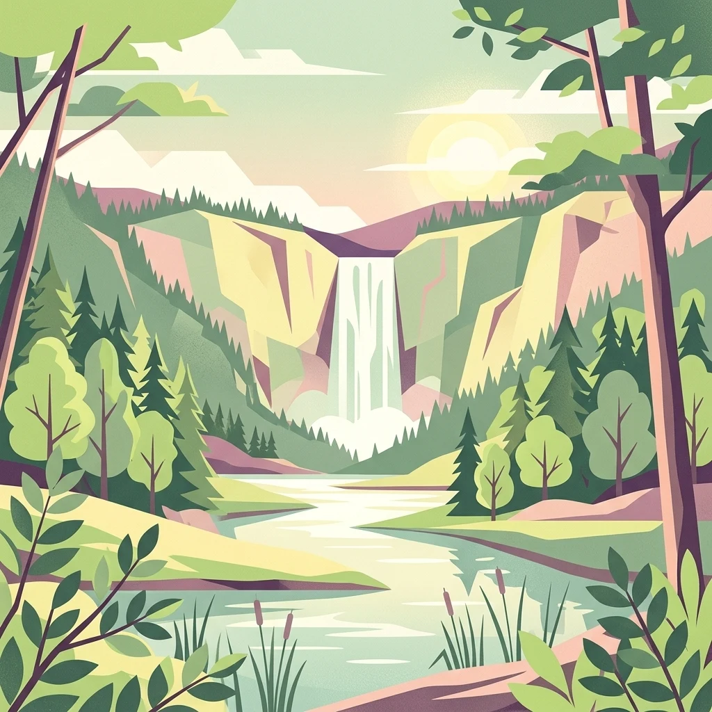
Illustration of a waterfall surrounded by forests and mountains with a river flowing through the scene, trees in the foreground, and a sun in the sky

Finland's largest wilderness park in the heart of Lapland

Lemmenjoki National Park

Lemmenjoki National Park is Finland's largest national park and one of the most extensive wilderness areas in Europe, encompassing 2,850 square kilometres of pristine Arctic landscape in the northern Lapland region. Established in 1956 and subsequently expanded, the park occupies a vast territory straddling the municipalities of Inari and Kittilä, situated well above the Arctic Circle at approximately 68.5°N latitude. The park takes its name from the Lemmenjoki River, an 80-kilometre waterway that carves through the protected terrain, serving as both a geographical landmark and a thread linking the region's ecological and cultural heritage. The protected area represents a critical component of Finland's wilderness preservation network, designated under IUCN Category Ib as a true wilderness area where natural processes continue with minimal human intervention.

Location
Finland
Park type
National park
Established
1956
Area
2,850 km²
Lemmenjoki National Park Geography
Regional park map

See the ranked park cluster in its geographic setting

Nearby parks around Lemmenjoki National Park

This regional map shows the same 20 nearby parks ranked below around Lemmenjoki National Park. Select a ranked marker to highlight that park’s boundary where boundary data is available.
Reference park: Lemmenjoki National ParkRanked nearby parkSelected boundary: Lemmenjoki National Park20 nearby parks shown
20 nearby parks

Distance ranked regional park geography and surrounding protected landscapes

Parks and Protected Areas Geographically Near Lemmenjoki National Park

Examine the ranked collection of protected areas situated geographically near Lemmenjoki National Park to evaluate surrounding territorial patterns. These structured spatial comparisons use mapped separation distances and recorded environmental characteristics to analyze regional conservation contexts.
National parkKarasjok Municipality
About 15 km away#1 closest

Northwest

Anárjohka National Park: Mapped Subarctic Wilderness and Protected Landscape

Explore Norway's Finnmarksvidda plateau geography.

Anárjohka National Park, a protected area in Norway's Finnmark region, offers a compelling atlas-level view of subarctic wilderness. The park's landscape is defined by its location on the Finnmarksvidda plateau, featuring rolling birch woodlands, open pine barrens, and extensive wetlands, all mapped within its protected boundaries. This park provides a crucial point of discovery for understanding regional geography, natural terrain, and the interconnectedness of protected lands across northern Europe.

Area
1,409 km²
Established
1976
IUCN
II
Relief
Mixed relief
Watercolor painting showing rolling hills, forests, and distant mountains under a soft sky
National parkLapland
43 km away#2 closest

Southwest

Pallas-Yllästunturi National Park: Lapland's Premier Protected Fell Landscape for Atlas Exploration

Explore its ancient mountain geography and mapped protected area.

Pallas-Yllästunturi National Park presents a unique atlas of Lapland's ancient geography, characterized by a vast chain of rounded fells that are the remnants of three-billion-year-old mountains. As Finland's most popular national park, it offers a deep dive into protected landscape discovery, showcasing diverse boreal forests, mires, and exceptional fell terrain. Understand its geographic scope and protected boundaries for comprehensive map-based exploration.

Area
1,020 km²
Established
2005
IUCN
II
Visitors
598.8K annual
Watercolor painting of a lake surrounded by hills and vegetation
National parkLapland
51 km away#3 closest

East

Urho Kekkonen National Park: Detailed Map and Protected Landscape Exploration in Lapland

Discover Finland's expansive Arctic wilderness and fell terrain.

Urho Kekkonen National Park represents a significant portion of Finland's protected Arctic landscape, offering a rich opportunity for geographic and atlas-based discovery. This national park in Lapland showcases dramatic fell formations, boreal forests, and extensive wetlands, with mapped boundaries that define its wild eastern reaches and more accessible western trails. Users can explore the unique terrain and understand its place within the broader regional geography, appreciating the vastness of this protected natural area.

Area
2,550 km²
Established
1983
IUCN
II
Visitors
435.9K annual
National parkNorway
About 98 km away#4 closest

Northeast

Øvre Pasvik National Park: Norway's Pristine Siberian Taiga & Mapped Boreal Geography

Explore ancient forests, wetlands, and transboundary protected landscapes.

Øvre Pasvik National Park is a landmark protected area in Northern Norway, showcasing a remarkably intact Siberian taiga ecosystem characterized by ancient Scots pine forests and extensive wetlands. This national park offers a unique geographic perspective with its notably flat terrain, distinguishing it within the broader Norwegian atlas. As part of the Pasvik, Inari Trilateral Park, it highlights significant transboundary conservation efforts and provides a valuable mapped resource for understanding European boreal landscapes and their unique wildlife habitats.

Area
119 km²
Established
1970
IUCN
II
Relief
Lowland
National parkNorway
109 km away#5 closest

North

Stabbursdalen National Park: Protected Arctic Landscape and Northernmost Pine Forest Atlas

Explore Finnmark's unique geography and protected terrain.

Stabbursdalen National Park preserves a remarkable ecological boundary, featuring the planet's northernmost Scots pine woodland within a dramatic Arctic landscape. This protected area offers a deep dive into rugged mountain terrain, river valley formations, and vital wetland habitats. As a key component of Norway's protected lands, it provides essential context for understanding regional geography and the limits of forest ecosystems on the mapped landscape.

Area
747 km²
Established
1970
IUCN
II
Relief
Mixed relief
Watercolor illustration showing a lake, rolling hills, and vegetation.
National parkLapland
123 km away#6 closest

South

Pyhä-Luosto National Park: Ancient Geological Heritage and Fell Landscape

Explore Lapland's southernmost large fell system and deep gorges.

Pyhä-Luosto National Park offers a unique window into Finland's deep geological past and its boreal ecosystems. As a protected area, it encompasses a prominent chain of twelve fells composed of two-billion-year-old quartzite, showcasing the southernmost large fell system in the country. The park's landscape is further defined by features like Isokuru, Finland's deepest gorge, and extensive old-growth forests, providing rich context for map-based discovery and regional geographic understanding within Lapland.

Area
142 km²
Established
2005
IUCN
II
Visitors
198.9K annual
National parkTroms
About 135 km away#7 closest

Northwest

Reisa National Park: Dramatic River Valley and Protected Landscape Atlas

Subarctic terrain and geographic context in Troms, Norway.

MoriAtlas offers detailed geographic context for Reisa National Park, a protected landscape in Norway's Troms county. Explore the park's identity as a significant subarctic river valley, carved by the Reisa River into a dramatic canyon system. This page provides insights into its mapped natural features, regional landscape setting, and its importance within the broader atlas of protected areas. Understand the park's protected boundaries and terrain for structured geographic discovery.

Area
803 km²
Established
1986
IUCN
II
Relief
Mixed relief
National parkFinnmark
179 km away#8 closest

North

Seiland National Park: Arctic Island Landscape and Northernmost Scandinavian Glaciers

Mapped boundaries of protected terrain in Finnmark

Seiland National Park offers a distinct glimpse into Arctic island geography, renowned for protecting Scandinavia's northernmost glaciers. This protected area in Finnmark features a dramatic landscape shaped by glaciated mountains, deep coastal fjords, and alpine terrain, making it a key destination for understanding Nordic natural environments. MoriAtlas facilitates exploration of its mapped boundaries and the unique combination of glacial and marine ecosystems present.

Area
316 km²
Established
2006
IUCN
II
Relief
Mountain
National parkTroms
187 km away#9 closest

West

Øvre Dividal National Park: Arctic Alpine Protected Landscape in Troms, Norway

Mapped boundaries and unique ecological terrain of a pristine wilderness.

Øvre Dividal National Park stands as a premier example of Arctic alpine wilderness, meticulously preserved as a national park in Norway's Troms region. This entry facilitates a detailed exploration of its mapped protected boundaries and the distinct elevational ecological zones, from boreal forests to high-altitude tundra. Gain geographic context for this vital landscape, which supports diverse habitats and contributes to Scandinavia's largest contiguous wilderness areas.

Area
750 km²
Established
1971
IUCN
II
Relief
Mountain
National parkFinnmark
About 200 km away#10 closest

Northeast

Varangerhalvøya National Park: Explore Finnmark's Unique Subarctic Protected Landscape

Mapped tundra, wetlands, and Arctic fox conservation.

Varangerhalvøya National Park offers a compelling atlas exploration of Norway's northeasternmost protected landscapes. This national park in Finnmark is distinguished by its subarctic terrain, featuring expansive tundra, diverse wetlands, and a unique ecological position where multiple biomes converge. It is a critical habitat for the Arctic fox and a vital Important Bird Area, providing deep insights into protected area geography and landscape context for those studying regional conservation and natural formations.

Area
1,804.1 km²
Established
2006
IUCN
II
Relief
Lowland
Watercolor illustration showing a lake, trees, and hills under a light sky
National parkLapland
About 209 km away#11 closest

Southeast

Salla National Park: Mapped Protected Landscape in Lapland, Finland

Explore its geographic context and protected area identity.

Understand Salla National Park as a distinct protected landscape situated within the expansive northern Finnish region of Lapland. This MoriAtlas entry focuses on its identity as a national park, detailing its mapped boundaries and geographic setting. Discover how Salla National Park contributes to the atlas of protected areas, offering a specific point of reference for exploring the natural terrain and regional geography of this subarctic territory.

Area
99.83 km²
Established
2022
IUCN
II
Visitors
55.9K annual
Watercolor painting depicting mountain peaks, a lake, and grassy areas in the foreground
National parkTroms
211 km away#12 closest

West

Rohkunborri National Park: Northern Norway's Dramatic Protected Landscape

Explore its mapped terrain, canyon, and alpine ecosystems.

Rohkunborri National Park offers a profound encounter with northern Norway's wild geography. As a designated national park in Troms county, it features the iconic Sørdalen canyon, a dominant geological feature that shapes its diverse terrain. The park's landscape encompasses a rich ecological gradient, from boreal forests to alpine tundra, supporting a variety of wildlife. This protected area is crucial for understanding Scandinavian mountain ecosystems and transboundary conservation efforts, providing rich content for atlas-based exploration of its mapped boundaries and natural context.

Area
571 km²
Established
2011
IUCN
II
Relief
Mountain
Watercolor illustration of a river flowing through a forested landscape with mountains in the background
National parkLapland
242 km away#13 closest

Southeast

Oulanka National Park: Protected Landscape Atlas and Geographic Context in Lapland

Explore mapped boundaries and regional terrain.

Discover Oulanka National Park as a distinct protected landscape entity within the extensive northern region of Lapland, Finland. This page provides structured geographic information, focusing on the park's mapped area, its regional setting, and its identity as a national park. MoriAtlas facilitates an atlas-driven understanding of Oulanka National Park's place in Finland's protected lands and its inherent natural terrain.

Area
270 km²
Established
1956
IUCN
II
Visitors
187.4K annual
Watercolor illustration showing a landscape with green vegetation, hills, and stylized human figures
National parkLapland
245 km away#14 closest

Southeast

Riisitunturi National Park: Explore Protected Landscape and Lapland Geography

Mapped boundaries of a national park in northern Finland.

Delve into the protected landscape of Riisitunturi National Park, a key national park situated in the expansive region of Lapland, Finland. This MoriAtlas entry provides detailed geographic context, focusing on the park's mapped boundaries and its role within the natural terrain of northern Finland. Understand its identity as a protected area and its significance within a broader atlas of natural landscapes.

Area
77 km²
Established
1982
IUCN
II
Visitors
58.8K annual
Watercolor painting showing mountains, a river, and forested areas
National parkNorrbotten County
247 km away#15 closest

Southwest

Muddus National Park: Explore Sweden's Largest Old-Growth Protected Forest Landscape

Mapped boreal terrain with ancient pines and dramatic ravines.

Muddus National Park is a landmark protected area in Norrbotten County, celebrated for its immense scale and preserved old-growth forest character. This national park features a unique geography defined by ancient coniferous forests, including Sweden's oldest pine tree, alongside striking ravines and extensive mire systems. As part of the Laponian Area UNESCO World Heritage Site, Muddus offers an unparalleled opportunity for atlas-based discovery of an undisturbed boreal ecosystem accessible solely by foot, highlighting its profound natural and mapped landscape significance.

Area
493.4 km²
Established
1942
IUCN
II
Relief
Upland
Watercolor painting showing green hills, a body of water, and distant mountains
National parkNorrbotten County
249 km away#16 closest

West

Abisko National Park

Subarctic national park with unique landscapes

Abisko National Park in Swedish Lapland offers a glimpse into dramatic subarctic terrain. Explore its protected boundaries, river canyons, and alpine tundra through structured geographic data.

Area
77 km²
Established
1909
IUCN
II
Visitors
50K annual
Watercolor painting of a coastal inlet with soft green hills and pink tinted water.
Protected landscapeTroms
About 255 km away#17 closest

Northwest

Skipsfjord landskapsvernområde: Protected Landscape and Coastal Geography in Troms

Mapped terrain, fjord basins, and mountain catchment zones

Skipsfjord landskapsvernområde represents a compact, biologically diverse corridor on the island of Vanna. This protected landscape encompasses the salmon-rich Skipsfjordelva, expansive mire systems, and coastal shorelines that document a transition from historical agricultural use to undisturbed natural conservation. Explore the precise geography and environmental character of this significant northern protected area.

Area
64.8 km²
Established
1978
Relief
Lowland
Climate
Subpolar
Watercolor illustration showing mountains in the background, a winding river, and vegetation in the foreground
National parkNorrbotten County
261 km away#18 closest

West

Vadvetjåkka National Park: Arctic Mountain Landscape and Karst Terrain

Northernmost National Park in Norrbotten County, Sweden

Vadvetjåkka National Park offers a unique atlas perspective on Sweden's northernmost protected mountain landscape. Explore its remote Arctic terrain, characterized by glaciers existing at unusual low altitudes and significant karst cave systems carved into limestone bedrock. This is a vital point for understanding the mapped geography and protected natural features of Norrbotten County and Swedish Lapland.

Area
26.3 km²
Established
1920
IUCN
II
Relief
Mountain
Watercolor illustration of a landscape with lake, trees, and hills
National parkRepublic of Karelia
264 km away#19 closest

Southeast

Paanajärvi National Park: Protected Boreal Wilderness and Karelian Landscape Atlas

Mapping the old growth taiga forests and mountain terrain of northwestern Russia.

Located in the Republic of Karelia, Paanajärvi National Park is a significant protected area of boreal forest and lake ecosystems. This landscape, characterized by the Maanselkä hills and the summit of Nuorunen, offers a pristine look at the intact wilderness of northern Europe. Examine the mapped boundaries and geographic features that define this essential transboundary conservation area.

Area
1,043.71 km²
Established
1992
IUCN
II
Relief
Highland
Watercolor landscape featuring green hills, pine trees, and a yellowish field
National parkFinland
272 km away#20 closest

South

Syöte National Park: Mapped Protected Landscape and Fell Geography in Finland

Explore Finland's southernmost fell and diverse northern wilderness.

Delve into the protected territory of Syöte National Park, a key national park in northern Finland. This page highlights the park's distinct geographic features, including its southernmost fell, Iso-Syöte, alongside expansive mire systems and old-growth boreal forests. Understand the mapped boundaries and the unique ecological transition zone it represents within the Finnish atlas, offering a comprehensive view of its landscape context and protected area status.

Area
299 km²
Established
2000
IUCN
II
Visitors
88.2K annual
Distance methodology

Geographic measurements, not driving distances

How nearby park distances are calculated

Distances use park boundaries whenever the available geometry allows it. When one or both boundaries are missing, the mapped park locations provide a clearly labelled estimate. Every value represents straight-line geographic separation and does not use roads or routing.

Boundary distance

Calculated between the nearest points of both park boundaries.

Location-to-boundary estimate

Estimated from one mapped park location to the nearest boundary of the other park.

Mapped-location estimate

Estimated between the mapped locations of both parks.

MoriAtlas Explorer

Continue Exploring Lemmenjoki National Park's Geographic Context and Map Details

Delve deeper into the structured geographic information surrounding Lemmenjoki National Park. Understanding this protected landscape's boundaries and its place within Finland's atlas provides essential context for broader regional exploration and analysis of Northern European natural areas. MoriAtlas enables detailed discovery of these vital protected territories.

Global natural geography