Mori Atlas logo
Nearby park discovery

Regional mapping of surrounding wilderness areas and landscape context

National Parks and Protected Areas Near Skarvan and Roltdalen National Park in Norway

Investigate the geographic distribution and proximity of protected lands surrounding Skarvan and Roltdalen National Park in Trøndelag. This regional view provides a clear map of nearby wilderness areas, helping to contextualize the unique mountain ridges, peatlands, and boreal forests of this central Norwegian landscape.

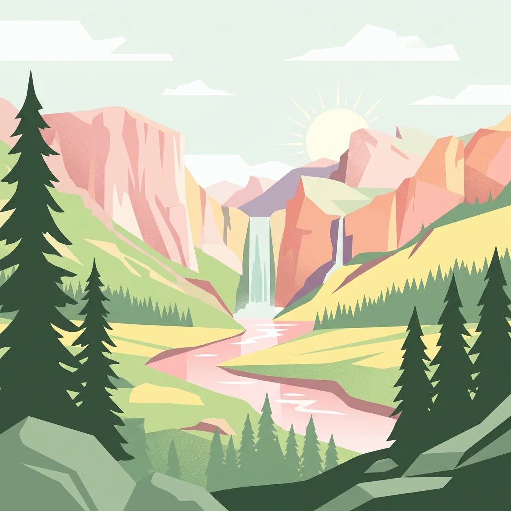
Illustration showing mountains, waterfall, river, and forest landscape

Mountain wilderness and pristine peatlands in central Norway

Skarvan and Roltdalen National Park

Skarvan and Roltdalen National Park is a protected wilderness area in Trøndelag county, central Norway, established in 2004. The 441.5-square-kilometer park spans across four municipalities—Selbu, Tydal, Meråker, and Stjørdal—close to the Swedish border. The park encompasses two distinct but complementary landscapes: the Skarvan mountain range, a notable geological feature stretching from Ruten to Fongen, and the Roltdalen valley, which is the largest roadless mountain valley in southern Trøndelag. The protected area was created to preserve both the cultural and natural heritage of this representative Trøndelag landscape, featuring extensive spruce forests, alpine heath, and one of the most extensive peatland systems in the region.

Location
Norway
Park type
National park
Established
2004
Area
441.5 km²
Skarvan and Roltdalen National Park Atlas
Regional park map

See the ranked park cluster in its geographic setting

Nearby parks around Skarvan and Roltdalen National Park

This regional map shows the same 20 nearby parks ranked below around Skarvan and Roltdalen National Park. Select a ranked marker to highlight that park’s boundary where boundary data is available.
Reference park: Skarvan and Roltdalen National ParkRanked nearby park20 nearby parks shown
20 nearby parks

Geographic proximity and environmental comparisons across surrounding regional park geography

Ranked Protected Areas Near Skarvan and Roltdalen National Park

Spatial distance metrics rank surrounding protected areas geographically near Skarvan and Roltdalen National Park to establish structured terrain comparisons. Evaluating these neighboring locations highlights broader regional conservation patterns and surrounding landscape variations without relying on route distances.
National parkNorway
About 41 km away#1 closest

Southwest

Forollhogna National Park: Norway's Gently Rolling Alpine Protected Landscape Atlas

Explore unique terrain and vital wild reindeer habitat in Central Norway.

MoriAtlas provides structured geographic context for Forollhogna National Park, Norway's nineteenth national park. This area is best known for its distinctively gentle, rolling alpine terrain, a contrast to other Norwegian mountain ranges, and as a critical habitat for wild reindeer. Discover the park's unique landscape character, its role as a protected area, and the ongoing cultural traditions tied to its mountain pastures, all visualized within a comprehensive atlas framework.

Area
1,062 km²
Established
2001
IUCN
II
Relief
Mountain
Marine protected areaNorway
About 59 km away#2 closest

Northwest

Tauterryggen Marine Protected Area: Submerged Glacial Ridge and Coral Reef Map in Norway

Tracing the geological boundaries and marine biodiversity of the Trondheimsfjord.

Tauterryggen represents a crucial nexus of marine conservation and glacial history. This protected submerged ridge serves as the home to unusually shallow cold-water coral colonies, offering an essential window into the complex biological and geological dynamics of the Norwegian fjord system. The area provides a pristine example of protected underwater terrain where trawling and drilling are prohibited to ensure habitat integrity.

Established
2013
Relief
Lowland
Climate
Temperate
Access
Access unknown
National parkInnlandet
About 117 km away#3 closest

South

Femundsmarka National Park: Exploring Norway's Distinctive Wetland and Boreal Protected Landscape

Mapped boundaries and regional geography in Innlandet.

Femundsmarka National Park in Innlandet, Norway, offers a profound look into a preserved wetland wilderness characterized by vast marshlands, numerous lakes, and scattered boreal forests. As a designated national park, its ecological significance is tied to the surrounding water systems and the unique landscape stretching towards the Swedish border. This entry provides detailed geographic context, mapping information, and an understanding of its protected area status, inviting exploration of its remote boreal terrain and notable wildlife habitats.

Area
573 km²
Established
1971
IUCN
II
Relief
Mixed relief
Watercolor painting showing a mountainous landscape with a waterfall, grassy fields, and wildflowers
National parkInnlandet
About 119 km away#4 closest

Southwest

Dovrefjell, Sunndalsfjella National Park: Mapping Norway's Largest Alpine Protected Landscape

Explore its protected boundaries, mountain terrain, and unique ecological significance.

Dovrefjell, Sunndalsfjella National Park is a cornerstone of Norwegian protected areas, offering an expansive alpine wilderness with dramatic mountain scenery. This page details the park's geographic context, mapped landscape features, and its importance as a refuge for unique wildlife like wild reindeer and muskox. Users can investigate the park's protected boundaries and understand its role within the regional geography of Innlandet, contributing to a structured atlas of Scandinavia's natural heritage.

Area
1,693 km²
Established
2002
IUCN
II
Relief
Mountain
Watercolor illustration of rolling hills with soft pastel colors including pink, green, yellow, and blue
National parkDalarna County
About 126 km away#5 closest

Southeast

Töfsingdalen National Park: Ancient Old-Growth Forest in Rugged Terrain

Remote protected landscape within Dalarna County, Sweden.

Töfsingdalen National Park showcases a rare example of an ancient, up-to-500-year-old pine forest thriving in extremely rugged, boulder-strewn valley terrain. This protected area, located in Sweden's Dalarna County, offers a glimpse into a near-wilderness landscape shaped by glacial forces and defined by its remoteness and ecological integrity. Discover the mapped park boundaries and the unique geographic context of this remarkably untouched natural reserve.

Area
16.15 km²
Established
1930
IUCN
II
Relief
Lowland
National parkTrøndelag
About 137 km away#6 closest

Northeast

Blåfjella, Skjækerfjella National Park: Norway's Extensive Protected Wilderness Landscape Atlas

Mapped natural terrain and protected area boundaries in Trøndelag.

Blåfjella, Skjækerfjella National Park stands as a paramount example of Norway's commitment to preserving vast, untouched natural areas. This protected landscape in Trøndelag features expansive mountain plains, glacial valleys, and important wetland habitats, making it a significant area for understanding regional geography and biodiversity. As one of the country's largest national parks, it offers unique insights into the ecological history of spruce migration and serves as a vital sanctuary for large predators. MoriAtlas provides structured map data and geographic context to explore the protected boundaries and diverse terrain of this remarkable wilderness.

Area
1,924 km²
Established
2004
IUCN
II
Relief
Mixed relief
Watercolor illustration showing green forests, a lake, and distant mountains under a light sky
National parkInnlandet
About 139 km away#7 closest

South

Gutulia National Park: Protected Southernmost Mountain Birch Forest Landscape Atlas

Explore Norway's unique subarctic forest geography and park boundaries.

Gutulia National Park stands as a key protected area within Norway's Innlandet region, distinguished by its role in preserving the country's southernmost mountain birch forest ecosystem. Covering approximately 23 square kilometers, this national park provides critical insights into subarctic forest ecology at the southern extent of its natural range. MoriAtlas enables detailed exploration of its mapped terrain and geographic context, offering a valuable resource for understanding this significant protected landscape.

Area
23 km²
Established
1968
IUCN
II
Scope
Terrestrial
Watercolor painting showing green forests, rolling hills, and distant mountains under a pale sky
National parkSweden
About 145 km away#8 closest

Southeast

Sonfjället National Park: Mapped Alpine Terrain and Protected Landscape in Sweden

Explore the glacial geography and subalpine transition zones.

Sonfjället National Park is a key protected area in central Sweden, offering a unique glimpse into an alpine environment shaped by glacial forces. The park's landscape is characterized by the prominent Sånfjället mountain, steep glacial valleys, mires, and small lakes, showcasing raw, natural terrain. As a southern outpost for subalpine ecosystems, it presents a distinct ecological transition zone valuable for geographic discovery and understanding protected nature.

IUCN
II
Watercolor painting of mountain peaks with green valleys and grassy foreground
National parkInnlandet
About 150 km away#9 closest

Southwest

Rondane National Park: Norway's Premier Alpine Protected Landscape and Historic National Park

Mapped glacial terrain, iconic peaks, and wild reindeer sanctuary.

As Norway's first national park, Rondane offers a profound exploration of a protected alpine environment. Situated in Innlandet county, its 963 square kilometers showcase a landscape sculpted by glaciers, featuring a striking array of ten peaks exceeding 2,000 meters. This page details Rondane National Park's distinct mapped boundaries, dramatic mountain geography, and its ecological significance as a refuge for wild reindeer, making it a cornerstone of Scandinavian natural heritage.

Area
963 km²
Established
1962
IUCN
II
Relief
Mountain
National parkInnlandet
About 159 km away#10 closest

Southwest

Dovre National Park: Mapped Alpine Terrain & Protected Reindeer Habitat in Innlandet

Norway's protected mountain plateau landscape and wildlife corridor.

Dovre National Park is a significant protected area in Innlandet, Norway, characterized by its expansive alpine plateau terrain and role as a vital ecological corridor for wild reindeer. This national park offers users an atlas-level view of its mapped natural boundaries, focusing on the unique subarctic mountain landscape and its conservation importance. Understand Dovre National Park's geographic identity and its contribution to a contiguous network of protected lands.

Area
289 km²
Established
2003
IUCN
II
Relief
Mountain
A soft watercolor painting depicting a wide, open mountain landscape with rolling green hills, muted yellow foreground vegetation, and pale purple mountain ridges in the distance.
Protected landscapeInnlandet
About 164 km away#11 closest

Southwest

Fokstugu landskapsvernområde: Alpine Protected Landscape and Regional Ecological Corridor

A vital bridge for mountain migration in Innlandet, Norway.

Fokstugu landskapsvernområde protects a unique mix of alpine terrain, geological formations, and cultural mountain heritage across the Dovrefjell plateau. Serving as a connective corridor between major national parks, this protected area maintains essential migratory paths for wild reindeer and preserves traditional Norwegian upland farming features.

Area
72.3 km²
Established
2002
Relief
Mountain
Climate
Alpine
National parkTrøndelag
About 167 km away#12 closest

Northeast

Lierne National Park: A Protected Mountain and Wetland Wilderness in Trøndelag

Explore mapped boundaries, alpine terrain, and Scandinavian wilderness.

Lierne National Park is a prime example of Norway's protected mountain and wetland landscapes, situated in the Trøndelag region. This national park offers a detailed study of terrain shaped by glacial activity, featuring high peaks and expansive peat bogs. Its role in preserving habitats for large carnivores and the Arctic fox adds ecological depth to its geographic profile, providing valuable context for atlas-based discovery of protected areas.

Area
333 km²
Established
2004
IUCN
II
Relief
Mountain
Watercolor illustration showing mountains, forests, and a river
National parkDalarna County
About 183 km away#13 closest

South

Fulufjället National Park: Protected Plateau Landscape and Transboundary Conservation in Dalarna County

Sweden's southernmost alpine plateau, mapped geography, and natural wonders.

Fulufjället National Park in Dalarna County, Sweden, protects a significant high plateau landscape, notable for its ancient sandstone geology and unique lichen-heath environments. This national park is home to Njupeskär, Sweden's tallest waterfall, and is part of a transboundary protected area with Norway. Explore the mapped terrain and distinct natural features of this important conservation area within the Scandinavian Mountains.

Area
385 km²
Established
2002
IUCN
II
Visitors
53K annual
Watercolor illustration of a mountainous landscape with a lake, green fields, and pink flowers
National parkNorway
About 206 km away#14 closest

South

Fulufjellet National Park: Protected Boreal Forest Landscape and Regional Geography

Explore mapped boundaries, rolling terrain, and transboundary conservation.

Fulufjellet National Park offers a detailed look at a protected boreal forest ecosystem in southeastern Norway. This page details the park's gently rolling hills, dominated by Norway spruce and Scots pine, interspersed with lakes and peat bogs. It highlights the park's designation as a national park, its establishment in 2012, and its contiguous protected status with Sweden's Fulufjället National Park, contributing to a significant transboundary conservation area. Users can explore its geographic features and protected landscape context within Scandinavia.

Area
82.5 km²
Established
2012
IUCN
II
Relief
Mountain
National parkInnlandet
About 206 km away#15 closest

Southwest

Reinheimen National Park: Norway's Vast Protected Wilderness Landscape and Alpine Geography

Map of protected boundaries and diverse mountain terrain.

Reinheimen National Park is a cornerstone of Norway's protected areas, encompassing a substantial portion of Western Norway's alpine wilderness. This national park protects a dynamic landscape characterized by dramatic western peaks and gentler eastern plateaus, providing critical habitat for wild reindeer and other wildlife. Its extensive mapped boundaries and varied natural terrain offer a rich subject for geographic discovery and atlas exploration, highlighting the ecological significance of well-preserved mountain ecosystems within Innlandet.

Area
1,969 km²
Established
2006
IUCN
II
Relief
Mountain
Watercolor illustration of a mountain range with green hills and a lake in the foreground
National parkNorway
About 219 km away#16 closest

Southwest

Jotunheimen National Park: Norway's Iconic Alpine Protected Landscape and Geographic Core

Explore mapped glacial terrain and alpine geography.

Jotunheimen National Park stands as a monument to Norway's alpine grandeur, protecting over 1,151 square kilometers of spectacular mountainous terrain. This protected area is defined by its dramatic glacial features, including sharp peaks exceeding 1,900 meters, U-shaped valleys, and pristine alpine lakes, making it a significant focus for geographic exploration and mapped landscape study. Delve into the core of Norway's mountain heartland, understanding the mapped boundaries and regional geological context that shape this iconic protected landscape.

Area
1,151 km²
Established
1980
IUCN
II
Relief
Mountain
National parkNordland
About 226 km away#17 closest

Northeast

Børgefjell National Park: Explore Norway's Extensive Undeveloped Wilderness and Alpine Terrain

Mapped protected landscape in Nordland, known for granite peaks and arctic fox.

Børgefjell National Park offers a rare glimpse into Norway's most secluded and undeveloped mountain wilderness, spanning dramatic granite peaks and expansive marshlands. This protected landscape in Nordland provides a rich subject for atlas-based discovery, highlighting its unique geological formations, vital habitats for species like the arctic fox and wolverine, and extensive network of lakes and rivers. Navigate its geographic context and understand the protected boundaries of this significant natural area.

Area
1,447 km²
Established
1963
IUCN
II
Relief
Mountain
Watercolor illustration of a lake surrounded by trees and distant hills with a soft sky
National parkGävleborg County
About 234 km away#18 closest

Southeast

Hamra National Park: Ancient Forests, Mires, and Protected Landscape in Gävleborg County

Discover pristine Swedish nature and mapped park boundaries.

Hamra National Park in Gävleborg County, Sweden, protects an extraordinary natural landscape. At its heart lies a distinct moraine hill adorned with some of central Sweden's oldest coniferous trees, some reaching 400 years. Surrounding this ancient forest is a vast, unbroken expanse of mire and wetland, a landscape preserved from drainage and modification. This park offers a profound insight into pristine ecosystems and geographic context, making it a key destination for atlas exploration of protected natural areas.

Area
13.83 km²
Established
1909
IUCN
II
Relief
Lowland
National parkInnlandet
About 246 km away#19 closest

Southwest

Langsua National Park: Protected Mountain Forests and Inland Wilderness in Innlandet, Norway

Discover mapped boundaries and regional geographic context.

Langsua National Park, a designation expanded in 2011, is a prominent protected area in Norway's Innlandet county. This national park encompasses 537.1 square kilometers of diverse mountainous terrain, characterized by extensive mountain forests and inland wilderness habitats. Its creation consolidates fragmented nature reserves into a significant contiguous protected landscape, offering valuable insight into Norway's conservation strategies and the geographic context of its eastern mountain regions.

Area
537.1 km²
Established
2011
IUCN
II
Relief
Mixed relief
Watercolor painting of mountains, a river, and trees under a pink and yellow sky
National parkNordland
About 248 km away#20 closest

North

Lomsdal, Visten National Park: Mapped Protected Landscape and Karst Geology in Nordland

Explore the protected geography of northern Norway's unique terrain.

Delve into the protected world of Lomsdal, Visten National Park, a key national park within Norway's Nordland county. This area is celebrated for its extraordinary geological formations, including significant karst features like caves, subterranean rivers, and natural arches, set against a backdrop of dramatic fjords and rugged mountain landscapes. The park’s diverse ecosystems, from valley woodlands to alpine environments, offer rich context for understanding regional geography and the mapped distribution of protected natural areas in Scandinavia. Discover the unique characteristics that define this significant conservation landscape.

Area
1,102 km²
Established
2009
IUCN
II
Relief
Mountain
Distance methodology

Geographic measurements, not driving distances

How nearby park distances are calculated

Distances use park boundaries whenever the available geometry allows it. When one or both boundaries are missing, the mapped park locations provide a clearly labelled estimate. Every value represents straight-line geographic separation and does not use roads or routing.

Boundary distance

Calculated between the nearest points of both park boundaries.

Location-to-boundary estimate

Estimated from one mapped park location to the nearest boundary of the other park.

Mapped-location estimate

Estimated between the mapped locations of both parks.

MoriAtlas Explorer

Continue Exploring Skarvan and Roltdalen National Park's Geographic Features

Dive deeper into the mapped geography and protected landscape of Skarvan and Roltdalen National Park. Understand its unique terrain, from expansive peatlands to alpine mountain ranges, and its role within the broader Trøndelag region. MoriAtlas provides structured data to enhance your discovery of this significant Norwegian natural area.