Mori Atlas logo
Countries

Browse Poland's mapped natural landscapes and discover protected area distributions across the country.

Poland: parks and protected areas

Poland's protected landscapes include European bison habitat in Białowieża's lowland forest and the mountain lakes of the Tatras. Compare the woodland along the Belarusian border with high-country terrain around Morskie Oko.

Poland: parks and protected areas
Park system

Poland Park System: Mapped Landscapes and Protected Area Data

Comparative metrics on land conservation, historical establishment, and habitat distribution

Registered conservation records offer a structured perspective on the spatial scale, historical age, and diverse habitat classifications of Polish protected landscapes. Analyzing current atlas records reveals the distribution of regional climates and official designations across mountains, wetlands, and river valleys.

Known protected area

55,950 km²

Area data available for 376 of 381 parks.

Median park size

1.6 km²

Median across 376 parks with known area.

Oldest known park

Established in 1349.

Largest known park

Recorded area: 21,350 km².

About

Map the geographic distribution of Poland's protected areas, from its Baltic Sea wetlands to the rugged Carpathian Mountain ranges.

Explore National Parks and Protected Areas Across Poland's Diverse Geography

Poland offers a comprehensive entry point for exploring national parks and protected landscapes across Central Europe. This atlas provides a structured overview of the country's conservation areas, enabling users to understand their geographic distribution and navigate directly to detailed park pages for further discovery.

Poland, officially the Republic of Poland, is a Central European country spanning from the Baltic Sea in the north to the Carpathian Mountains in the south. It borders Germany, Czech Republic, Slovakia, Ukraine, Belarus, Lithuania, and Kaliningrad Oblast. The country has a temperate climate, diverse landscapes, and is known for its rich history, cultural heritage, and strong economic position within the EU.

Poland is a unitary parliamentary republic located in Central Europe. The country emerged as a unified state in 1025 following the Christianization of Poland in 966. It became a major European power through the Polish-Lithuanian Commonwealth in the 16th-18th centuries, experienced partitions in the late 18th century, and regained independence after World War I. Today, Poland is a member of the European Union, NATO, and the United Nations. The country is known for its historical architecture, cultural traditions, and significant contributions to European history and politics.

Largest city:Warsaw
Currency code:PLN
ISO code:PL
Parks count
381
Capital
Warsaw
Area
312,696 km²
Population
37,893,970 (2,026)

Coastal
Island
Mountainous
Landlocked
Park atlas381 parks

Discover Poland's diverse protected landscapes, from Baltic coastlines to Carpathian Mountains, through our detailed geographic index.

Explore National Parks in Poland: A Comprehensive Atlas of Protected Areas

MoriAtlas offers a structured overview of national parks and significant protected areas across Poland. Browse detailed geographic information, mapped terrain, and conservation landscapes, spanning from the Baltic Sea wetlands to the Carpathian mountain ranges. This country-level view provides essential context for exploring Poland's rich natural heritage and unique ecosystems.
Watercolor illustration of a river flowing through grassy terrain with rolling hills in the background
National parkPodlaskie Voivodeship

Białowieża National Park

Northeastern Poland's ancient woodland and river valley geography

Białowieża National Park, in Podlaskie Voivodeship, Poland. Landscapes: forests, woodlands, and wetlands.

Area
105.17 km²
Established
1932
IUCN
II
Visitors
140K annual
Watercolor painting of mountain ranges, forests, and a winding river
National parkLesser Poland Voivodeship

Tatra National Park: An Atlas Discovery of Poland's Alpine High-Mountain Protected Landscape

Glacial valleys, granite peaks, and mountain biodiversity in Lesser Poland.

Tatra National Park stands as a vital sanctuary for Poland's alpine mountain ecosystems. The protected area features a striking landscape of high-altitude rock formations, glacial cirques holding deep blue lakes, and extensive subterranean cave systems. By studying the park boundaries and vertical zonation, users gain insight into the ecological diversity of the Carpathian arc and the physical geography of the Lesser Poland region.

Area
211.64 km²
Established
1954
IUCN
II
Visitors
3.9M annual
A soft, light-toned watercolor painting of a lowland forest landscape with trees, meadows, and distant hills.
Protected areaPoland

Puszcza Białowieska Protected Area: Primeval Forest Geography and Mapped Boundaries

Ancient lowland forest landscapes of the Polish-Belarusian border

Examine the geographic composition of Puszcza Białowieska, an extensive primeval lowland forest characterized by multi-aged tree stands and abundant deadwood ecosystems. The area serves as a primary site for ecological research into natural forest regeneration and megafauna protection, specifically for the European bison and diverse predator populations living within its protected landscape boundaries.

Area
1,500 km²
Established
1932
Relief
Lowland
Climate
Temperate
A horizontal watercolor painting depicting a soft, layered landscape of green rolling hills and mountain ridges under a bright, clear sky.
National parkSubcarpathian Voivodeship

Bieszczady National Park

Explore mapped terrain, alpine meadows, and old-growth forests.

Bieszczady National Park, in Subcarpathian Voivodeship, Poland. Landscapes: mountains, forests, and woodlands.

Area
292.02 km²
Established
1973
IUCN
II
Visitors
388K annual
Watercolor painting depicting mountains, rivers, and green terrain
National parkWest Pomeranian Voivodeship

Wolin National Park: Coastal Protected Landscape and Glacial Terrain in West Pomeranian Voivodeship

Explore Poland's first marine national park and its dynamic geography.

Wolin National Park offers a profound look into Poland's protected coastal geography. This national park in the West Pomeranian Voivodeship is distinguished by its high sea cliffs, inclusion of Baltic Sea and Szczecin Lagoon waters as Poland's first marine protected area, and a landscape sculpted by glacial moraines. Discover the park's complex delta systems, ancient forests, and the mapped terrain that supports significant bird migration, providing a rich focus for atlas exploration.

Area
109.37 km²
Established
1960
IUCN
II
Visitors
1.5M annual
Watercolor illustration of a mountainous landscape with green forests and a river
National parkLesser Poland Voivodeship

Pieniny National Park: Geographic and Protected Area Map Analysis of Lesser Poland

Limestone karst landscapes and Carpathian mountain terrain

Examine the topography of Pieniny National Park, from the towering Trzy Korony peaks to the narrow channels of the Dunajec River gorge. This detailed overview covers the protected limestone ridges and species-rich meadows that define one of the most prominent natural landscapes in the Lesser Poland region.

Area
23.46 km²
Established
1932
IUCN
II
Visitors
815K annual
Watercolor illustration of sand dunes, tall grasses, pine trees, and distant mountains under a soft sky
National parkPomeranian Voivodeship

Slovincian National Park: Moving Dunes and Baltic Coast Protected Landscape Exploration

Discover its unique geography and mapped terrain.

Slovincian National Park is a protected area in Pomeranian Voivodeship, Poland, celebrated for its impressive moving sand dunes and coastal wetland ecosystems. These dynamic dunes, some reaching 30 meters high, migrate inland, creating an ever-changing landscape. The park also features large shallow lakes like Łebsko and Gardno, vital for migratory birds. Explore the mapped boundaries and geographic context of this significant protected area, a Ramsar site and UNESCO biosphere reserve.

Area
186.18 km²
Established
1967
IUCN
II
Visitors
319K annual
Watercolor artwork depicting a landscape with green hills, distant mountains, and pastel sky
National parkLower Silesian Voivodeship

Stołowe Mountains National Park: Explore Poland's Sandstone Rock Cities and Protected Terrain

National Park in Lower Silesian Voivodeship: Geological Wonders.

Stołowe Mountains National Park is a protected national park in Poland celebrated for its unparalleled sandstone geological features. Within the Lower Silesian Voivodeship, the park showcases a dramatic landscape dominated by flat-topped rock plateaus, natural labyrinths, and vertical sandstone formations that create a visually stunning and geologically significant environment. Its protected status ensures the preservation of these unique landforms and the rare ecosystems, such as raised peat bogs, offering extensive opportunities for atlas exploration and understanding the region's distinct natural context.

Area
63.39 km²
Established
1993
IUCN
II
Visitors
1.3M annual
Watercolor painting of rolling green hills and distant forested mountains under a light sky
National parkLesser Poland Voivodeship

Babia Góra National Park

Explore protected landscapes and regional geography in Lesser Poland Voivodeship.

Babia Góra National Park, in Lesser Poland Voivodeship, Poland. Landscapes: mountains, forests, and valleys.

Area
33.92 km²
Established
1954
IUCN
II
Visitors
81K annual
Watercolor painting showing a wetland scene with reeds, patches of water, and trees under a light sky
National parkPodlaskie Voivodeship

Biebrza National Park

Tracing the largest lowland peat bog complex in the European landscape

Biebrza National Park, in Podlaskie Voivodeship, Poland. Landscapes: wetlands, marshes, and rivers.

Area
592.23 km²
Established
1993
IUCN
II
Visitors
23.2K annual
A soft watercolor illustration of a marshy landscape with low rolling hills, scattered trees, and a winding stream, rendered in light green and yellow tones on a white background.
National parkMasovian Voivodeship

Kampinos National Park

Inland dune formations and wetland habitats in Masovian Voivodeship

Kampinos National Park, in Masovian Voivodeship, Poland. Landscapes: forests, wetlands, and dunes.

Area
385.44 km²
Established
1959
IUCN
II
Visitors
1M annual
Watercolor painting of a lake surrounded by trees and hills under a pale sky
National parkLublin Voivodeship

Roztocze National Park: Geographic Insights into Poland's Premier Upland Protected Forest Area

Mapping forest heritage and river valleys in the Lublin Voivodeship.

Roztocze National Park offers a detailed look at one of Poland's most significant upland protected landscapes. Explore the distribution of ancient monument trees, the expansive Wieprz river valley, and the diverse terrain of the Roztocze range. This overview provides a clear understanding of the park's physical boundaries, forest ecosystems, and its role as a critical wildlife corridor within the broader Lublin Voivodeship geography.

Area
84.83 km²
Established
1974
IUCN
II
Visitors
134K annual
Landscape and environment

Understand how Poland is shaped by terrain, ecosystems, and seasonal conditions

Poland geography, nature, climate, and landscape context for park-focused travel research

Explore the physical geography, natural setting, and climate patterns of Poland through a location-first overview built for travel research, national park discovery, and broader regional context. This section helps explain how landscapes, habitats, and environmental conditions shape what people search for, where they travel, and how they experience protected areas in Poland.

Poland geography and landscape

Poland occupies 312,696 km2 in Central Europe, extending from the Baltic Sea coast in the north to the Sudetes and Carpathian Mountains in the south. It borders Germany to the west, Czech Republic and Slovakia to the south, Ukraine and Belarus to the east, and Lithuania and Kaliningrad Oblast to the northeast. The landscape includes lowland plains, uplands, and mountain ranges.

Poland nature and environment

Poland features diverse ecosystems including Baltic coastal areas, forest regions, mountain habitats in the Carpathians and Sudetes, and numerous lakes and river valleys. The country contains several national parks protecting its natural heritage.

Poland climate and seasonal conditions

Poland has a temperate climate with distinct seasons, influenced by its position in Central Europe and proximity to the Baltic Sea.

Explore this place

Related topics and popular queries

Ways to explore Poland

Useful phrases, related topics, and discovery prompts connected to Poland.
where is polandwhat is poland known forpoland capital city warsawpoland geography and borderspoland climate and weatherpoland population and demographicscentral european countriespoland travel guidepoland countrycentral europe countryrepublic of polandpoland geographypoland populationpoland eu memberpoland capital warsawpoland historypoland tourism
Park map

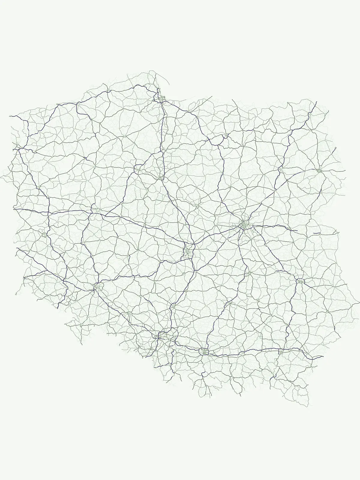
Access a detailed geographic overview of Poland's protected areas, illustrating their distribution from the Baltic to the Carpathians.

Poland National Parks Map: Visualize Protected Areas Across Central European Terrain

Preview Poland's national parks and key protected areas on this interactive map, revealing their geographic placement across the country's varied landscapes. Continue to the dedicated country map for Poland to explore the full distribution of conservation landscapes and understand their comprehensive regional context.
Natural feature types

Explore the Geographic Features and Natural Landmarks Across Poland

Continue your investigation into the physical geography of Poland. MoriAtlas provides a clear structure for comparing natural features across protected areas, helping to connect specific regional terrain with the broader national landscape context.

Gain insights into Poland's diverse park geography, from its Baltic Sea coastline to the Carpathian Mountains.

Common Questions on Poland's National Parks, Geography, and Protected Landscapes

Delve into common questions about the national parks and protected areas across Poland, covering their locations, types, and defining geographic features. This resource provides essential context for understanding the country's diverse conservation landscapes and their regional spread, from its northern coast to southern mountains.
Other countries

Browse mapped geography and protected landscapes across Central Europe, expanding your park discovery from Poland.

Explore National Parks and Protected Areas in Central Europe and Beyond Poland

Explore an extensive atlas of national parks and protected areas across countries neighboring Poland and other Central European geographies, providing rich regional context. This structured country-level view facilitates comparing diverse park geographies, supporting deeper atlas exploration and expanded protected-area discovery.

Germany: parks and protected areas

Parks and protected areas in Germany, including Wadden Sea National Park and Bavarian Forest.

1,251 parks

Lithuania: parks and protected areas

Parks and protected areas in Lithuania, including Curonian Spit and Aukštaitija.

18 parks

Hungary: parks and protected areas

Parks and protected areas in Hungary, including Hortobágy and Aggtelek.

13 parks

Slovakia: parks and protected areas

Parks and protected areas in Slovakia, including TANAP and Poloniny.

9 parks

Protected area types

Continue Exploring Poland's Protected Area Designations and Geography

Deepen your understanding of Poland's conservation landscape by continuing to explore its specific protected area classifications. This route offers detailed geographic context for each represented designation type, enabling a more granular discovery of national parks and other protected territories across the country. Use these classification pathways to refine your geographic exploration and uncover the nuances of Poland's natural heritage.

Poland Protected Area Designations
MoriAtlas Explorer

National parks and protected areas worldwide

Find a park and explore its geography, habitats, and monthly climate.

Global natural geography